geocat.ch
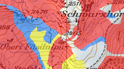
Carte synoptique des dangers d'avalanche
Inventaire géographique des zones exposées à des dangers d'avalanche par processus principal comprenant également le danger indicatif.
Simple
- Alternate title
-
Secteurs des dangers d'avalanche
- Date (Creation)
- 2011-07-12
- Date (Revision)
- 2025-11-06
- Identifier
- 122
- Purpose
-
Cartographie des dangers, détermination du degré de danger; utilisation dans l'aménagement du territoire pour l'octroi de permis de construire, dans le cadre de la gestion des risques naturels.
- Status
- On going
Custodian
- Spatial representation type
- Vector
Spatial resolution
Equivalent scale
- Denominator
- 10000
- Topic category
-
- F Geoscientific information
Extent
Extent
- Description
-
Canton of Valais (VS)
))

- Maintenance and update frequency
- As needed
Resource format
- Title
-
ESRI Enterprise Geodatabase
- Date
- GEMET - INSPIRE themes, version 1.0
-
-
Natural risk zones
-
- GEMET
-
-
avalanche
-
mapping
-
hazard
-
- geocat.ch
-
-
outline map
-
opendata.swiss
-
official geodata
-
hazard map
-
Resource constraints
- Use limitation
-
Il n'est pas possible de garantir l'exactitude, l'exhaustivité, la fiabilité et l'actualité des données. Toutes les données sont par conséquent dépourvues de foi publique.
Resource constraints
- Access constraints
- Other restrictions
- Other constraints
-
Géodonnées accessibles au public (niveau A selon l'OGéo)
- Other constraints
-
Les conditions générales d'utilisation des géodonnées du Canton du Valais font foi ( https://www.vs.ch/fr/web/guest/information-legale).
Associated resource
- Association Type
- Reference from one resource to another
- Metadata Reference
- Language
- Français
- Character encoding
- UTF8
- Language
- Deutsch
- Character encoding
- UTF8
- Environment description
-
S:\Géodonnées VS\F3 Dangers naturels\Danger d'avalanche.lyr
- Subtopic Category
- F3 Natural Hazards
- Basic Geodata
- true
- Basic Geodata ID
-
166>A.1
- Basic Geodata Legal Level
- Cantonal
- Basic Geodata Type
- basicGeodata
- Included with dataset
- 0
- Title
-
Catalogue d'objets: Secteurs de danger avalanche, géodonnées de base No. 166.1
- Date (Publication)
- 2024-01-15
- Distribution format
-
-
ESRI Shapefile (SHP)
-
OGC Web Map Service (WMS)
-
ArcGIS REST Feature Service
-
Distributor
Digital transfer options
- OnLine resource
-
Géoportail du Canton du Valais
Géoportail du Canton du Valais
Digital transfer options
- OnLine resource
-
geodienste.ch le portail intercantonal
Téléchargement de géodonnées conformes au modèle minimal
Digital transfer options
- OnLine resource
-
Landing Page
Landing Page pour opendata
Digital transfer options
- OnLine resource
-
Permalink opendata.swiss
Permalink opendata.swiss
Digital transfer options
- OnLine resource
-
OpenData Valais
Site de téléchargement de géodonnées à l'Etat du Valais: multiformat et WebMercator
Digital transfer options
- OnLine resource
-
10
AVA_Avalanche
Digital transfer options
- OnLine resource
-
DANAT_avalanche/Carte d'avalanche
Danger des avalanches
Digital transfer options
- OnLine resource
-
DANAT_avalanche/Avalanches
Danger des avalanches
- Statement
-
Cartes élaborées sur la base d'études réalisées par des bureaux spécialisés
- Hierarchy level
- Dataset
- Description
-
Etudes de terrain et modélisations
- Geometric object type
- Surface
- Geometric object count
- 4727
- Reference system identifier
- EPSG:2056/CH1903+_MN95
- Title
-
Modèle de représentation: Secteurs de danger avalanche, géodonnées de base No. 166.1
- Date (Publication)
- 2024-01-15
Metadata
- Metadata identifier
- 11432978-d1fc-4c04-92e9-c6dead94f7e6
- Language
- Français
- Character encoding
- UTF8
- Language
- Deutsch
- Character encoding
- UTF8
- Language
- Italiano
- Character encoding
- UTF8
- Language
- English
- Character encoding
- UTF8
- Language
- Rumantsch
- Character encoding
- UTF8
Distributor
Type of resource
- Resource scope
- Dataset
- Metadata linkage
-
https://www.geocat.ch/geonetwork/srv/api/records/11432978-d1fc-4c04-92e9-c6dead94f7e6
- Date info (Creation)
- 2017-02-06T17:17:03Z
- Date info (Revision)
- 2026-04-13T09:36:18.403617Z
Metadata standard
- Title
-
eCH-0271