geocat.ch
Basic spatial statistical units (USPAT)
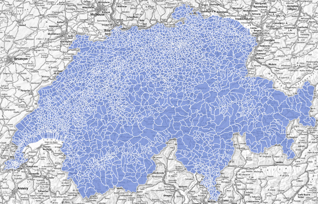
The FSO has developed basic spatial statistical units (USPAT), which divide the Swiss territory into around 3 600 entities that can be grouped together along the boundaries of existing communes. They are designed to be stable over time, despite mergers of municipalities. The statistics produced at this level will enable a detailed analysis of the territory in both rural and urban areas. These small units are grouped together to provide a total of about 750 larger spatial units, each with around 10 000 inhabitants, to provide a more comprehensive range of statistics than at municipal level.
Simple
- Date (Publication)
- 2024-06-28
- Identifier
- ch.bfs.uspat
- Status
- Completed
Point of contact
- Topic category
-
- D Boundaries
Extent
Extent
- Description
-
Switzerland
))

- Maintenance and update frequency
- Irregular
- Duration of Conservation
- 100
- Appraisal of Archival Value
- N
Resource format
- Title
-
OGC Geopackage (GPKG)
- Date
Resource format
- Title
-
ESRI Shapefile (SHP)
- Date
- Keywords
-
-
Statistik; Grundeinheit
-
- geocat.ch
-
-
opendata.swiss
-
boundary line
-
confederation
-
Resource specific usage
- Specific usage
-
Kommerzielle Verwendung nur mit separater Vereinbarung
Resource constraints
- Other constraints
- Opendata OPEN BY: Open use. Must provide the source.
- Language
- Deutsch
- Character encoding
- UTF8
- Basic Geodata
- false
- Basic Geodata Legal Level
- Federal
- Distribution format
-
-
ESRI Shapefile (SHP)
-
OGC Geopackage (GPKG)
-
Digital transfer options
- OnLine resource
-
Datenbeschreibung
Digital transfer options
- OnLine resource
-
GEOSTAT
GEOSTAT ist das BFS-Kompetenzzentrum für Geoinformation und digitale Bildverarbeitung.
Digital transfer options
- OnLine resource
-
Variablenliste
I14Y Interoperability platform
Digital transfer options
Digital transfer options
- OnLine resource
-
USPAT1 Geodaten (GeoPackage, Shapefile)
- Geometric object type
- Surface
- Reference system identifier
- EPSG:2056
Metadata
- Metadata identifier
- 0fc42082-e42c-4e25-a89f-b998981ccd19
- Language
- Deutsch
- Character encoding
- UTF8
- Language
- Français
- Character encoding
- UTF8
- Language
- Italiano
- Character encoding
- UTF8
- Language
- English
- Character encoding
- UTF8
- Language
- Rumantsch
- Character encoding
- UTF8
Custodian
- Metadata linkage
-
https://www.geocat.ch/geonetwork/srv/api/records/0fc42082-e42c-4e25-a89f-b998981ccd19
- Date info (Creation)
- 2024-07-02T08:06:44.505Z
- Date info (Revision)
- 2026-08-14T13:32:11.624688Z
Metadata standard
- Title
-
eCH-0271