geocat.ch
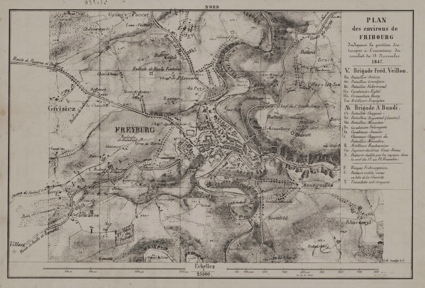
Plan de la Ville de Fribourg de 1847 (BCU)
Le plan des environs de Fribourg, mesurant 29.4 x 20.9 cm à l'échelle 1:25000, illustre la position des troupes au début du combat du 13 novembre 1847 (Guerre de Sonderbung).
Einfach
- Alternativtitel
-
Plan 1847
- Datum (Erstellung)
- 2024-08-28
- Kennung
- BCUF: 7/P (Glasson 630)
- Präsentationsform
- Papierkarte
- Weitere Referenzinformationen
-
FR030
- Bearbeitungsstatus
- Historisches Archiv
Projektleiter
Kantons- und Universitätsbibliothek (KUB) - Nicolas Bugnon (Amt für Kultur (KA))
Rue de la Carrière 22
Fribourg
1701
CH
Räumliche Auflösung
Vergleichsmassstab
- Massstabszahl
- 25000
- Thematik
-
- A Oberflächenbeschreibung
- R Militär und Aufklärung
Ausdehnung
Ausdehnung
- Beschreibung
-
Fribourg
N
S
E
W
))

- GEMET
-
-
Militärische Aktivitäten
-
Plan
-
Kartographie
-
- Sprache
- Français
- Thematische Unterkategorien
- A1 Basiskarten, Landschaftsmodelle
- Abgabeformat
-
-
nan
-
Optionen für die digitale Übertragung
- Online
-
Guichet intranet de la Ville de Fribourg
Accès privé
Optionen für die digitale Übertragung
Optionen für die digitale Übertragung
- Online
-
Plan(s) et détails
- Name des Referenzsystems
- CH1903+/MN95
Metadaten
- Identifikator des Metadatensatzes
- 075a4e6a-4089-4fd5-b333-11b2196ad1f4
- Sprache
- Français
- Sprache
- Deutsch
Ansprechpartner
- Link zu den Metadaten
-
https://www.geocat.ch/geonetwork/srv/api/records/075a4e6a-4089-4fd5-b333-11b2196ad1f4
- Datumsangaben (Erstellung)
- 2024-08-28T09:52:10.812Z
- Datumsangaben (Aktualisierung)
- 2026-06-08T11:12:02.984117Z
Metadatenstandard
- Titel
-
ISO 19115-3