geocat.ch
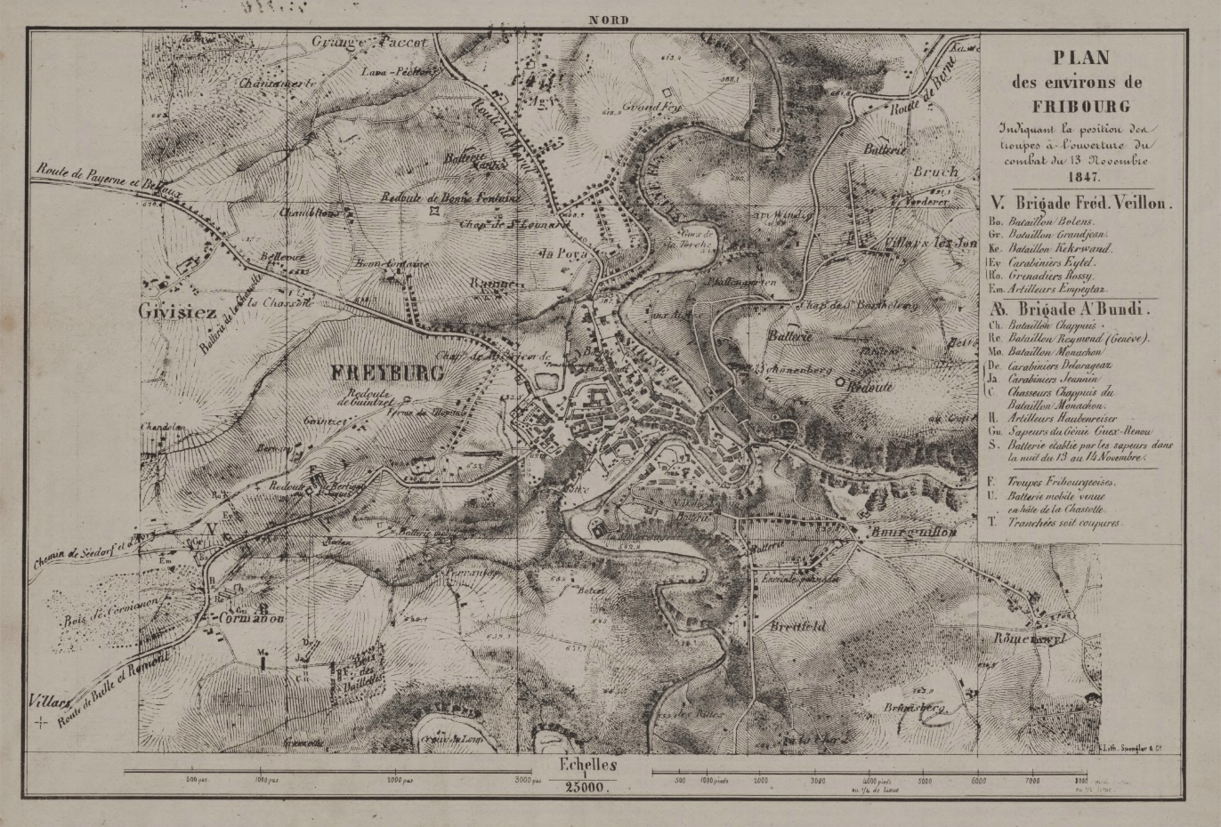
Plan de la Ville de Fribourg de 1847 (BCU)
Le plan des environs de Fribourg, mesurant 29.4 x 20.9 cm à l'échelle 1:25000, illustre la position des troupes au début du combat du 13 novembre 1847 (Guerre de Sonderbung).
Simple
- Alternate title
-
Plan 1847
- Date (Creation)
- 2024-08-28
- Identifier
- BCUF: 7/P (Glasson 630)
- Presentation form
- Hardcopy map
- Other citation details
-
FR030
- Status
- Historical archive
Principal investigator
Bibliothèque cantonale et universitaire (BCU) - Nicolas Bugnon (Service de la culture (SeCu))
Rue de la Carrière 22
Fribourg
1701
CH
Spatial resolution
Equivalent scale
- Denominator
- 25000
- Topic category
-
- A Imagery base maps earth cover
- R Intelligence military
Extent
Extent
- Description
-
Fribourg
N
S
E
W
))

- GEMET
-
-
activité militaire
-
plan
-
cartographie
-
- Language
- Français
- Subtopic Category
- A1 Base Maps, Landscape Models
- Distribution format
-
-
nan
-
Digital transfer options
- OnLine resource
-
Guichet intranet de la Ville de Fribourg
Accès privé
Digital transfer options
- OnLine resource
-
Guichet cartographique de la Ville de Fribourg
Digital transfer options
- OnLine resource
-
Plan(s) et détails
- Reference system identifier
- CH1903+/MN95
Metadata
- Metadata identifier
- 075a4e6a-4089-4fd5-b333-11b2196ad1f4
- Language
- Français
- Language
- Deutsch
Point of contact
- Metadata linkage
-
https://www.geocat.ch/geonetwork/srv/api/records/075a4e6a-4089-4fd5-b333-11b2196ad1f4
- Date info (Creation)
- 2024-08-28T09:52:10.812Z
- Date info (Revision)
- 2026-06-08T11:12:02.984117Z
Metadata standard
- Title
-
ISO 19115-3