geocat.ch
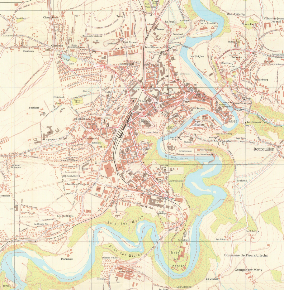
Plan de 1973 - Ville de Fribourg
Plan de la Ville de Fribourg réalisé en 1973.
Simple
- Date (Creation)
- 2025-11-07
Point of contact
- Topic category
-
- A Imagery base maps earth cover
Extent
Extent
- Description
-
Fribourg
N
S
E
W
))

- Maintenance and update frequency
- Unknown
- GEMET
-
-
plan
-
ville
-
- geocat.ch
-
-
carte historique
-
- Language
- Français
- Subtopic Category
- A1 Base Maps, Landscape Models
- Distribution format
-
-
nan
-
Digital transfer options
- OnLine resource
-
Guichet cartographique de la Ville de Fribourg
Digital transfer options
- OnLine resource
-
Guichet intranet de la Ville de Fribourg
Accès privé
- Reference system identifier
- CH1903+/MN95
Metadata
- Metadata identifier
- 06b38a28-f798-4052-b718-5f84515d6bc9
- Language
- Français
- Language
- Deutsch
Point of contact
- Metadata linkage
-
https://www.geocat.ch/geonetwork/srv/api/records/06b38a28-f798-4052-b718-5f84515d6bc9
- Date info (Creation)
- 2025-11-07T14:30:30.178Z
- Date info (Revision)
- 2026-06-08T11:21:37.982676Z
Metadata standard
- Title
-
ISO 19115-3