geocat.ch
VECTOR25 Gewässernetz GWN07
VECTOR25 Réseau hydrographique GWN07
VECTOR25 Rete idrica GWN07
VECTOR25 Hydrographic network GWN07
VECTOR25 Rait idrografica GWN07
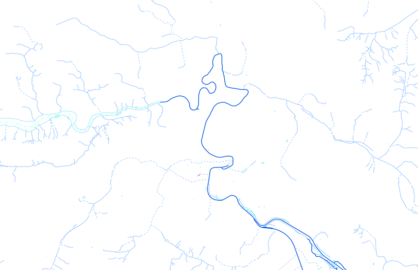
Die Ebene Gewässernetz umfasst ein gerichtetes Liniennetz, die dazu gehörenden Gewässernetzknoten und eine Tabelle ohne Geometrie. Diese Objekte bilden auf dem Gebiet der Schweiz und des Fürstentums Liechtenstein die Grundlage des Gewässerinformationssystems Schweiz GEWISS. GEWISS wird vom Bundesamt für Umwelt (BAFU) verwaltet. Im Rahmen des Projekts GWN07 wurde die Ebene Gewässernetz stark überarbeitet. Die Ausgabe 2007 von VECTOR25 gwn wird als Referenz publiziert.
La couche réseau hydrographique contient un réseau de lignes orientées, reliées entre elles par des noeuds, ainsi qu'une table sans géométrie. Pour les territoires de la Suisse et de la Principauté de Liechtenstein, ces éléments constituent la base du système d'information des eaux de Suisse - GEWISS- géré par l'Office fédéral de l'environnement (OFEV). Dans le cadre du projet GWN07, la couche réseau hydrographique a été profondément remaniée. La version 2007 de VECTOR25 gwn est publiée comme référence.
Il livello Rete idrica comprende una rete di linee orientate, i relativi nodi della rete dei corsi d'acqua e una tabella priva di geometria. Questi oggetti costituiscono, sul territorio della Svizzera e del Principato del Liechtenstein, la base del sistema d'informazione delle acque in Svizzera GEWISS. GEWISS è gestito dall'Ufficio federale dell'ambiente (UFAM). Nell'ambito del progetto GWN07 il livello Rete idrica è stato sottoposto a un'intensa rielaborazione. La versione 2007 di VECTOR25 gwn è pubblicata come riferimento.
The layer "Hydrographic network" consists of a directionally oriented line network connected to each other with nodes, and of a table without geometry. Those features which are in Switzerland and the Principality of Liechtenstein form the basis for the Swiss Water Information System (GEWISS). GEWISS is managed by the Federal Office for the Environment (FOEN). The layer Hydrographic network has been completely revised within the project GWN07. The release 2007 of VECTOR25 gwn is published as reference.
Il plaun Rait d'auas cumpiglia ina rait da lingias orientadas ch'èn colliadas tranter ellas cun nufs sco er ina tabella senza geometria. Per il territori da la Svizra e dal Principadi da Liechtenstein furman quests objects la basa dal sistem d'infurmaziun svizzer da las auas GEWISS – administrà da l'Uffizi federal d'ambient (UFAM). En il rom dal project GWN07 è il plaun Rait d'auas vegnì repassà profundamain. Dapi la versiun 2007 da VECTOR25 vegn el publitgà en in nov model da datas.
Simple
-
Autre titreAltri nomi o acronimiAlternate titleAlternate titleAlternativtitel
-
Gewässernetz VECTOR25
Réseau hydrographique VECTOR25
Rete idrica VECTOR25
Hydrological network VECTOR25
Rait idrografica VECTOR25
-
Date (Publication)Data (Pubblicazione)Date (Publication)Date (Publication)Datum (Publikation)
- 2007-08-31
-
IdentifiantIdentificatoreIdentifierIdentifierKennung
- ch.swisstopo.vec25-gewaessernetz_referenz
-
Autres informations de référenceAltre informazioni di riferimentoOther citation detailsOther citation detailsWeitere Referenzinformationen
-
Teil des VECTOR25 Datensatzes
Fait partie du jeux de données VECTOR25
Part of the vECTOR25 Dataset
-
ÉtatStatoStatusStatusBearbeitungsstatus
-
TerminéCompletatoCompletedCompletedAbgeschlossen
Point de contact
Punto di contatto
Point of contact
Point of contact
Ansprechpartner
-
Type de représentation spatialeTipo di rappresentazione spazialeSpatial representation typeSpatial representation typeRäumliche Darstellungsart
-
vecteurVettorialeVectorVectorVektor
Résolution spatiale
Risoluzione spaziale
Spatial resolution
Spatial resolution
Räumliche Auflösung
Fraction représentative
Frazione rappresentativa
Equivalent scale
Equivalent scale
Vergleichsmassstab
-
DénominateurDenominatoreDenominatorDenominatorMassstabszahl
- 25000
-
Catégorie de thèmeCategoria ISOTopic categoryTopic categoryThematik
-
-
I Eaux intérieuresI Acque interneI Inland watersI Inland watersI Binnengewässer
-
Étendue
Estensione
Extent
Extent
Ausdehnung
Étendue
Estensione
Extent
Extent
Ausdehnung
-
DescriptionDescrizioneDescriptionDescriptionBeschreibung
-
National Map 1:25'000
Landeskarte 1:25'000
Carte nationale 1:25'000
Carta nazionale 1:25'000
-
Identifiant géographiqueIdentificatore geograficoGeographic identifierGeographic identifierGeografische Kennung
- NM25LK25CN25CN25CN25
))

-
Fréquence de mise à jourFrequenza di aggiornamentoMaintenance and update frequencyMaintenance and update frequencyWartungsintervall
-
Non planifiéeNon pianificatoNot plannedNot plannedNicht geplant
-
NiveauLivelloHierarchy levelHierarchy levelBezugsebene
-
Jeu de donnéesSet di datiDatasetDatasetDatenbestand
-
Remarque sur la mise à jourNota sull'aggiornamentoMaintenance noteMaintenance noteAnmerkung
-
Wird seit 2008 nicht mehr nachgeführt
N’est plus mis à jour depuis 2008
Since 2008 not updated anymore
Format de la ressource
Formato della risorsa
Resource format
Resource format
Format der Ressource
-
TitreTitoloTitleTitleTitel
-
ESRI File Geodatabase FileGDB (GDB)
-
DateDataDateDateDatum
- GEMET - INSPIRE themes, version 1.0
-
-
Hydrographie
Idrografia
Hydrography
-
- GEMET
-
-
lac
lago
lake
-
système d'information géographique
sistema informativo geografico
geographic information system
-
eaux (géographie)
acque (geografia)
water (geographic)
-
- geocat.ch
-
-
rivière
fiume
river
-
modèle du territoire
modello del territorio
landscape model
-
opendata.swiss
opendata.swiss
opendata.swiss
opendata.swiss
-
e-geo.ch
e-geo.ch
e-geo.ch
-
SIG (Système d'Information Géographique)
SIG (Sistema Informativo Geografico)
GIS (Geographic Information System)
-
- geocat.ch
-
-
BGDI Bundesgeodaten-Infrastruktur
IFDG l’Infrastructure Fédérale de données géographiques
IFDG Infrastruttura federale dei dati geografici
FSDI Federal Spatial Data Infrastructure
-
- GEMET
-
-
Nomenklatur
nomenclature
nomenclatura
nomenclature
-
Contraintes sur la ressource
Vincoli sulle risorse
Resource constraints
Resource constraints
Ressourcenbeschränkungen
-
Autres contraintesAltri vincoliOther constraintsOther constraintsAndere Einschränkungen
-
Freie Nutzung. Quellenangabe ist Pflicht.
Utilisation libre. Obligation d’indiquer la source.
Libero utilizzo. Indicazione della fonte obbligatoria.
NonCommercialAllowed-CommercialAllowed-ReferenceRequired
Ressource associée
Risorsa associata
Associated resource
Associated resource
Verlinkte Ressource
-
Type d'associationTipo di associazioneAssociation TypeAssociation TypeAssoziationstyp
-
Citation de travail plus largeCitazione di un'opera più ampiaReference to a master resource of which this one is a partReference to a master resource of which this one is a partÜbergeordneter Datenbestand
-
Metadata ReferenceRiferimento metadatiMetadata ReferenceMetadata ReferenceMetadatenreferenz
Ressource associée
Risorsa associata
Associated resource
Associated resource
Verlinkte Ressource
-
TitreTitoloTitleTitleTitel
-
VECTOR25 gwn
-
Type d'associationTipo di associazioneAssociation TypeAssociation TypeAssoziationstyp
-
Citation de travail plus largeCitazione di un'opera più ampiaReference to a master resource of which this one is a partReference to a master resource of which this one is a partÜbergeordneter Datenbestand
-
LangueLinguaLanguageLanguageSprache
- Deutsch
-
Encodage de caractèresCodifica dei caratteriCharacter encodingCharacter encodingZeichenkodierung
-
Utf8UTF8UTF8UTF8Utf8
-
LangueLinguaLanguageLanguageSprache
- English
-
Encodage de caractèresCodifica dei caratteriCharacter encodingCharacter encodingZeichenkodierung
-
Utf8UTF8UTF8UTF8Utf8
-
Description de l'environnement de travailDescrizione dell'ambiente di lavoroEnvironment descriptionEnvironment descriptionBeschreibung der Arbeitsumgebung
-
ARC/INFO
ARC/INFO
-
Informations supplémentairesInformazioni supplementariSupplemental InformationSupplemental InformationZusätzliche Informationen
-
Die Ebenen Strassennetz, Eisenbahnnezt, Übriger Verkehr, Gewässernetz, Primärflächen, Gebäude, Hecken und Bäume, Anlagen und Einzelobjekte bilden zusammen den Datensatz VECTOR25.
Les couches Réseau routier, Réseau ferroviaire, Autres moyens de transport, Réseau hydrographique, Surfaces primaires, Bâtiments,Haies et arbres isolés, Surfaces aménagées et Objets isolés forment ensemble le jeu de données VECTOR25.
The layers Road network, Railway network, Other traffic, Hydrographic network, Primary surfaces, Buildings, Hedges and trees, Functional surfaces and Single objects build together the dataset VECTOR25.
-
Conformité à ISO 19110Conformità alla norma ISO 19110Compliance codeCompliance codeKonformität mit ISO 19110
- 0
-
LangueLinguaLanguageLanguageSprache
- Deutsch
-
LangueLinguaLanguageLanguageSprache
- Français
-
Livré avec jeu de donnéesFornito con set di datiIncluded with datasetIncluded with datasetMit Datensatz geliefert
- true
-
TitreTitoloTitleTitleTitel
-
VECTOR25 Das digitale Lanschaftsmodell der Schweiz : Produkteinformation
VECTOR25 Le modèle numérique du territoire de la Suisse : Information de produit
-
Date (Publication)Data (Pubblicazione)Date (Publication)Date (Publication)Datum (Publikation)
- 2004-04-01
-
Forme de la présentationForma della presentazionePresentation formPresentation formPräsentationsform
-
Document numériqueDocumento digitaleDigital documentDigital documentDigitales Dokument
-
Format de distributionFormato (codifica)Distribution formatDistribution formatAbgabeformat
-
-
AutoCAD DXF (DXF)
-
ESRI Shapefile (SHP)
-
ESRI File Geodatabase FileGDB (GDB)
-
Options de transfert numérique
Opzioni di trasferimento digitale
Digital transfer options
Digital transfer options
Optionen für die digitale Übertragung
-
Ressource en ligneRisorsa onlineOnLine resourceOnLine resourceOnline
-
Vorschau map.geo.admin.ch
Vorschau map.geo.admin.chAperçu map.geo.admin.chPrevisione map.geo.admin.chPreview map.geo.admin.ch
Options de transfert numérique
Opzioni di trasferimento digitale
Digital transfer options
Digital transfer options
Optionen für die digitale Übertragung
-
Ressource en ligneRisorsa onlineOnLine resourceOnLine resourceOnline
-
ch.swisstopo.vec25-gewaessernetz_referenz
WMS-BGDI Dienst, Layer "Gewässernetz VECTOR25"Service WMS-IFDG, couche "Réseau hydrographique VECTOR25"Servizio WMS-IFDG, strato "Rete idrica VECTOR25"WMS-FSDI service, layer "Hydrological network VECTOR25"WMS-BGDI Dienst, Layer "Gewässernetz VECTOR25"
Options de transfert numérique
Opzioni di trasferimento digitale
Digital transfer options
Digital transfer options
Optionen für die digitale Übertragung
-
Ressource en ligneRisorsa onlineOnLine resourceOnLine resourceOnline
-
ch.swisstopo.vec25-gewaessernetz_referenz
WMTS-BGDI Dienst, Layer "Gewässernetz VECTOR25"Service WMTS-IFDG, couche , Layer "Réseau hydrographique VECTOR25"Servizio WMTS-IFDG, strato "Rete idrica VECTOR25"WMTS-FSDI service, layer "Hydrological network VECTOR25"WMTS-BGDI Dienst, Layer "Gewässernetz VECTOR25"
Options de transfert numérique
Opzioni di trasferimento digitale
Digital transfer options
Digital transfer options
Optionen für die digitale Übertragung
Options de transfert numérique
Opzioni di trasferimento digitale
Digital transfer options
Digital transfer options
Optionen für die digitale Übertragung
-
Ressource en ligneRisorsa onlineOnLine resourceOnLine resourceOnline
-
RESTful API von geo.admin.ch
RESTful API von geo.admin.chRESTful API de geo.admin.chRESTful API da geo.admin.chRESTful API from geo.admin.chRESTful API dad geo.admin.ch
-
Généralités sur la provenanceInformazioni generali sulla provenienzaStatementStatementErklärung
-
Inhaltlich und geometrisch auf der Landeskarte 1:25'000 basiert. Lagegenauigkeit: 3-8 M.
Se base sur le contenu et la géométrie de la carte nationale suisse au 1:25'000. Précision de position : 3 - 8 m.
Content and geometry based on the swiss National Map 1:25'000. Geometric precision : 3-8 m.
-
NiveauLivelloHierarchy levelHierarchy levelBezugsebene
-
Jeu de donnéesSet di datiDatasetDatasetDatenbestand
-
Niveau de topologieLivello di topologiaTopology levelTopology levelTopologieebene
-
Topologie de réseau complèteGrafo planare completoFull planar graphFull planar graphVollständige Netzwerktopologie
-
Type d’objet géométriqueTipo di oggetto geometricoGeometric object typeGeometric object typeTyp des geometrischen Objekts
-
LigneCurvaCurveCurvecurve
-
Nombre d’objets géométriquesNumero di oggetti geometriciGeometric object countGeometric object countAnzahl geometrischer Objekte
- 275000
-
Nom du système de référenceNome del sistema di riferimentoReference system identifierReference system identifierName des Referenzsystems
- EPSG:21781
-
Fréquence de mise à jourFrequenza di aggiornamentoMaintenance and update frequencyMaintenance and update frequencyWartungsintervall
-
Comme nécessaireSecondo necessitàAs neededAs neededBei Bedarf
Metadata
-
Identifiant des métadonnéesIdentificativo della schedaMetadata identifierMetadata identifierIdentifikator des Metadatensatzes
- 0351bc2e-3cdc-4e8a-b422-0142e494e7b4
-
LangueLinguaLanguageLanguageSprache
- Deutsch
-
Encodage de caractèresCodifica dei caratteriCharacter encodingCharacter encodingZeichenkodierung
-
Utf8UTF8UTF8UTF8Utf8
-
LangueLinguaLanguageLanguageSprache
- Français
-
Encodage de caractèresCodifica dei caratteriCharacter encodingCharacter encodingZeichenkodierung
-
Utf8UTF8UTF8UTF8Utf8
-
LangueLinguaLanguageLanguageSprache
- Italiano
-
Encodage de caractèresCodifica dei caratteriCharacter encodingCharacter encodingZeichenkodierung
-
Utf8UTF8UTF8UTF8Utf8
-
LangueLinguaLanguageLanguageSprache
- English
-
Encodage de caractèresCodifica dei caratteriCharacter encodingCharacter encodingZeichenkodierung
-
Utf8UTF8UTF8UTF8Utf8
-
LangueLinguaLanguageLanguageSprache
- Rumantsch
-
Encodage de caractèresCodifica dei caratteriCharacter encodingCharacter encodingZeichenkodierung
-
Utf8UTF8UTF8UTF8Utf8
Point de contact
Punto di contatto
Point of contact
Point of contact
Ansprechpartner
-
Heures de serviceOrario di servizioHours of serviceHours of serviceBetriebszeiten
-
08h30 - 11h00 / 14h00 - 16h00 GMT+1
Type de ressource
Tipo di risorsa
Type of resource
Type of resource
Anwendungsbereich der Metadaten
-
Domaine d'application de la ressourceAmbito di applicazione della risorsaResource scopeResource scopeDomäne der Ressourcenanwendung
-
Jeu de donnéesSet di datiDatasetDatasetDatenbestand
-
NomNomeNameNameName
-
Layer
-
Lien vers la métadonnéeCollegamento ai metadatiMetadata linkageMetadata linkageLink zu den Metadaten
-
https://www.geocat.ch/geonetwork/srv/api/records/0351bc2e-3cdc-4e8a-b422-0142e494e7b4
-
Informations de date (Création)Informazioni sulla data (Creazione)Date info (Creation)Date info (Creation)Datumsangaben (Erstellung)
- 2007-12-17T12:00:00Z
-
Informations de date (Révision)Informazioni sulla data (Revisione)Date info (Revision)Date info (Revision)Datumsangaben (Aktualisierung)
- 2026-04-13T09:42:45.889379Z
Norme des métadonnées
Standard dei metadati
Metadata standard
Metadata standard
Metadatenstandard
-
TitreTitoloTitleTitleTitel
-
GM03 2+