geocat.ch
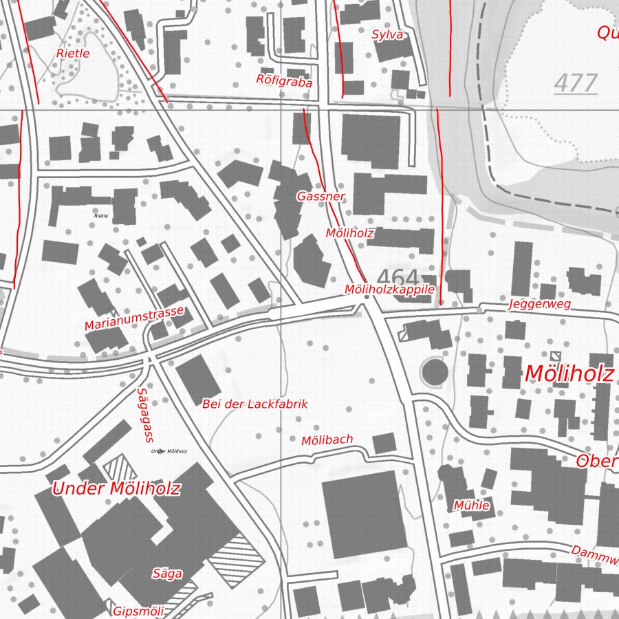
Field names of the Liechtenstein municipalities
Field names from the field name map of the Liechtenstein municipalities. The field name map was compiled by the Liechtenstein Name Book and contains place, field, terrain, path and water names that have been analysed from a linguistic and cultural point of view. Updating by the Office for Culture is not regulated.
Simple
- Alternate title
-
Field name map
- Date (Creation)
- 1987-12-31
- Identifier
- https://metadata.geo.llv.li/00f86319-c80c-40d0-a127-82f3db833993
- Purpose
-
Historical and cultural-historical investigation, basis for the nomenclature of official surveying
- Status
- Completed
Publisher
- Hours of service
-
8:00-11:30 und 13:30-17:00
Owner
- Hours of service
-
8:00-11:30 und 13:30-17:00
- Spatial representation type
- Vector
Spatial resolution
Equivalent scale
- Denominator
- 10000
- Topic category
-
- B Location
Extent
Extent
- Description
-
Liechtenstein
))

- Maintenance and update frequency
- Not planned
Resource format
- Title
-
INTERLIS 1 (ITF)
- Date
- GEMET
-
-
vector
-
nomenclature
-
- geocat.ch
-
-
place name
-
local name
-
OpenData
-
INSPIRE
-
- GEMET - INSPIRE themes, version 1.0
-
-
Geographical names
-
- Räumlicher Anwendungsbereich
-
-
National
-
Resource constraints
- Use limitation
-
keine
- Access constraints
- Other restrictions
- Use constraints
- Other restrictions
- Other constraints
- No limitations to public access
Resource constraints
- Access constraints
- Other restrictions
- Use constraints
- Other restrictions
- Other constraints
- No conditions to access and use
- Other constraints
- Opendata BY: Open use. Must provide the source.
- Language
- Deutsch
- Character encoding
- UTF8
- Included with dataset
- 0
- Title
-
Datenmodell Flurnamen
- Date (Publication)
- 2010-04-01
- Distribution format
-
-
INTERLIS 1 (ITF)
-
Point of contact
- Hours of service
-
8:00-11:30 und 13:30-17:00
Digital transfer options
- OnLine resource
-
Geodatenportal der Liechtensteinische Landesverwaltung
Geodata Portal of the National Administration
Digital transfer options
- OnLine resource
-
li.abi.namensbuch
Public OGC-WMS Service of the National Administration
Digital transfer options
- OnLine resource
-
Zip Download über das Geodatenportal
Zip download via the geodata portal
- Hierarchy level
- Dataset
Report
Result
- Title
-
VERORDNUNG (EG) Nr. 1089/2010 DER KOMMISSION vom 23. November 2010 zur Durchführung der Richtlinie 2007/2/EG des Europäischen Parlaments und des Rates hinsichtlich der Interoperabilität von Geodatensätzen und -diensten
- Date (Publication)
- 2010-12-08
- Explanation
-
datenmodell nicht konform
- Pass
- false
- Statement
-
Digitalisierung ab FLurnamenskarte 1:5'000 resp. 1:10'000
- Hierarchy level
- Dataset
- Topology level
- Geometry only
- Geometric object type
- Point
- Geometric object count
- 9000
- Reference system identifier
- http://www.opengis.net/def/crs/EPSG/0/2056
- Maintenance and update frequency
- As needed
Metadata
- Metadata identifier
- 00f86319-c80c-40d0-a127-82f3db833993
- Language
- Deutsch
- Character encoding
- UTF8
- Language
- Français
- Character encoding
- UTF8
- Language
- Italiano
- Character encoding
- UTF8
- Language
- English
- Character encoding
- UTF8
Point of contact
- Hours of service
-
8:00-11:30 und 13:30-17:00
Type of resource
- Resource scope
- Dataset
- Metadata linkage
-
https://www.geocat.ch/geonetwork/srv/api/records/00f86319-c80c-40d0-a127-82f3db833993
- Date info (Creation)
- 2010-09-01T10:04:30Z
- Date info (Revision)
- 2026-04-13T09:17:46.726485Z
Metadata standard
- Title
-
eCH-0271