geocat.ch
Schatzkarte
Carte-tresor
Mappa-Tesoro
Tresurehunt
Charta da stgazis
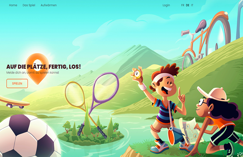
<a href=" http://www.schatz-karte.ch" target="_blank">www.schatz-karte.ch</a> ist ein Unterrichtsinstrument, welches den Geografie Unterricht auf der Primar- und Sekundarstufe sinnvoll ergänzt und bereichert (für Schülerinnen und Schüler im Alter von 10 – 15 Jahren). In 9 erlebnisreichen Lektionen lernen Schülerinnen und Schüler auf spielerische Weise die Schweizer Karte, geographische Daten (Geodaten) sowie spannende Themen aus der Schweiz kennen. Sie werden mit Hilfe der unterschiedlichen Geodaten (zum Beispiel Luftbilder, Landeskarten, Höhendaten und Grenzen) lernen, die Schweiz zu erkunden. Sie können die innovativen, vielseitigen und kostenlosen kartografischen Werkzeuge von map.geo.admin.ch und map.lubis.admin.ch ausprobieren. Sie erhalten eine Landeskarte1:25‘000, sobald die ganze Klasse die Schatzsuche erfolgreich beendet hat. <a href=" http://www.schatz-karte.ch" target="_blank">www.schatz-karte</a> steht immer zur Verfügung und kann im Jahresprogramm zu einem beliebigen Zeitpunkt integriert werden .
<a href=" http://www.carte-tresor.ch" target="_blank">www.carte-tresor.ch</a> est un instrument pédagogique qui complète et enrichit l'enseignement de la géographie aux niveaux primaire et secondaire (élèves de 10 à 15 ans).En 9 leçons riches en aventures, les élèves se familiarisent de façon ludique avec la carte et les données géographiques de la Suisse (géodonnées) tout en découvrant certaines particularités de notre pays. Ils apprennent à explorer le territoire suisse au moyen de différentes géodonnées (par exemple les photographies aériennes, les cartes nationales, les limites nationales et cantonales ou les modèles d'altitude). Ils découvrent des applications cartographiques innovatrices, faciles d'utilisation et gratuites telles que map.geo.admin.ch ou map.lubis.admin.ch. Ils reçoivent une carte nationale au 1:25‘000 dès que l'ensemble de leur classe a fini la chasse au trésor. <a href=" http://www.carte-tresor.ch" target="_blank">www.carte-tresor.ch</a> est un jeu mis à disposition des enseignantes et enseignants tout au long de l'année, il peut être ainsi intégré à tout moment dans le programme de l'année scolaire .
La caccia al tesoro è rivolta ai ragazzi della scuola elementare e della scuola media (dai 10 ai 15 anni). Nelle 9 tappe ricche di esperienze, gli studenti scoprono divertendosi la carta geografica e i numerosi geodati della Svizzera. Inoltre, acquisiscono dimestichezza con le applicazioni geografiche messe a disposizione gratuitamente da swisstopo. Alla fine del gioco gli allievi sapranno utilizzare efficacemente gli strumenti e i geodati di swisstopo anche in maniera autonoma su map.geo.admin.ch. La partecipazione al gioco online è gratuita e non comporta alcun impegno. L'unica condizione è l'iscrizione della classe da parte dell'insegnante sul sito www.mappa-tesoro.ch. Alla conclusione del gioco, gli allievi ricevono come ricompensa una carta nazionale 1:25 000, che l'insegnante può ordinare gratuitamente presso swisstopo.
The treasure hunt comprises around eleven puzzles that need to be solved. These are dotted all over Switzerland and are based around a common theme. This game consists of various puzzles that have to be solved. The hidden treasures are located all over Switzerland and are based around a common theme. The game helps schoolchildren to learn through play how to use different types of geodata such as aerial photographs and topographic maps. Once all children in the class have found the treasure, they will receive a 1:25,000 topographic map.
<a href=" http://www.schatz-karte.ch" target="_blank">www.schatz-karte.ch</a> è in instrument pedagogic che sustegna e ch'enritgescha l'instrucziun da geografia en la scola primara e secundara en moda utila (per scolaras e scolars da la vegliadetgna da 10 fin 15 onns). En 9 lecziuns ritgas d'aventuras emprendan las scolaras ed ils scolars ad enconuscher cun divertiment la charta svizra, datas geograficas (geodatas) sco er temas interessants da la Svizra. Ellas ed els emprendan da perscrutar la Svizra cun agid da las differentas geodatas (p.ex. fotografias ord l'aria, chartas naziunalas, datas altimetricas e cunfins). Ellas ed els pon far experiments cun ils instruments cartografics innovativs, multifars e gratuits da map.geo.admin.ch e da map.lubis.admin.ch. Ellas ed els survegnan ina Charta naziunala 1:25'000, uschespert che tut la classa ha terminà cun success la tschertga da stgazis (treasurehunt). <a href=" http://www.schatz-karte.ch" target="_blank">www.schatz-karte</a> stat adina a disposiziun e po vegnir integrà en il program da l'onn cur ch'igl è .
Simple
-
Autre titreAltri nomi o acronimiAlternate titleAlternate titleAlternativtitel
-
Schatzkarte
Carte-tresor
Mappa-Tesoro
Tresurehunt
Charta da stgazis
-
Date (Dernière révision)Data (Ultima revisione)Date (Last Revision)Date (Last Revision)Datum (Letzte Überprüfung)
- 2017-08-01
-
IdentifiantIdentificatoreIdentifierIdentifierKennung
- ch.swisstopo.treasurehunt
Résolution spatiale
Risoluzione spaziale
Spatial resolution
Spatial resolution
Räumliche Auflösung
Fraction représentative
Frazione rappresentativa
Equivalent scale
Equivalent scale
Vergleichsmassstab
-
DénominateurDenominatoreDenominatorDenominatorMassstabszahl
- 10000
Résolution spatiale
Risoluzione spaziale
Spatial resolution
Spatial resolution
Räumliche Auflösung
Fraction représentative
Frazione rappresentativa
Equivalent scale
Equivalent scale
Vergleichsmassstab
-
DénominateurDenominatoreDenominatorDenominatorMassstabszahl
- 10000
-
Catégorie de thèmeCategoria ISOTopic categoryTopic categoryThematik
-
-
M SociétéM SocietàM SocietyM SocietyM Gesellschaft
-
Étendue
Estensione
Extent
Extent
Ausdehnung
Étendue
Estensione
Extent
Extent
Ausdehnung
-
DescriptionDescrizioneDescriptionDescriptionBeschreibung
-
Switzerland
Schweiz
Suisse
Svizzera
Svizra
))

-
Fréquence de mise à jourFrequenza di aggiornamentoMaintenance and update frequencyMaintenance and update frequencyWartungsintervall
-
Comme nécessaireSecondo necessitàAs neededAs neededBei Bedarf
- geocat.ch
-
-
IFDG l’Infrastructure Fédérale de données géographiques
IFDG Infrastruttura federale dei dati geografici
FSDI Federal Spatial Data Infrastructure
-
Contraintes sur la ressource
Vincoli sulle risorse
Resource constraints
Resource constraints
Ressourcenbeschränkungen
-
Contraintes d'utilisationVincoli d'usoUse constraintsUse constraintsNutzungseinschränkungen
-
Autres restrictionsAltre restrizioniOther restrictionsOther restrictionsAndere Beschränkungen
-
Autres contraintesAltri vincoliOther constraintsOther constraintsAndere Einschränkungen
-
-- URL Nutzungsbedingungen (s. Handbuch)
Contraintes sur la ressource
Vincoli sulle risorse
Resource constraints
Resource constraints
Ressourcenbeschränkungen
-
Limitation d'utilisationLimitazione d'usoUse limitationUse limitationNutzungsbeschränkung
-
-- gebührenpflichtig --
Ressource associée
Risorsa associata
Associated resource
Associated resource
Verlinkte Ressource
-
Type d'associationTipo di associazioneAssociation TypeAssociation TypeAssoziationstyp
-
Citation de travail plus largeCitazione di un'opera più ampiaReference to a master resource of which this one is a partReference to a master resource of which this one is a partÜbergeordneter Datenbestand
-
LangueLinguaLanguageLanguageSprache
- Deutsch
-
Encodage de caractèresCodifica dei caratteriCharacter encodingCharacter encodingZeichenkodierung
-
Utf8UTF8UTF8UTF8Utf8
-
Géodonnées de baseGeodati di baseBasic GeodataBasic GeodataGeobasisdaten
- false
-
Niveau des géodonnées de baseLivello legale dei geodati di baseBasic Geodata Legal LevelBasic Geodata Legal LevelGeobasisdatenebene
-
FédéralFederaleFederalFederalNational
-
Format de distributionFormato (codifica)Distribution formatDistribution formatAbgabeformat
-
-
autres formats sur demande / andere Formate auf Anfrage
-
Options de transfert numérique
Opzioni di trasferimento digitale
Digital transfer options
Digital transfer options
Optionen für die digitale Übertragung
Options de transfert numérique
Opzioni di trasferimento digitale
Digital transfer options
Digital transfer options
Optionen für die digitale Übertragung
-
Ressource en ligneRisorsa onlineOnLine resourceOnLine resourceOnline
-
Vorschau map.geo.admin.ch
-
Type d’objet géométriqueTipo di oggetto geometricoGeometric object typeGeometric object typeTyp des geometrischen Objekts
-
PointPuntoPointPointpoint
-
Nom du système de référenceNome del sistema di riferimentoReference system identifierReference system identifierName des Referenzsystems
- EPSG:21781
Metadata
-
Identifiant des métadonnéesIdentificativo della schedaMetadata identifierMetadata identifierIdentifikator des Metadatensatzes
- ffda4480-52ca-4463-aac4-0a58bf87e5b5
-
LangueLinguaLanguageLanguageSprache
- Deutsch
-
Encodage de caractèresCodifica dei caratteriCharacter encodingCharacter encodingZeichenkodierung
-
Utf8UTF8UTF8UTF8Utf8
-
LangueLinguaLanguageLanguageSprache
- Français
-
Encodage de caractèresCodifica dei caratteriCharacter encodingCharacter encodingZeichenkodierung
-
Utf8UTF8UTF8UTF8Utf8
-
LangueLinguaLanguageLanguageSprache
- Italiano
-
Encodage de caractèresCodifica dei caratteriCharacter encodingCharacter encodingZeichenkodierung
-
Utf8UTF8UTF8UTF8Utf8
-
LangueLinguaLanguageLanguageSprache
- English
-
Encodage de caractèresCodifica dei caratteriCharacter encodingCharacter encodingZeichenkodierung
-
Utf8UTF8UTF8UTF8Utf8
-
LangueLinguaLanguageLanguageSprache
- Rumantsch
-
Encodage de caractèresCodifica dei caratteriCharacter encodingCharacter encodingZeichenkodierung
-
Utf8UTF8UTF8UTF8Utf8
Point de contact
Punto di contatto
Point of contact
Point of contact
Ansprechpartner
-
Heures de serviceOrario di servizioHours of serviceHours of serviceBetriebszeiten
-
08h30 - 11h00 / 14h00 - 16h00 GMT+1
Type de ressource
Tipo di risorsa
Type of resource
Type of resource
Anwendungsbereich der Metadaten
-
Domaine d'application de la ressourceAmbito di applicazione della risorsaResource scopeResource scopeDomäne der Ressourcenanwendung
-
Jeu de donnéesSet di datiDatasetDatasetDatenbestand
-
Lien vers la métadonnéeCollegamento ai metadatiMetadata linkageMetadata linkageLink zu den Metadaten
-
Informations de date (Création)Informazioni sulla data (Creazione)Date info (Creation)Date info (Creation)Datumsangaben (Erstellung)
- 2018-05-18T12:14:29Z
-
Informations de date (Révision)Informazioni sulla data (Revisione)Date info (Revision)Date info (Revision)Datumsangaben (Aktualisierung)
- 2026-06-15T08:55:49.507772Z
Norme des métadonnées
Standard dei metadati
Metadata standard
Metadata standard
Metadatenstandard
-
TitreTitoloTitleTitleTitel
-
eCH-0271