 geocat.ch
Waldränder, ökologisches Potenzial
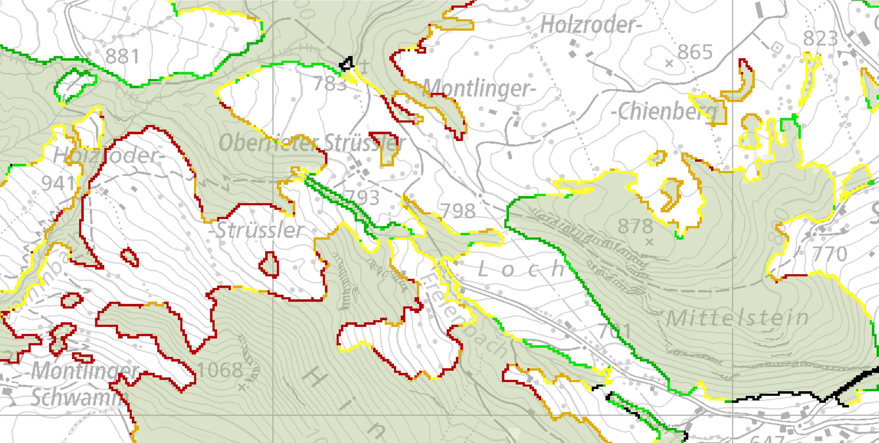
Das Produkt Waldränder, ökologisches Potenzial wurde im Auftrag des ANJF und des KFA erstellt und zeigt das ökologische Potenzial aller Waldränder des Kantons. Ökologisch wertvolle Waldränder sind artenreich und weisen einen stufigen, strukturreichen Aufbau auf. Für das Anlegen und die Pflege von ökologisch wertvollen Waldrändern können GAöL-Beiträge oder Beiträge zur Waldbiodiversität gewährt werden. Aus dieser Karte geht hervor, ob ein Waldrand grundsätzlich für eine Aufwertung geeignet ist.
Simple
- Date (Creation)
- 2017-05-08
- Date (Revision)
- 2026-06-21
- Other citation details
-
Wald, Flora, Fauna
- Purpose
-
-
partner
- Hours of service
-
Mo. - Fr. von 8:00 - 17:00 Uhr
- Spatial representation type
- Vector
Spatial resolution
Equivalent scale
- Denominator
- 10000
- Topic category
-
- G Biota
Extent
Extent
- Description
-
Kanton St.Gallen
))
- Maintenance and update frequency
- As needed
- geocat.ch
-
-
opendata.swiss
-
Resource constraints
- Access constraints
- Other restrictions
- Other constraints
-
A = öffentlich
Resource constraints
- Classification
- Unclassified
- Language
- Deutsch
- Distribution format
-
-
ESRI Shapefile
-
andere Formate auf Anfrage
-
Distributor
- Hours of service
-
Mo. - Fr. von 8:00 - 17:00 Uhr
Digital transfer options
- Statement
-
Projekt "GIS-basierte Priorisierung der Waldränder im Kanton St.Gallen hinsichtlich ihres ökologischen Potenzials" an der ZHAW Wädenswil im Auftrag des ANJF und KFA.
- Hierarchy level
- Dataset
- Reference system identifier
- CH1903+_LV95 / EPSG 2056
Metadata
- Metadata identifier
- fc68682a-d79b-4a64-b801-98c2c4f4b77e-8371
- Language
- Deutsch
- Character encoding
- UTF8
Resource provider
- Hours of service
-
Mo. - Fr. von 8:00 - 17:00 Uhr
Type of resource
- Resource scope
- Dataset
- Date info (Revision)
- 2026-06-21T01:15:42+02:00
Metadata standard
- Title
-
GM03 Core
)))
