geocat.ch
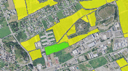
Plan sectoriel des surfaces d'assolement
Surfaces d'assolement
Simple
- Alternate title
-
SDA
- Date (Creation)
- 1996-01-01
- Date (Revision)
- 2025-12-15
- Identifier
- 57
- Purpose
-
Numérisation des SDA afin de garantir le quota cantonal auprès de la confédération
- Status
- Completed
Custodian
- Spatial representation type
- Vector
Spatial resolution
Equivalent scale
- Denominator
- 25000
- Topic category
-
- S Farming
- E Planning cadastre
Extent
Extent
- Description
-
Canton of Valais (VS)
))

- Maintenance and update frequency
- Continual
- Maintenance note
-
Adaptation régulière en fonction des modifications du PAZ
Resource format
- Title
-
ESRI Enterprise Geodatabase
- Date
- GEMET themes
-
-
administration
-
agriculture
-
- GEMET
-
-
agricultural land
-
- geocat.ch
-
-
opendata.swiss
-
land use zone
-
local planning
-
official geodata
-
Resource constraints
- Use limitation
-
Aucune
Resource constraints
- Access constraints
- Other restrictions
- Other constraints
-
Géodonnées accessibles au public (niveau A selon l'OGéo)
- Other constraints
-
Les conditions générales d'utilisation des géodonnées du Canton du Valais font foi ( https://www.vs.ch/fr/web/guest/information-legale).
Associated resource
- Association Type
- Reference from one resource to another
- Metadata Reference
- Language
- Français
- Character encoding
- UTF8
- Environment description
-
S:\Géodonnées VS\E1 Développement territorial\Surfaces d_assolement.lyr
- Subtopic Category
- E1 Spatial Planning, Spatial Development
- Basic Geodata
- true
- Basic Geodata ID
-
68>A.1
- Basic Geodata Legal Level
- Cantonal
- Basic Geodata Type
- basicGeodata
- Included with dataset
- true
- Title
-
Catalogue d‘objet – Surfaces d‘assolement (SDA)
- Date (Creation)
- 2021-02-23
- Distribution format
-
-
ESRI Shapefile (SHP)
-
autres formats sur demande / andere Formate auf Anfrage
-
ArcGIS REST Feature Service
-
Distributor
Digital transfer options
- OnLine resource
-
Landing Page
Landing Page pour opendata
Digital transfer options
- OnLine resource
-
geodienste.ch le portail intercantonal
Téléchargement de géodonnées conformes au modèle minimal (divers formats)
Digital transfer options
- OnLine resource
-
Permalink opendata.swiss
Permalink opendata.swiss
Digital transfer options
- OnLine resource
-
Géoportail du Canton du Valais
Géoportail du Canton du Valais
Digital transfer options
- OnLine resource
-
OpenData Valais
Site de téléchargement de géodonnées à l'Etat du Valais: multiformat et WebMercator
Digital transfer options
- OnLine resource
-
surfaces_assolement
Plan sectoriel des surfaces d'assolement
- Statement
-
Données numérisées sur la base du plan sectoriel au 1:25000
- Hierarchy level
- Dataset
- Description
-
Numérisation
- Geometric object type
- Surface
- Geometric object count
- 3451
- Reference system identifier
- EPSG:2056/CH1903+_MN95
Metadata
- Metadata identifier
- f8727c92-7ffb-44c4-8d1d-1631315431e0
- Language
- Français
- Character encoding
- UTF8
- Language
- Deutsch
- Character encoding
- UTF8
- Language
- Italiano
- Character encoding
- UTF8
- Language
- English
- Character encoding
- UTF8
- Language
- Rumantsch
- Character encoding
- UTF8
Distributor
Type of resource
- Resource scope
- Dataset
- Metadata linkage
-
https://www.geocat.ch/geonetwork/srv/api/records/f8727c92-7ffb-44c4-8d1d-1631315431e0
- Date info (Creation)
- 2016-06-30T15:50:23Z
- Date info (Revision)
- 2026-04-13T09:34:33.695724Z
Metadata standard
- Title
-
eCH-0271