geocat.ch
Aerial images third parties
Within the framework of various projects of public and private clients, aerial images of Switzerland are collected and offered by third parties. These aerial images can be reported to swisstopo and are published in the " Aerial images third parties" layer. The layer contains only the information supplied to swisstopo and makes no claim to completeness.
All aerial photographs are presented in the form of the image centre coordinates and the ground segment covered by the aerial image, as well as the attributed meta-information. The aerial images can be ordered or obtained from the respective third party.
Simple
- Alternate title
-
Aerial images third parties
- Date (Creation)
- 1927-01-01
- Identifier
- ch.swisstopo.lubis-luftbilder-dritte-firmen
Point of contact
- Spatial representation type
- Grid
- Topic category
-
- A Imagery base maps earth cover
Extent
Extent
- Description
-
Switzerland
))

- Maintenance and update frequency
- Unknown
- GEMET
-
-
aerial photograph
-
aerial photograph
-
private sector
-
public-private partnership
-
- GEMET - INSPIRE themes, version 1.0
-
-
Orthoimagery
-
- geocat.ch
-
-
FSDI Federal Spatial Data Infrastructure
-
Resource constraints
- Use limitation
-
Subject to fee
Associated resource
- Association Type
- Reference to a master resource of which this one is a part
- Metadata Reference
Associated resource
- Title
-
Digital aerial photographs
- Association Type
- Reference to a master resource of which this one is a part
- Language
- Deutsch
- Character encoding
- UTF8
- Subtopic Category
- A3 Aerial and Satellite Imagery
- Distribution format
-
-
nan
-
Digital transfer options
- OnLine resource
-
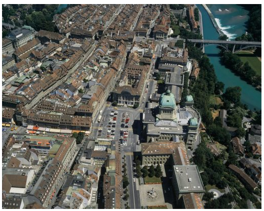
Vorschau map.geo.admin.ch
Preview map.geo.admin.ch
Digital transfer options
- OnLine resource
-
ch.swisstopo.lubis-luftbilder-dritte-firmen
WMS-FSDI service, layer "Aerial images third parties"
Digital transfer options
- OnLine resource
-
ch.swisstopo.lubis-luftbilder-dritte-firmen
WMTS-FSDI service, layer "Aerial images third parties"
Digital transfer options
- OnLine resource
-
RESTful API von geo.admin.ch
Digital transfer options
Metadata
- Metadata identifier
- f614decc-a4f2-480f-b007-b8d9b99bdde5
- Language
- Deutsch
- Character encoding
- UTF8
- Language
- Français
- Character encoding
- UTF8
- Language
- Italiano
- Character encoding
- UTF8
- Language
- English
- Character encoding
- UTF8
- Language
- Rumantsch
- Character encoding
- UTF8
Point of contact
Type of resource
- Resource scope
- Dataset
- Metadata linkage
-
https://www.geocat.ch/geonetwork/srv/api/records/f614decc-a4f2-480f-b007-b8d9b99bdde5
- Date info (Creation)
- 2013-01-24T15:24:58Z
- Date info (Revision)
- 2026-04-13T09:34:25.208772Z
Metadata standard
- Title
-
eCH-0271