 geocat.ch
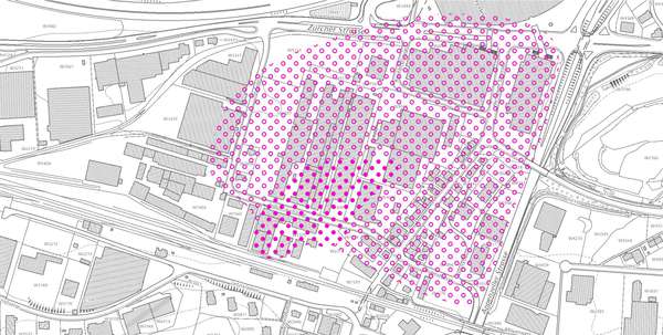
Abstrombereiche, Schadstofffahnen
An diesen Standorten ist die Schadstoffbelastung hoch, d.h. über halbem Konzentrationswert Anhang 1 Altlastenverordnung (SR 814.680) oder mittel, d.h. über Anforderungen an Grundwasserqualität nach Anhang 2 Ziffer 22 der Gewässerschutzverordnung (SR814.201) bzw. über Indikatorwert Anhang 1 der Wegleitung Grundwasserschutz (BAFU 2004).
Simple
- Date (Creation)
- 2015-08-27
- Date (Revision)
- 2026-06-21
- Other citation details
-
Natur- und Landschaftsschutz
- Purpose
-
-
- Status
- On going
partner
- Hours of service
-
Mo. - Fr. von 8:00 - 17:00 Uhr
- Spatial representation type
- Vector
Spatial resolution
Equivalent scale
- Denominator
- 5000
Extent
Extent
- Description
-
Kanton St.Gallen
))
- Maintenance and update frequency
- Irregular
- GEMET
-
-
Grundwasser
-
- geocat.ch
-
-
opendata.swiss
-
Resource constraints
- Access constraints
- Other restrictions
- Other constraints
-
A = öffentlich
Resource constraints
- Classification
- Unclassified
- Language
- Deutsch
- Subtopic Category
- L2 Nature and Landscape Protection
- Distribution format
-
-
ESRI Shapefile
-
andere Formate auf Anfrage
-
Distributor
- Hours of service
-
Mo. - Fr. von 8:00 - 17:00 Uhr
Digital transfer options
- Statement
-
Die Auswahl der betroffenen KbS-Flächen wird vom Amt für Umwelt (AFU) getroffen. Auf Papierausdrucken aus dem Geoportal ( http://www.geoportal.ch); Zoomstufe 1:5'000) werden von Hand die Abgrenzungen der Schadstoff-Fahnen eingezeichnet und mit der KbS-Standortnummer versehen. Gleichzeitig werden die Sachdaten erhoben und in eine Sachdatenbank des AFU eingetragen.
- Hierarchy level
- Dataset
- Reference system identifier
- CH1903+_LV95 / EPSG 2056
Metadata
- Metadata identifier
- f51dccb5-4ce2-4211-8469-ba89ef53bf46-8371
- Language
- Deutsch
- Character encoding
- UTF8
Resource provider
- Hours of service
-
Mo. - Fr. von 8:00 - 17:00 Uhr
Type of resource
- Resource scope
- Dataset
- Date info (Revision)
- 2026-06-21T01:15:46+02:00
Metadata standard
- Title
-
GM03 Core
)))
