 geocat.ch
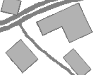
Gebäudehöhe
Gebäudehöhe abgeleitet aus Gebäudedaten aus Amtlicher Vermessung (MOPUBE) und berechnet anhand von LIDAR-Daten.
Simple
- Date (Creation)
- 2020-08-20
- Date (Revision)
- 2026-01-01
- Date (Publication)
- 2026-01-08
- Identifier
- GEBHOEHE
- Status
- On going
Owner
Principal investigator
Principal investigator
- Topic category
-
- C Elevation
Extent
Extent
- Description
- Kanton Bern Canton de Berne
N
S
E
W
))
- Maintenance and update frequency
- Irregular
- Keywords
-
-
Gebäude
-
Höhe
-
opendata.swiss
-
Resource constraints
- Use limitation
-
Auf sämtlichen Plots und Publikationen ist der Vermerk "Gebäudehöhe © Amt für Gemeinden und Raumordnung des Kantons Bern, Amt für Wald und Naturgefahren des Kantons Bern, Amt für Geoinformation des Kantons Bern" anzugeben.
Resource constraints
- Use constraints
- Licence End User
- Other constraints
- Die Daten dürfen gemäss Nutzungsbedingungen frei genutzt werden. Les données peuvent être utilisées librement selon les conditions d’utilisation.
Resource constraints
- Other constraints
- Freie Nutzung. Quellenangabe ist Pflicht. Utilisation libre. Obligation d’indiquer la source.
- Language
- Deutsch
- Character encoding
- UTF8
- Language
- Français
- Character encoding
- UTF8
- Language
- Italiano
- Character encoding
- UTF8
- Language
- English
- Character encoding
- UTF8
- Basic Geodata
- false
- Included with dataset
- false
- Distribution format
-
-
SHP
-
GPKG
-
GeoParquet
-
Digital transfer options
- Transfer size
- 60152097
- OnLine resource
-
ZIP-Datei mit Shapefile, Metadaten und Begleitdaten
Digital transfer options
- Transfer size
- 61791402
- OnLine resource
-
ZIP-Datei mit Geopackage mit Metadaten
Digital transfer options
- Transfer size
- 45455657
- OnLine resource
-
Geoparquet-Datei - Gebäudehöhe
Digital transfer options
- OnLine resource
-
STAC-Collection - GEBHOEHE
Digital transfer options
- OnLine resource
-
Link zum Geoportal des Kantons Bern
- Reference system identifier
- CH1903+ / LV95 -- Swiss CH1903+ / LV95/EPSG:2056
Metadata
- Metadata identifier
- f2a8131a-a602-4f0f-9088-91d68cb2361d
- Language
- Deutsch
- Character encoding
- UTF8
- Language
- Français
- Character encoding
- UTF8
Point of contact
Type of resource
- Resource scope
- Dataset
- Name
-
Geoprodukt - Géoproduit
- Date info (Creation)
- 2020-08-20T00:00:00Z
- Date info (Revision)
- 2026-01-08T00:00:00Z
Metadata standard
- Title
-
GM03 2+
)))