geocat.ch
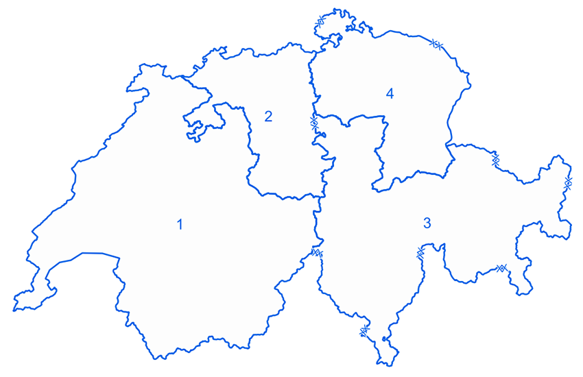
Territorial divisions
The territorial divisions (ter div) are the link with the civilian authorities and ensure the cooperation between the armed forces and the cantons in their area. They provide the contact with the civilian authorities where there is a need for support from the armed forces. They are responsible for conducting the following activities within their area: general support (not police-related), military disaster relief in the interior and across the border, as well as protection tasks. They can be engaged for operations/missions and conduct the units under their command. They provide training and ensure the command readiness of the cantonal territorial liaison staffs.
Simple
- Alternate title
-
Territorial divisions
- Date (Revision)
- 2018-01-01
- Identifier
- ch.vbs.territorialregionen
- Topic category
-
- R Intelligence military
Extent
Extent
- Description
-
Switzerland
))

- Maintenance and update frequency
- Unknown
- geocat.ch
-
-
opendata.swiss
-
- GEMET - INSPIRE themes, version 1.0
-
-
Area management/restriction/regulation zones and reporting units
-
- geocat.ch
-
-
FSDI Federal Spatial Data Infrastructure
-
Resource constraints
- Use constraints
- Other restrictions
- Other constraints
- Opendata BY: Open use. Must provide the source.
- Language
- Deutsch
- Character encoding
- UTF8
- Language
- Français
- Character encoding
- UTF8
- Distribution format
-
-
ESRI File Geodatabase FileGDB (GDB)
-
ESRI Shapefile (SHP)
-
Digital transfer options
- OnLine resource
-
Vorschau map.geo.admin.ch
Preview map.geo.admin.ch
Digital transfer options
- OnLine resource
-
ch.vbs.territorialregionen
WMS-FSDI service, layer "Territorial divisions"
Digital transfer options
Digital transfer options
- OnLine resource
-
RESTful API von geo.admin.ch
RESTful API from geo.admin.ch
- Reference system identifier
- EPSG:2056
Metadata
- Metadata identifier
- f1d7d608-74d7-46fc-a478-b4357409f34b
- Language
- Deutsch
- Character encoding
- UTF8
- Language
- Français
- Character encoding
- UTF8
- Language
- Italiano
- Character encoding
- UTF8
- Language
- English
- Character encoding
- UTF8
- Language
- Rumantsch
- Character encoding
- UTF8
Custodian
Type of resource
- Resource scope
- Dataset
- Metadata linkage
-
https://www.geocat.ch/geonetwork/srv/api/records/f1d7d608-74d7-46fc-a478-b4357409f34b
- Date info (Creation)
- 2015-03-10T13:23:34Z
- Date info (Revision)
- 2026-04-13T09:29:22.518537Z
Metadata standard
- Title
-
eCH-0271