geocat.ch
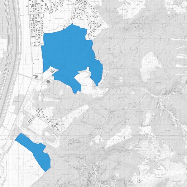
Protected landscape areas
Landscape protection areas in accordance with the Law on the Protection of Nature and Landscape LGBl. 1996 No. 117, Article 18). The landscape protection areas are protected by ordinance.
Simple
- Date (Publication)
- 2013-09-20
- Identifier
- https://metadata.geo.llv.li/f1830fc4-1606-4354-a025-83c189aeb534
- Purpose
-
Protected areas, documentation Protected areas
- Status
- On going
Publisher
- Hours of service
-
8:00-11:30 und 13:30-17:00
Owner
- Hours of service
-
8:00-11:30 und 13:30-17:00
- Spatial representation type
- Vector
Spatial resolution
Equivalent scale
- Denominator
- 10000
- Topic category
-
- L Environment
Extent
Extent
- Description
-
Liechtenstein
))

- Maintenance and update frequency
- As needed
- GEMET
-
-
vector
-
protected area
-
- GEMET - INSPIRE themes, version 1.0
-
-
Protected sites
-
- geocat.ch
-
-
OeREB
-
nature
-
INSPIRE
-
OpenData
-
- Räumlicher Anwendungsbereich
-
-
National
-
- GEMET
-
-
landscape
-
Resource constraints
- Classification
- Unclassified
Resource constraints
- Use limitation
-
keine
- Access constraints
- Other restrictions
- Use constraints
- Other restrictions
- Other constraints
- No limitations to public access
Resource constraints
- Access constraints
- Other restrictions
- Use constraints
- Other restrictions
- Other constraints
- No conditions to access and use
- Other constraints
- Opendata BY: Open use. Must provide the source.
- Language
- Deutsch
- Character encoding
- UTF8
- Subtopic Category
- L1 Environmental Protection, Noise
- Subtopic Category
- L2 Nature and Landscape Protection
- Distribution format
-
-
INTERLIS 1 (ITF)
-
ESRI Shapefile (SHP)
-
AutoCAD DXF (DXF)
-
Point of contact
- Hours of service
-
8:00-11:30 und 13:30-17:00
Digital transfer options
- OnLine resource
-
Geodatenportal der Liechtensteinischen Landesverwaltung
Geodata Portal of the National Administration
Digital transfer options
- OnLine resource
-
li.au.nl_landschaftschutz
OGC-WMS Service of the National Administration
Digital transfer options
- OnLine resource
-
Zip Download über das Geodatenportal
Zip download via the geodata portal
- Hierarchy level
- Dataset
Report
Result
- Title
-
VERORDNUNG (EG) Nr. 1089/2010 DER KOMMISSION vom 23. November 2010 zur Durchführung der Richtlinie 2007/2/EG des Europäischen Parlaments und des Rates hinsichtlich der Interoperabilität von Geodatensätzen und -diensten
- Date (Publication)
- 2010-12-08
- Explanation
-
nicht konform
- Pass
- false
- Statement
-
Konstruktion auf der Grundlage der AV und der Landeskarten
- Hierarchy level
- Dataset
- Topology level
- Full planar graph
- Geometric object type
- Surface
- Geometric object count
- 2
- Reference system identifier
- http://www.opengis.net/def/crs/EPSG/0/2056
- Reference system identifier
- http://www.opengis.net/def/crs/EPSG/0/4936
Metadata
- Metadata identifier
- f1830fc4-1606-4354-a025-83c189aeb534
- Language
- Deutsch
- Character encoding
- UTF8
- Language
- Français
- Character encoding
- UTF8
- Language
- Italiano
- Character encoding
- UTF8
- Language
- English
- Character encoding
- UTF8
Point of contact
- Hours of service
-
8:00-11:30 und 13:30-17:00
Type of resource
- Resource scope
- Dataset
- Metadata linkage
-
https://www.geocat.ch/geonetwork/srv/api/records/f1830fc4-1606-4354-a025-83c189aeb534
- Date info (Creation)
- 2013-09-20T14:38:54Z
- Date info (Revision)
- 2026-04-13T09:32:13.65673Z
Metadata standard
- Title
-
eCH-0271