geocat.ch
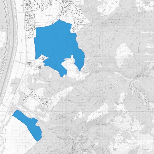
Landschaftsschutzgebiete
Protected landscape areas
Landschaftsschutzgebiete gemäss gemäss Gesetz zum Schutz von Natur und Landschaft LGBl. 1996 Nr. 117, Artikel 18). Die Landschaftsschutzgebiete sind mit Verordnung geschützt.
Landscape protection areas in accordance with the Law on the Protection of Nature and Landscape LGBl. 1996 No. 117, Article 18). The landscape protection areas are protected by ordinance.
Simple
-
Date (Publication)Data (Pubblicazione)Date (Publication)Datum (Publikation)
- 2013-09-20
-
IdentifiantIdentificatoreIdentifierKennung
- https://metadata.geo.llv.li/f1830fc4-1606-4354-a025-83c189aeb534
-
ButScopoPurposeZweck
-
Schutzgebiete, Dokumentation Schutzgebiete
Protected areas, documentation Protected areas
-
ÉtatStatoStatusBearbeitungsstatus
-
ContinuIn corsoOn goingKontinuierliche Aktualisierung
responsable de la publication
Editore
Publisher
Herausgeber
-
Heures de serviceOrario di servizioHours of serviceBetriebszeiten
-
8:00-11:30 und 13:30-17:00
Propriétaire
Proprietario
Owner
Eigentümer
-
Heures de serviceOrario di servizioHours of serviceBetriebszeiten
-
8:00-11:30 und 13:30-17:00
-
Type de représentation spatialeTipo di rappresentazione spazialeSpatial representation typeRäumliche Darstellungsart
-
vecteurVettorialeVectorVektor
Résolution spatiale
Risoluzione spaziale
Spatial resolution
Räumliche Auflösung
Fraction représentative
Frazione rappresentativa
Equivalent scale
Vergleichsmassstab
-
DénominateurDenominatoreDenominatorMassstabszahl
- 10000
-
Catégorie de thèmeCategoria ISOTopic categoryThematik
-
-
L EnvironnementL AmbienteL EnvironmentL Umwelt
-
Étendue
Estensione
Extent
Ausdehnung
Étendue
Estensione
Extent
Ausdehnung
-
DescriptionDescrizioneDescriptionBeschreibung
-
Liechtenstein
Liechtenstein
Liechtenstein
Liechtenstein
))

-
Fréquence de mise à jourFrequenza di aggiornamentoMaintenance and update frequencyWartungsintervall
-
Comme nécessaireSecondo necessitàAs neededBei Bedarf
- GEMET
-
-
vecteur
vettore
vector
-
espace protégé
area protetta
protected area
-
- GEMET - INSPIRE themes, version 1.0
-
-
Sites protégés
Siti protetti
Protected sites
-
- geocat.ch
-
-
RDPPF
RDPP
OeREB
-
nature
natura
nature
-
INSPIRE
INSPIRE
INSPIRE
-
OpenData
OpenData
OpenData
-
- Räumlicher Anwendungsbereich
-
-
Nationales
Nazionali
National
-
- GEMET
-
-
Landschaft
paysage
paesaggio
landscape
-
Contraintes sur la ressource
Vincoli sulle risorse
Resource constraints
Ressourcenbeschränkungen
-
Restrictions de manipulationRestrizioni di manipolazioneClassificationHandhabungsbeschränkungen
-
Non classifiéNon classificatoUnclassifiedNicht klassifiziert
Contraintes sur la ressource
Vincoli sulle risorse
Resource constraints
Ressourcenbeschränkungen
-
Limitation d'utilisationLimitazione d'usoUse limitationNutzungsbeschränkung
-
keine
-
Contraintes d'accèsVincoli di accessoAccess constraintsZugriffsbeschränkungen
-
Autres restrictionsAltre restrizioniOther restrictionsAndere Beschränkungen
-
Contraintes d'utilisationVincoli d'usoUse constraintsNutzungseinschränkungen
-
Autres restrictionsAltre restrizioniOther restrictionsAndere Beschränkungen
-
Autres contraintesAltri vincoliOther constraintsAndere Einschränkungen
- No limitations to public accessNo limitations to public accessNo limitations to public accessNo limitations to public access
Contraintes sur la ressource
Vincoli sulle risorse
Resource constraints
Ressourcenbeschränkungen
-
Contraintes d'accèsVincoli di accessoAccess constraintsZugriffsbeschränkungen
-
Autres restrictionsAltre restrizioniOther restrictionsAndere Beschränkungen
-
Contraintes d'utilisationVincoli d'usoUse constraintsNutzungseinschränkungen
-
Autres restrictionsAltre restrizioniOther restrictionsAndere Beschränkungen
-
Autres contraintesAltri vincoliOther constraintsAndere Einschränkungen
- No conditions to access and useNo conditions to access and useNo conditions to access and useNo conditions to access and use
-
Autres contraintesAltri vincoliOther constraintsAndere Einschränkungen
- Opendata BY: Freie Nutzung. Quellenangabe ist Pflicht.Opendata BY: Utilisation libre. Obligation d’indiquer la source.Opendata BY: Libero utilizzo. Indicazione della fonte obbligatoria.Opendata BY: Open use. Must provide the source.
-
LangueLinguaLanguageSprache
- Deutsch
-
Encodage de caractèresCodifica dei caratteriCharacter encodingZeichenkodierung
-
Utf8UTF8UTF8Utf8
-
Catégorie de sous-thèmeCategoria di sottotemaSubtopic CategoryThematische Unterkategorien
-
L1 Protection de l’environnement, bruitL1 Protezione ambientale, RumoreL1 Environmental Protection, NoiseL1 Umweltschutz, Lärm
-
Catégorie de sous-thèmeCategoria di sottotemaSubtopic CategoryThematische Unterkategorien
-
L2 Protection de la nature et du paysageL2 Protezione della natura e del paesaggioL2 Nature and Landscape ProtectionL2 Natur- und Landschaftsschutz
-
Format de distributionFormato (codifica)Distribution formatAbgabeformat
-
-
INTERLIS 1 (ITF)
-
ESRI Shapefile (SHP)
-
AutoCAD DXF (DXF)
-
Point de contact
Punto di contatto
Point of contact
Ansprechpartner
-
Heures de serviceOrario di servizioHours of serviceBetriebszeiten
-
8:00-11:30 und 13:30-17:00
Options de transfert numérique
Opzioni di trasferimento digitale
Digital transfer options
Optionen für die digitale Übertragung
-
Ressource en ligneRisorsa onlineOnLine resourceOnline
-
Geodatenportal der Liechtensteinischen Landesverwaltung
Geodatenportal der LandesverwaltungGeodata Portal of the National Administration
Options de transfert numérique
Opzioni di trasferimento digitale
Digital transfer options
Optionen für die digitale Übertragung
-
Ressource en ligneRisorsa onlineOnLine resourceOnline
-
li.au.nl_landschaftschutz
OGC WMS Service der Liechtensteinen LandesverwaltungOGC-WMS Service of the National Administration
Options de transfert numérique
Opzioni di trasferimento digitale
Digital transfer options
Optionen für die digitale Übertragung
-
Ressource en ligneRisorsa onlineOnLine resourceOnline
-
Zip Download über das Geodatenportal
Zip Download über das GeodatenportalZip download via the geodata portal
-
NiveauLivelloHierarchy levelBezugsebene
-
Jeu de donnéesSet di datiDatasetDatenbestand
Rapport sur la qualité
Rapporto sulla qualità
Report
Qualitätsbericht
Result
Risultato
Result
Ergebnis
-
TitreTitoloTitleTitel
-
VERORDNUNG (EG) Nr. 1089/2010 DER KOMMISSION vom 23. November 2010 zur Durchführung der Richtlinie 2007/2/EG des Europäischen Parlaments und des Rates hinsichtlich der Interoperabilität von Geodatensätzen und -diensten
-
Date (Publication)Data (Pubblicazione)Date (Publication)Datum (Publikation)
- 2010-12-08
-
ExplicationSpiegazioneExplanationErläuterung
-
nicht konform
-
Degré de conformitéGrado di conformitàPassKonformitätsgrad
- false
-
Généralités sur la provenanceInformazioni generali sulla provenienzaStatementErklärung
-
Konstruktion auf der Grundlage der AV und der Landeskarten
-
NiveauLivelloHierarchy levelBezugsebene
-
Jeu de donnéesSet di datiDatasetDatenbestand
-
Niveau de topologieLivello di topologiaTopology levelTopologieebene
-
Topologie de réseau complèteGrafo planare completoFull planar graphVollständige Netzwerktopologie
-
Type d’objet géométriqueTipo di oggetto geometricoGeometric object typeTyp des geometrischen Objekts
-
PolygoneSuperficieSurfacesurface
-
Nombre d’objets géométriquesNumero di oggetti geometriciGeometric object countAnzahl geometrischer Objekte
- 2
-
Nom du système de référenceNome del sistema di riferimentoReference system identifierName des Referenzsystems
- http://www.opengis.net/def/crs/EPSG/0/2056
-
Nom du système de référenceNome del sistema di riferimentoReference system identifierName des Referenzsystems
- http://www.opengis.net/def/crs/EPSG/0/4936
Metadata
-
Identifiant des métadonnéesIdentificativo della schedaMetadata identifierIdentifikator des Metadatensatzes
- f1830fc4-1606-4354-a025-83c189aeb534
-
LangueLinguaLanguageSprache
- Deutsch
-
Encodage de caractèresCodifica dei caratteriCharacter encodingZeichenkodierung
-
Utf8UTF8UTF8Utf8
-
LangueLinguaLanguageSprache
- Français
-
Encodage de caractèresCodifica dei caratteriCharacter encodingZeichenkodierung
-
Utf8UTF8UTF8Utf8
-
LangueLinguaLanguageSprache
- Italiano
-
Encodage de caractèresCodifica dei caratteriCharacter encodingZeichenkodierung
-
Utf8UTF8UTF8Utf8
-
LangueLinguaLanguageSprache
- English
-
Encodage de caractèresCodifica dei caratteriCharacter encodingZeichenkodierung
-
Utf8UTF8UTF8Utf8
Point de contact
Punto di contatto
Point of contact
Ansprechpartner
-
Heures de serviceOrario di servizioHours of serviceBetriebszeiten
-
8:00-11:30 und 13:30-17:00
Type de ressource
Tipo di risorsa
Type of resource
Anwendungsbereich der Metadaten
-
Domaine d'application de la ressourceAmbito di applicazione della risorsaResource scopeDomäne der Ressourcenanwendung
-
Jeu de donnéesSet di datiDatasetDatenbestand
-
Informations de date (Création)Informazioni sulla data (Creazione)Date info (Creation)Datumsangaben (Erstellung)
- 2013-09-20T14:38:54Z
-
Informations de date (Révision)Informazioni sulla data (Revisione)Date info (Revision)Datumsangaben (Aktualisierung)
- 2026-04-13T09:32:13.65673Z
Norme des métadonnées
Standard dei metadati
Metadata standard
Metadatenstandard
-
TitreTitoloTitleTitel
-
eCH-0271