 geocat.ch
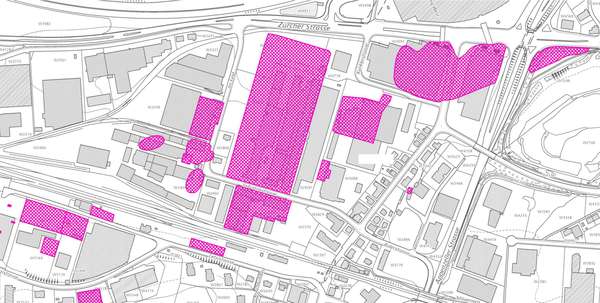
Kataster der belasteten Standorte
An diesen Standorten steht nach USG Art. 32c und AltlV Art. 5 fest oder es ist mit grosser Wahrscheinlichkeit zu erwarten, dass im Untergrund eine Belastung vorliegt.
Simple
- Date (Creation)
- 2014-01-15
- Date (Revision)
- 2026-06-21
- Other citation details
-
Natur- und Landschaftsschutz
- Purpose
-
Vollzugsgrundlage Umweltschutz, verbindlich für Behörden und Grundeigentümer
- Status
- On going
partner
Amt für Raumentwicklung und Geoinformation - geodaten@sg.ch
Lämmlisbrunnenstrasse 54
St. Gallen
9001
CH
Homepage
- Hours of service
-
Mo. - Fr. von 8:00 - 17:00 Uhr
- Spatial representation type
- Vector
Spatial resolution
- Spatial resolution
- 1 m
Extent
Extent
- Description
-
Kanton St.Gallen
N
S
E
W
))
- Maintenance and update frequency
- Weekly
- geocat.ch
-
-
opendata.swiss
-
Belasteter Standort
-
Resource constraints
- Access constraints
- Other restrictions
- Other constraints
-
A = öffentlich
Resource constraints
- Classification
- Unclassified
- Language
- Deutsch
- Subtopic Category
- L2 Nature and Landscape Protection
- Distribution format
-
-
ESRI Shapefile
-
andere Formate auf Anfrage
-
Distributor
Amt für Raumentwicklung und Geoinformation - geodaten@sg.ch
Lämmlisbrunnenstrasse 54
St. Gallen
9001
CH
Homepage
- Hours of service
-
Mo. - Fr. von 8:00 - 17:00 Uhr
Digital transfer options
- Statement
-
Ab 1990 systematische Erhebung aller Verdachtsflächen, 2002 - 2009 Überprüfung und Zuteilung zum KbS.
- Hierarchy level
- Dataset
- Reference system identifier
- CH1903+_LV95 / EPSG 2056
Metadata
- Metadata identifier
- ef8fd14e-c77b-4f3d-a8a8-65f08073d925-8371
- Language
- Deutsch
- Character encoding
- UTF8
Resource provider
Amt für Raumentwicklung und Geoinformation - geodaten@sg.ch
Lämmlisbrunnenstrasse 54
St. Gallen
9001
CH
Homepage
- Hours of service
-
Mo. - Fr. von 8:00 - 17:00 Uhr
Type of resource
- Resource scope
- Dataset
- Date info (Revision)
- 2026-06-21T01:15:43+02:00
Metadata standard
- Title
-
GM03 Core
)))
