geocat.ch
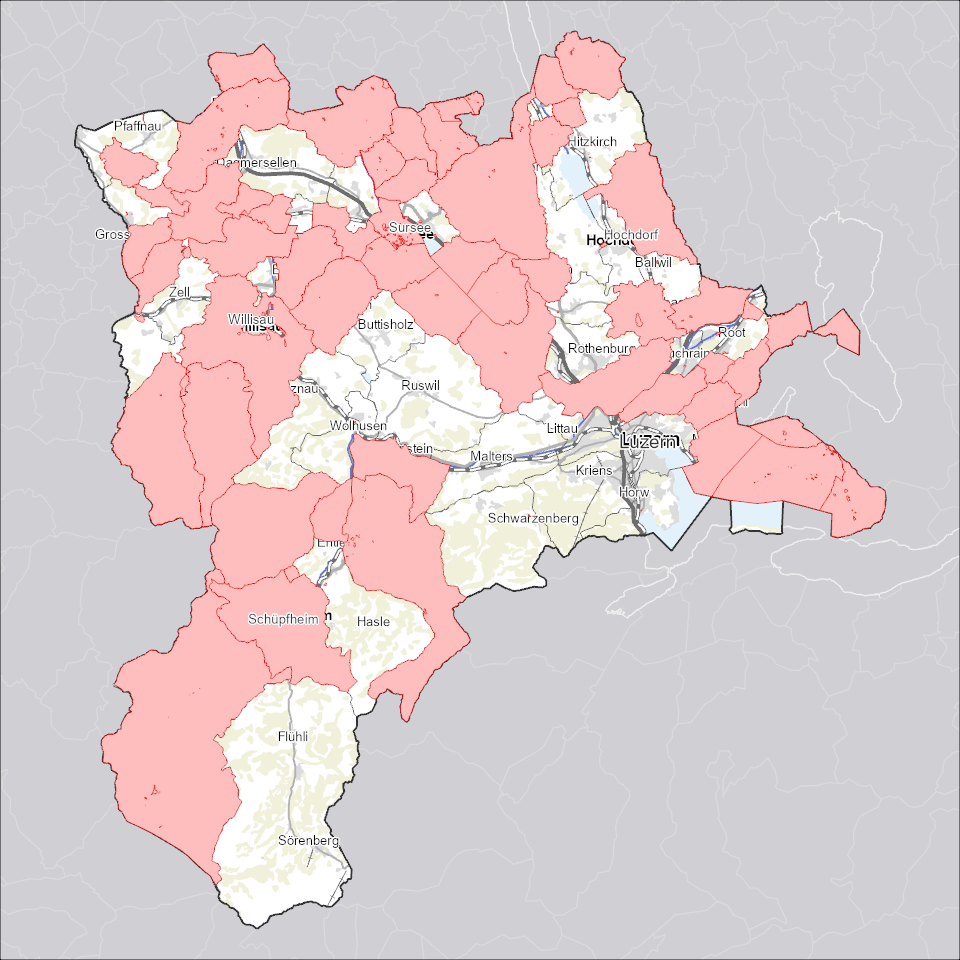
Nutzungsplanung: Planungszonen
Mit Planungszonen wird sichergestellt, dass in den betroffenen Gebieten nur Vorhaben zulässig sind, die der geplanten künftigen Nutzung nicht widersprechen.
Simple
Informazioni di identificazione
- Titolo alternativo
-
ZPLPLZON_DS
- Data (Creazione)
- 2025-12-18
- Formato di presentazione
- Mappa digitale
- Finalità
-
Planungszonen dienen der Sicherstellung der Nutzungsplanung. Mit temporären Planungszonen wird sichergestellt, dass in den betroffenen Gebieten nur Vorhaben zulässig sind, die der geplanten künftigen Nutzung nicht widersprechen. Die Planungszone wird von einer Behörde erlassen und ist sofort mit deren Erlass rechtswirksam. In einem mit Planungszone bezeichnetem Gebiet darf nichts unternommen werden, das die (zukünftige) Nutzungsplanung präjudizieren würde.
- Status
- In corso
Punto di contatto
Servizio responsabile
- Nome dell'ente
-
Kanton Luzern, Abteilung Geoinformation
- Telefono
-
041 228 51 83
Indirizzo
- Risorsa online
- https://geoportal.lu.ch/ ( https )
- Ruolo
- Publisher
Punto di contatto
Servizio responsabile
- Nome dell'ente
-
Raumdatenpool Kanton Luzern
Indirizzo
- Città
-
Luzern
- Codice postale
-
6002
- Nazione
-
CH
- Via
-
Murbacherstrasse
- Numero
-
21
- Ruolo
- Owner
- Cognome
-
Raumdatenpool Kanton Luzern
- Abbreviazione dell'organizzazione
-
RDP
- Frequenza di aggiornamento
- Continuo
-
geocat.ch
-
-
opendata.swiss
-
Bewilligungen
-
Eigentumsbeschränkung/ÖREB
-
Nutzungsplanung
-
Raumplanung
-
Zonenplan
-
- Vincoli di accesso
- none
- Vincoli di fruibilità
- Proprietà intellettuale dei dati
- Limitazione d’uso
-
öffentlich zugängliche Geobasisdaten
- Vincoli di accesso
- none
- Vincoli di fruibilità
- none
- Limitazione d’uso
-
Freie Nutzung. Quellenangabe ist Pflicht
- Identificatore aggregato del dataset
- fcc0cabd-c6f7-451f-94c5-9176f35e29f0
- Tipo di associazione
- Larger work citation
- Identificatore aggregato del dataset
- e74766d2-6d07-45dc-b87b-09c295dd24d4
- Tipo di associazione
- Larger work citation
- Identificatore aggregato del dataset
- de753132-f8a7-4a4d-a652-65946f1263b0
- Tipo di associazione
- Larger work citation
- Identificatore aggregato del dataset
- b2bff274-9579-48a7-b7ea-bbc075101618
- Tipo di associazione
- Larger work citation
- Identificatore aggregato del dataset
- bb1668d9-b78f-42ee-8b45-f465cd324a5d
- Tipo di associazione
- Larger work citation
- Identificatore aggregato del dataset
- 54185867-d324-444e-b2f7-d95e597ccc47
- Tipo di associazione
- Larger work citation
- Identificatore aggregato del dataset
- ff397148-97d0-487f-9f9c-2c457ed25b55
- Tipo di associazione
- Larger work citation
- Identificatore aggregato del dataset
- 27eecdb2-85f3-4e01-8139-511808d2f251
- Tipo di associazione
- Larger work citation
- Identificatore aggregato del dataset
- 9c5975db-6808-4cc1-ad69-c2e02fb51199
- Tipo di associazione
- Larger work citation
- Identificatore aggregato del dataset
- eb3b82b1-93d6-4bdb-9a83-5eab36266e9e
- Tipo di associazione
- Larger work citation
- Identificatore aggregato del dataset
- a0610b38-3a85-4f3a-a423-88d10b97e197
- Tipo di associazione
- Larger work citation
- Identificatore aggregato del dataset
- d15fb7b2-bc57-442b-b1cf-731650752f3f
- Tipo di associazione
- Larger work citation
- Identificatore aggregato del dataset
- ab16e834-933d-41d8-a632-d1608e3fda25
- Tipo di associazione
- Larger work citation
- Identificatore aggregato del dataset
- 72cfc34c-293b-413a-b977-0cef5411c64b
- Tipo di associazione
- Larger work citation
- Tipo di rappresentazione spaziale
- Dati vettoriali
- Denominatore
- 1000
- Lingua dei metadati
- Deutsch
- Set dei caratteri dei metadati
- UTF8
- Tema
-
- E Pianificazione territoriale, catasto fondiario
- E1 Pianificazione e sviluppo territoriale
- Descrizione
-
Kanton Luzern
))
- Formato di distribuzione
-
-
ESRI Geodatabase (.gdb)
(
)
-
ESRI Shapefile (.shp)
(
)
-
OGC GeoPackage (.gpkg)
(
)
-
INTERLIS (.itf/.xtf)
(
)
-
ESRI Geodatabase (.gdb)
(
)
Distributore
Servizio responsabile
- Nome dell'ente
-
Dienststelle Raum und Wirtschaft (rawi)
- Telefono
-
041 228 51 83
Indirizzo
- Risorsa online
- https://geoportal.lu.ch ( https )
- Ruolo
- Point of contact
- Nome
-
Geodaten
- Cognome
-
Kanton Luzern
- Abbreviazione dell'organizzazione
-
rawi
- Risorsa online
-
Datenshop
(
https
)
Produktansicht Geodatenshop
- Livello
- Set di dati
- Genealogia del dato – Processo di produzione
-
Grundlagen: Daten der amtlichen Vermessung (AV)
- Oggetto di tipo geometrico
- polygon
- Identificatore del sistema di riferimento
- CH1903+
Informazioni sul contenuto
- Lingua dei metadati
-
ger
- Included with dataset
- Data (Pubblicazione)
- 2017-06-19
Classe
- Designazione
-
Flächen
Attributo
- Nome
-
AUTHOFRESP
- Descrizione
-
Zuständige Behörde
Attributo
- Nome
-
DOSSIER
- Descrizione
-
Dossier
Attributo
- Nome
-
DOKUMENT
- Descrizione
-
Dokument
Attributo
- Nome
-
DATEOFVALID
- Descrizione
-
Datum Inkraftsetzung
Attributo
- Nome
-
DATEOFEXP
- Descrizione
-
Ablaufdatum
Attributo
- Nome
-
DATEOFCNCL
- Descrizione
-
Aufhebungsdatum
Attributo
- Nome
-
BEMERKUNGEN
- Descrizione
-
Bemerkungen
Attributo
- Nome
-
DATEOFCHNG
- Descrizione
-
Datum letzte Änderung
Attributo
- Nome
-
CREABY
- Descrizione
-
Erstellt durch
Attributo
- Nome
-
BEZEICHNUNG
- Descrizione
-
Bezeichnung
Attributo
- Nome
-
BASEKIND
- Descrizione
-
Art Grundlage
Attributo
- Nome
-
FILEID
- Descrizione
-
Identifiziert das zugehörige Interlisfile aus dem die Daten importiert werden
Attributo
- Nome
-
OBJECTID
- Descrizione
-
OBJECTID
Attributo
- Nome
-
SHAPE
- Descrizione
-
SHAPE
Attributo
- Nome
-
SHAPE.AREA
- Descrizione
-
SHAPE.AREA
Attributo
- Nome
-
SHAPE.LEN
- Descrizione
-
SHAPE.LEN
- Genere del modello
- Descrizione di oggetto
Metadata
- Lingua dei metadati
- Deutsch
- Set dei caratteri dei metadati
- UTF8
- Livello gerarchico
- Set di dati
- Data dei metadati
- 2025-12-13
- Nome dello Standard dei metadati
-
GM03 2+
Contatto
Servizio responsabile
- Nome dell'ente
-
Dienststelle Raum und Wirtschaft (rawi)
- Telefono
-
041 228 51 83
Indirizzo
- Città
-
Luzern
- Codice postale
-
6002
- Nazione
-
CH
- Via
-
Murbacherstrasse
- Numero
-
21
- Risorsa online
- https://geoportal.lu.ch ( https )
- Ruolo
- Point of contact
- Nome
-
Reto
- Cognome
-
Müller
- Abbreviazione dell'organizzazione
-
rawi
- Frequenza di aggiornamento
- Secondo necessità