geocat.ch
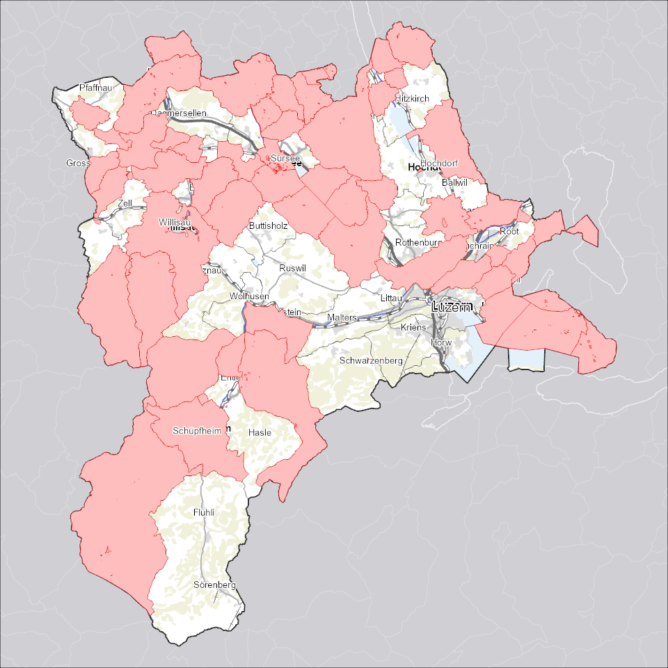
Nutzungsplanung: Planungszonen
Mit Planungszonen wird sichergestellt, dass in den betroffenen Gebieten nur Vorhaben zulässig sind, die der geplanten künftigen Nutzung nicht widersprechen.
Simple
Identification info
- Alternate title
-
ZPLPLZON_DS
- Date (Creation)
- 2025-12-18
- Presentation form
- Digital map
- Purpose
-
Planungszonen dienen der Sicherstellung der Nutzungsplanung. Mit temporären Planungszonen wird sichergestellt, dass in den betroffenen Gebieten nur Vorhaben zulässig sind, die der geplanten künftigen Nutzung nicht widersprechen. Die Planungszone wird von einer Behörde erlassen und ist sofort mit deren Erlass rechtswirksam. In einem mit Planungszone bezeichnetem Gebiet darf nichts unternommen werden, das die (zukünftige) Nutzungsplanung präjudizieren würde.
- Status
- On going
Point of contact
Responsible party
- Organisation name
-
Kanton Luzern, Abteilung Geoinformation
- Voice
-
041 228 51 83
Address
- City
-
Luzern
- Postal code
-
6002
- Country
-
CH
- Electronic mail address
- Streetname
-
Murbacherstrasse
- Streetnumber
-
21
- Website
- https://geoportal.lu.ch/ ( https )
- Role
- Publisher
Point of contact
Responsible party
- Organisation name
-
Raumdatenpool Kanton Luzern
Address
- City
-
Luzern
- Postal code
-
6002
- Country
-
CH
- Electronic mail address
- Streetname
-
Murbacherstrasse
- Streetnumber
-
21
- Role
- Owner
- Last Name
-
Raumdatenpool Kanton Luzern
- Organisation Acronym
-
RDP
- Maintenance and update frequency
- Continual
-
geocat.ch
-
-
opendata.swiss
-
Bewilligungen
-
Eigentumsbeschränkung/ÖREB
-
Nutzungsplanung
-
Raumplanung
-
Zonenplan
-
- Access constraints
- none
- Use constraints
- Copyright
- Use limitation
-
öffentlich zugängliche Geobasisdaten
- Access constraints
- none
- Use constraints
- none
- Use limitation
-
Freie Nutzung. Quellenangabe ist Pflicht
- Aggregate Datasetindentifier
- fcc0cabd-c6f7-451f-94c5-9176f35e29f0
- Association Type
- Larger work citation
- Aggregate Datasetindentifier
- e74766d2-6d07-45dc-b87b-09c295dd24d4
- Association Type
- Larger work citation
- Aggregate Datasetindentifier
- de753132-f8a7-4a4d-a652-65946f1263b0
- Association Type
- Larger work citation
- Aggregate Datasetindentifier
- b2bff274-9579-48a7-b7ea-bbc075101618
- Association Type
- Larger work citation
- Aggregate Datasetindentifier
- bb1668d9-b78f-42ee-8b45-f465cd324a5d
- Association Type
- Larger work citation
- Aggregate Datasetindentifier
- 54185867-d324-444e-b2f7-d95e597ccc47
- Association Type
- Larger work citation
- Aggregate Datasetindentifier
- ff397148-97d0-487f-9f9c-2c457ed25b55
- Association Type
- Larger work citation
- Aggregate Datasetindentifier
- 27eecdb2-85f3-4e01-8139-511808d2f251
- Association Type
- Larger work citation
- Aggregate Datasetindentifier
- 9c5975db-6808-4cc1-ad69-c2e02fb51199
- Association Type
- Larger work citation
- Aggregate Datasetindentifier
- eb3b82b1-93d6-4bdb-9a83-5eab36266e9e
- Association Type
- Larger work citation
- Aggregate Datasetindentifier
- a0610b38-3a85-4f3a-a423-88d10b97e197
- Association Type
- Larger work citation
- Aggregate Datasetindentifier
- d15fb7b2-bc57-442b-b1cf-731650752f3f
- Association Type
- Larger work citation
- Aggregate Datasetindentifier
- ab16e834-933d-41d8-a632-d1608e3fda25
- Association Type
- Larger work citation
- Aggregate Datasetindentifier
- 72cfc34c-293b-413a-b977-0cef5411c64b
- Association Type
- Larger work citation
- Spatial representation type
- Vector
- Denominator
- 1000
- Language
- Deutsch
- Character set
- UTF8
- Topic category
-
- E Spatial Planning, Cadastre
- E1 Spatial Planning, Spatial Development
- Description
-
Kanton Luzern
))
- Distribution format
-
-
ESRI Geodatabase (.gdb)
(
)
-
ESRI Shapefile (.shp)
(
)
-
OGC GeoPackage (.gpkg)
(
)
-
INTERLIS (.itf/.xtf)
(
)
-
ESRI Geodatabase (.gdb)
(
)
Distributor contact
Responsible party
- Organisation name
-
Dienststelle Raum und Wirtschaft (rawi)
- Voice
-
041 228 51 83
Address
- City
-
Luzern
- Postal code
-
6002
- Country
-
CH
- Electronic mail address
- Streetname
-
Murbacherstrasse
- Streetnumber
-
21
- Website
- https://geoportal.lu.ch ( https )
- Role
- Point of contact
- First Name
-
Geodaten
- Last Name
-
Kanton Luzern
- Organisation Acronym
-
rawi
- OnLine resource
-
Datenshop
(
https
)
Produktansicht Geodatenshop
- Hierarchy level
- Dataset
- Statement
-
Grundlagen: Daten der amtlichen Vermessung (AV)
- Geometric object type
- polygon
- Reference system identifier
- CH1903+
Content Information
- Metadata language
-
ger
- Included with dataset
- Date (Publication)
- 2017-06-19
Class
- Name
-
Flächen
Attribute
- Name
-
AUTHOFRESP
- Description
-
Zuständige Behörde
Attribute
- Name
-
DOSSIER
- Description
-
Dossier
Attribute
- Name
-
DOKUMENT
- Description
-
Dokument
Attribute
- Name
-
DATEOFVALID
- Description
-
Datum Inkraftsetzung
Attribute
- Name
-
DATEOFEXP
- Description
-
Ablaufdatum
Attribute
- Name
-
DATEOFCNCL
- Description
-
Aufhebungsdatum
Attribute
- Name
-
BEMERKUNGEN
- Description
-
Bemerkungen
Attribute
- Name
-
DATEOFCHNG
- Description
-
Datum letzte Änderung
Attribute
- Name
-
CREABY
- Description
-
Erstellt durch
Attribute
- Name
-
BEZEICHNUNG
- Description
-
Bezeichnung
Attribute
- Name
-
BASEKIND
- Description
-
Art Grundlage
Attribute
- Name
-
FILEID
- Description
-
Identifiziert das zugehörige Interlisfile aus dem die Daten importiert werden
Attribute
- Name
-
OBJECTID
- Description
-
OBJECTID
Attribute
- Name
-
SHAPE
- Description
-
SHAPE
Attribute
- Name
-
SHAPE.AREA
- Description
-
SHAPE.AREA
Attribute
- Name
-
SHAPE.LEN
- Description
-
SHAPE.LEN
- Model type
- Feature description
Metadata
- Metadata language
- Deutsch
- Character set
- UTF8
- Hierarchy level
- Dataset
- Date stamp
- 2025-12-13
- Metadata standard name
-
GM03 2+
Metadata author
Responsible party
- Organisation name
-
Dienststelle Raum und Wirtschaft (rawi)
- Voice
-
041 228 51 83
Address
- City
-
Luzern
- Postal code
-
6002
- Country
-
CH
- Electronic mail address
- Streetname
-
Murbacherstrasse
- Streetnumber
-
21
- Website
- https://geoportal.lu.ch ( https )
- Role
- Point of contact
- First Name
-
Reto
- Last Name
-
Müller
- Organisation Acronym
-
rawi
- Maintenance and update frequency
- As needed