geocat.ch
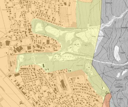
Map of the seismic subsoil classes
The subsoil class is required to determine the seismic action of a structure in accordance with the SIA 261 standard. The maps of the subsoil classes are to be regarded as indicative maps and are not plot-specific. Methodically, the subsoil class is mapped on the safe side in the event of uncertainties.
Simple
- Alternate title
-
Map of the seismic subsoil classes
- Date (Creation)
- 2024-09-06
- Identifier
- https://metadata.geo.llv.li/ed3dd7bb-9657-4ee8-b9bd-2b5d5f32c09d
- Purpose
-
Preliminary investigations into the effects of earthquakes on a structure
- Status
- Completed
Owner
- Hours of service
-
8:00-11:30 und 13:30-17:00
- Spatial representation type
- Vector
Spatial resolution
Equivalent scale
- Denominator
- 500
- Topic category
-
- F Geoscientific information
Extent
Extent
- Description
-
Liechtenstein
))

- Maintenance and update frequency
- Not planned
Point of contact
- Hours of service
-
8:00-11:30 und 13:30-17:00
Resource format
- Title
-
INTERLIS 2 (XTF)
- Date
- GEMET
-
-
agriculture
-
soil use
-
soil use
-
Resource constraints
- Access constraints
- Other restrictions
- Other constraints
- No limitations to public access
- Language
- Deutsch
- Character encoding
- UTF8
- Subtopic Category
- F2 Soils
- Distribution format
-
-
INTERLIS 2 (XTF)
-
Distributor
- Hours of service
-
8:00-11:30 und 13:30-17:00
- Fees
-
Aufwand
Digital transfer options
Digital transfer options
- OnLine resource
-
li.abs.baugrundklassen_flaechen
Public WMS Service of the National Administration
- Statement
-
no
- Hierarchy level
- Dataset
- Topology level
- Full planar graph
- Geometric object type
- Surface
- Geometric object count
- 100
- Reference system identifier
- EPSG:2056
Metadata
- Metadata identifier
- ed3dd7bb-9657-4ee8-b9bd-2b5d5f32c09d
- Language
- Deutsch
- Character encoding
- UTF8
- Language
- Français
- Character encoding
- UTF8
- Language
- Italiano
- Character encoding
- UTF8
- Language
- English
- Character encoding
- UTF8
Point of contact
- Hours of service
-
8:00-11:30 und 13:30-17:00
Type of resource
- Resource scope
- Dataset
- Metadata linkage
-
https://www.geocat.ch/geonetwork/srv/api/records/ed3dd7bb-9657-4ee8-b9bd-2b5d5f32c09d
- Date info (Creation)
- 2023-04-17T13:03:38.768Z
- Date info (Revision)
- 2026-04-13T09:32:14.746465Z
Metadata standard
- Title
-
eCH-0271