geocat.ch
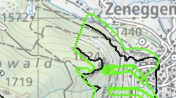
Périmètres d'études des dangers géologiques
Inventaire géographique des zones ayant fait l'objet d'une étude de danger géologique
Simple
- Alternate title
-
Périmètres d'études des dangers géologiques
- Date (Creation)
- 2010-08-31
- Date (Revision)
- 2026-01-28
- Identifier
- 333
- Purpose
-
Cartographie des périmètres d'études de danger géologique
- Status
- On going
Custodian
- Spatial representation type
- Vector
Spatial resolution
Equivalent scale
- Denominator
- 10000
- Topic category
-
- F Geoscientific information
Extent
Extent
- Description
-
Canton of Valais (VS)
))

- Maintenance and update frequency
- Irregular
Resource format
- Title
-
ESRI Enterprise Geodatabase
- Date
- GEMET themes
-
-
disasters, accidents, risk
-
- GEMET - INSPIRE themes, version 1.0
-
-
Natural risk zones
-
- GEMET
-
-
mapping
-
- GEMET
-
-
hazard
-
- geocat.ch
-
-
hazard map
-
Resource constraints
- Use limitation
-
Il n'est pas possible de garantir l'exactitude, l'exhaustivité, la fiabilité et l'actualité des données. Toutes les données sont par conséquent dépourvues de foi publique.
Resource constraints
- Access constraints
- Other restrictions
- Other constraints
-
Géodonnées accessibles au public (niveau A selon l'OGéo).
- Other constraints
-
Les conditions générales d'utilisation des géodonnées du Canton du Valais font foi ( https://www.vs.ch/fr/web/guest/information-legale).
- Language
- Français
- Character encoding
- UTF8
- Language
- Deutsch
- Character encoding
- UTF8
- Environment description
-
S:\Géodonnées VS\F3 Dangers naturels\Danger géologique.lyr
- Subtopic Category
- F3 Natural Hazards
- Included with dataset
- 0
- Title
-
Catalogue d'objets: Périmètres d'études des dangers géologiques
- Date (Creation)
- 2024-01-15
- Distribution format
-
-
ESRI Shapefile (SHP)
-
autres formats sur demande / andere Formate auf Anfrage
-
Distributor
- Statement
-
Périmètre défini par le canton, mais affiné et complété par le mandataire lors de la réalisation de l'étude
- Hierarchy level
- Dataset
- Description
-
Observation du terrain et analyse de la topologique en fonction des sources identifiées
- Geometric object type
- Surface
- Geometric object count
- 735
- Reference system identifier
- EPSG:2056/CH1903+_MN95
- Title
-
Modèle de représentation: Périmètres d'études des dangers géologiques
- Date (Publication)
- 2024-01-15
Metadata
- Metadata identifier
- ece13519-b5c5-4f7a-86b3-59331afa80b4
- Language
- Français
- Character encoding
- UTF8
- Language
- Deutsch
- Character encoding
- UTF8
- Language
- Italiano
- Character encoding
- UTF8
- Language
- English
- Character encoding
- UTF8
- Language
- Rumantsch
- Character encoding
- UTF8
Distributor
Type of resource
- Resource scope
- Dataset
- Metadata linkage
-
https://www.geocat.ch/geonetwork/srv/api/records/ece13519-b5c5-4f7a-86b3-59331afa80b4
- Date info (Creation)
- 2019-11-29T16:27:46Z
- Date info (Revision)
- 2026-04-13T09:16:13.479684Z
Metadata standard
- Title
-
eCH-0271