geocat.ch
Leitbild Strassenbäume
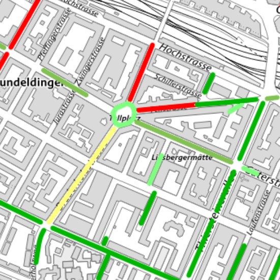
Das 'Leitbild Strassenbäume' (LBS) gibt Auskunft über bestehende und geplante, geprüft/verworfene und entfernt/nicht ersetzte Baumreihen.
Semplice
- Data (Creazione)
- 2013-06-04
- Scopo
-
LBS wird bei allen Planungen und Projekten auf Allmend konsultiert und dient als verwaltungsinternes Instrument zur koordinierten Planung.
- Stato
- Completato
Proprietario
- Tipo di rappresentazione spaziale
- Vettoriale
- Categoria ISO
-
- E Catasto urbanistico
Estensione
Estensione
- Descrizione
-
Basel
))

- Frequenza di aggiornamento
- Continua
- GEMET
-
-
albero
-
- GEMET
-
-
percorso
-
- geocat.ch
-
-
linee direttive
-
strada
-
Vincoli sulle risorse
- Altri vincoli
-
Die Geodaten sind beschränkt öffentlich zugänglich. (Zugangsberechtigungsstufe [B1] = intern)
- Altri vincoli
-
Es gelten die Nutzungsbedingungen für Geodaten des Kantons Basel-Stadt. ( http://www.geo.bs.ch/agb)
Risorsa associata
- Titolo
-
Leitbild Strassenbäume
- Tipo di associazione
- Citazione di un'opera più ampia
- Lingua
- Deutsch
- Codifica dei caratteri
- UTF8
- Categoria di sottotema
- E1 Pianificazione territoriale, sviluppo territoriale
- Geodati di base
- true
- Identificativo dei geodati di base
-
78-BS
- Livello legale dei geodati di base
- Cantonal
- Formato (codifica)
-
-
ESRI Shapefile (SHP)
-
INTERLIS 2 (XTF)
-
OGC Geopackage (GPKG)
-
ESRI File Geodatabase FileGDB (GDB)
-
Distributore
- Orario di servizio
-
Mo - Do: 8:00 bis 12:00, 13:30 bis 16:30, Fr: 8:00 bis 12:00, 13:30 bis 16:00
Opzioni di trasferimento digitale
- Risorsa online
-
MapBS
Öffentliches Auskunftssystem des Kantons Basel-Stadt
Opzioni di trasferimento digitale
- Risorsa online
-
Geodaten-Shop
Öffentlich zugänglicher Geodaten-Downloaddienst des Kantons Basel-Stadt
Opzioni di trasferimento digitale
- Risorsa online
-
WMS BS
Die derzeit im WMS BS verfügbaren Datenebenen entsprechen, bis auf wenige Ausnahmen, den Geodaten, welche auch in MapBS dargestellt sind. Der WMS BS ist kostenlos nutzbar und bietet Zugriff auf öffentliche sowie beschränkt öffentliche Geodaten, wobei gegebenenfalls Benutzername und Passwort benötigt werden (Zugangsdaten von MapBS).
Opzioni di trasferimento digitale
- Risorsa online
-
WFS BS
Die derzeit im WFS BS verfügbaren Datenebenen entsprechen, bis auf wenige Ausnahmen, den Geodaten, welche auch in MapBS dargestellt sind. Der WFS BS ist kostenlos nutzbar und bietet Zugriff auf öffentliche sowie beschränkt öffentliche Geodaten, wobei gegebenenfalls Benutzername und Passwort benötigt werden (Zugangsdaten von MapBS).
- Nome del sistema di riferimento
- CH1903+ / LV95/EPSG: 2056
Metadati
- Identificativo della scheda
- ec1efaa8-593c-4ee0-9242-c648add7bfc9
- Lingua
- Deutsch
- Codifica dei caratteri
- UTF8
- Lingua
- Français
- Codifica dei caratteri
- UTF8
- Lingua
- Italiano
- Codifica dei caratteri
- UTF8
- Lingua
- English
- Codifica dei caratteri
- UTF8
Custode
Tipo di risorsa
- Ambito di applicazione della risorsa
- Set di dati
- Collegamento ai metadati
-
https://www.geocat.ch/geonetwork/srv/api/records/ec1efaa8-593c-4ee0-9242-c648add7bfc9
- Informazioni sulla data (Creazione)
- 2013-06-06T10:44:40Z
- Informazioni sulla data (Revisione)
- 2026-04-13T09:16:25.069437Z
Standard dei metadati
- Titolo
-
eCH-0271