geocat.ch
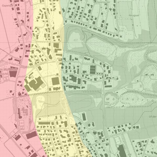
Geothermal probe map
The geothermal probe map shows where geothermal probes are eligible for authorisation. The demarcation ‘eligible for authorisation/not eligible for authorisation’ is set at approx. +- 20 m in the border area.
Simple
- Date (Publication)
- 2006-05-09
- Identifier
- https://metadata.geo.llv.li/ea1a780b-f752-41f6-917d-8f424eb4aae5
- Purpose
-
The geothermal probe map shows where geothermal probes are eligible for authorisation
- Status
- Completed
Publisher
- Hours of service
-
8:00-11:30 und 13:30-17:00
Owner
- Hours of service
-
8:00-11:30 und 13:30-17:00
- Spatial representation type
- Vector
Spatial resolution
Equivalent scale
- Denominator
- 5000
- Topic category
-
- F Geoscientific information
- O Structure
Extent
Extent
- Description
-
Liechtenstein
))

- Maintenance and update frequency
- As needed
Resource format
- Title
-
INTERLIS 1 (ITF)
- Date
- geocat.ch
-
-
OpenData
-
INSPIRE
-
- GEMET - INSPIRE themes, version 1.0
-
-
Energy resources
-
- Räumlicher Anwendungsbereich
-
-
National
-
- GEMET
-
-
geothermal energy
-
Resource constraints
- Use limitation
-
keine
- Access constraints
- Other restrictions
- Use constraints
- Other restrictions
- Other constraints
- No limitations to public access
Resource constraints
- Access constraints
- Other restrictions
- Use constraints
- Other restrictions
- Other constraints
- No conditions to access and use
- Other constraints
- Opendata BY: Open use. Must provide the source.
- Language
- Deutsch
- Character encoding
- UTF8
- Subtopic Category
- F1 Geology
- Language
- Deutsch
- Included with dataset
- 0
- Title
-
Erdsondenkarte
- Date (Publication)
- 2008-05-19
- Distribution format
-
-
INTERLIS 1 (ITF)
-
ESRI Shapefile (SHP)
-
Point of contact
- Hours of service
-
8:00-11:30 und 13:30-17:00
Digital transfer options
- OnLine resource
-
Geodatenportal der Liechtensteinischen Landesverwaltung
Geodata Portal of the National Administration
Digital transfer options
- OnLine resource
-
li.au.erdsondeneignung
OGC-WMS Service of the National Administration
Digital transfer options
- OnLine resource
-
Downloadbereich des Geodatenportals der Liechtensteinischen Landesverwaltung
Download Bereich des Geodatenportals
- Hierarchy level
- Dataset
Report
Result
- Title
-
VERORDNUNG (EG) Nr. 1089/2010 DER KOMMISSION vom 23. November 2010 zur Durchführung der Richtlinie 2007/2/EG des Europäischen Parlaments und des Rates hinsichtlich der Interoperabilität von Geodatensätzen und -diensten
- Date (Publication)
- 2010-12-08
- Explanation
-
Gemäss INSPIRE Bestandteil des Themas "Bewirtschaftungsgebiete/Schutzgebiete/geregelte Gebiete und Berichterstattungseinheiten"
- Pass
- false
- Statement
-
Digitalisierung
- Hierarchy level
- Dataset
- Topology level
- Full planar graph
- Geometric object type
- Surface
- Geometric object count
- 30
- Reference system identifier
- http://www.opengis.net/def/crs/EPSG/0/2056
- Reference system identifier
- http://www.opengis.net/def/crs/EPSG/0/4936
- Maintenance and update frequency
- As needed
Metadata
- Metadata identifier
- ea1a780b-f752-41f6-917d-8f424eb4aae5
- Language
- Deutsch
- Character encoding
- UTF8
- Language
- Français
- Character encoding
- UTF8
- Language
- Italiano
- Character encoding
- UTF8
- Language
- English
- Character encoding
- UTF8
Point of contact
- Hours of service
-
8:00-11:30 und 13:30-17:00
Type of resource
- Resource scope
- Dataset
- Metadata linkage
-
https://www.geocat.ch/geonetwork/srv/api/records/ea1a780b-f752-41f6-917d-8f424eb4aae5
- Date info (Creation)
- 2006-05-18T12:00:00Z
- Date info (Revision)
- 2026-04-13T09:18:12.596564Z
Metadata standard
- Title
-
eCH-0271