geocat.ch
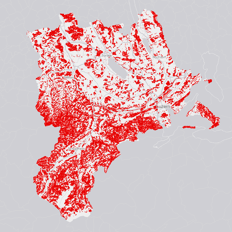
Waldbestand 2018
Zeigt den Waldbestand des Kantons Luzern mit Höhe der dominierenden Bäume, Anteil der von den grössten Bäumen bedeckten Fläche sowie den Anteil der Laub- und Nadelbäume.
Simple
Informazioni di identificazione
- Titolo alternativo
-
WLDBESTX_DS
- Data (Creazione)
- 2021-03-04
- Formato di presentazione
- Mappa digitale
- Finalità
-
Die vorliegende Bestandeskarte wurde mit Hilfe von Lidar-Daten (Vermessung der Landschaft mit Laserscanning) und Orthofotos von 2018 erarbeitet. Aus den Lidar-Daten wurde die Vegetationshöhe berechnet. Aufgrund von Sentinel-2 Satellitenbildern wurde der Anteil Nadel- bzw. Laubholz geschätzt.Die Waldgrenzen in der Bestandeskarte entsprechen der Waldfläche gemäss amtlicher Vermessung zum Zeitpunkt der Erstellung. Sie werden nicht nachgeführt.
- Status
- In corso
Punto di contatto
Servizio responsabile
- Nome dell'ente
-
Kanton Luzern, Abteilung Geoinformation
- Telefono
-
041 228 51 83
Indirizzo
- Risorsa online
- https://geoportal.lu.ch/ ( https )
- Ruolo
- Publisher
Punto di contatto
Servizio responsabile
- Nome dell'ente
-
Dienststelle Landwirtschaft und Wald (lawa)
- Telefono
-
041 349 74 00
Indirizzo
- Ruolo
- Owner
- Cognome
-
Dienststelle Landwirtschaft und Wald (lawa)
- Abbreviazione dell'organizzazione
-
lawa
- Frequenza di aggiornamento
- Secondo necessità
-
geocat.ch
-
-
opendata.swiss
-
Forstwirtschaft
-
Lebensraum
-
Vegetation
-
Wald
-
- Vincoli di accesso
- none
- Vincoli di fruibilità
- Proprietà intellettuale dei dati
- Limitazione d’uso
-
öffentlich zugängliche Geobasisdaten
- Vincoli di accesso
- none
- Vincoli di fruibilità
- none
- Limitazione d’uso
-
Freie Nutzung. Quellenangabe ist Pflicht
- Identificatore aggregato del dataset
- df012303-cb82-4c59-a628-8ae5a372a1a5
- Tipo di associazione
- Larger work citation
- Identificatore aggregato del dataset
- 2ddd3db5-ebbe-4ff2-a36c-8e02df762385
- Tipo di associazione
- Larger work citation
- Identificatore aggregato del dataset
- c65746e1-9a47-409c-960b-cf0467996212
- Tipo di associazione
- Larger work citation
- Identificatore aggregato del dataset
- e6bd9de5-9531-468c-9cb2-3b413fa825a7
- Tipo di associazione
- Larger work citation
- Identificatore aggregato del dataset
- 006d2d7b-7c23-473a-bdc9-d92b2b5a8011
- Tipo di associazione
- Larger work citation
- Identificatore aggregato del dataset
- e74766d2-6d07-45dc-b87b-09c295dd24d4
- Tipo di associazione
- Larger work citation
- Identificatore aggregato del dataset
- de753132-f8a7-4a4d-a652-65946f1263b0
- Tipo di associazione
- Larger work citation
- Identificatore aggregato del dataset
- a137aa83-5e91-4207-b80c-5ecf11c99c5f
- Tipo di associazione
- Larger work citation
- Identificatore aggregato del dataset
- b2bff274-9579-48a7-b7ea-bbc075101618
- Tipo di associazione
- Larger work citation
- Identificatore aggregato del dataset
- bb1668d9-b78f-42ee-8b45-f465cd324a5d
- Tipo di associazione
- Larger work citation
- Identificatore aggregato del dataset
- 1fdc46fe-88d5-4db1-a971-3ecf1a4254b0
- Tipo di associazione
- Larger work citation
- Identificatore aggregato del dataset
- a0610b38-3a85-4f3a-a423-88d10b97e197
- Tipo di associazione
- Larger work citation
- Identificatore aggregato del dataset
- ab16e834-933d-41d8-a632-d1608e3fda25
- Tipo di associazione
- Larger work citation
- Identificatore aggregato del dataset
- b5abda27-1bd4-474e-a108-060947179cb3
- Tipo di associazione
- Larger work citation
- Tipo di rappresentazione spaziale
- Dati vettoriali
- Denominatore
- 5000
- Lingua dei metadati
- Deutsch
- Set dei caratteri dei metadati
- UTF8
- Tema
-
- G Bosco, flora, fauna
- Descrizione
-
Kanton Luzern
- Formato di distribuzione
-
-
ESRI Geodatabase (.gdb)
(
)
-
ESRI Shapefile (.shp)
(
)
-
OGC GeoPackage (.gpkg)
(
)
-
ESRI Geodatabase (.gdb)
(
)
Distributore
Servizio responsabile
- Nome dell'ente
-
Dienststelle Raum und Wirtschaft (rawi)
- Telefono
-
041 228 51 83
Indirizzo
- Risorsa online
- https://geoportal.lu.ch ( https )
- Ruolo
- Point of contact
- Nome
-
Geodaten
- Cognome
-
Kanton Luzern
- Abbreviazione dell'organizzazione
-
rawi
- Risorsa online
-
Datenshop
(
https
)
Produktansicht Geodatenshop
- Livello
- Set di dati
- Genealogia del dato – Processo di produzione
-
Abgeleitet von: WLDBESTX_V1_PY
- Genealogia del dato – Processo di produzione
-
Grundlagen: Luftbilder
- Oggetto di tipo geometrico
- polygon
- Identificatore del sistema di riferimento
- CH1903+
Informazioni sul contenuto
- Lingua dei metadati
-
ger
- Included with dataset
- Data (Pubblicazione)
- 2021-03-04
Classe
- Designazione
-
Flächen
Attributo
- Nome
-
OBJECTID
- Descrizione
-
OBJECTID
Attributo
- Nome
-
DECKGR
- Descrizione
-
Hauptschicht = > 2/3 der Oberhöhe. Für Bestände mit hdom < 14 m gilt > 1/3 der Oberhöhe
Attributo
- Nome
-
DGRAD_KS
- Descrizione
-
Unterwuchs = < 40 cm
Attributo
- Nome
-
DGRAD_MS
- Descrizione
-
Mittelschicht = 1/3 bis 2/3 der Oberhöhe
Attributo
- Nome
-
DGRAD_OS
- Descrizione
-
Oberschicht = 2/3 der Oberhöhe bis hmax
Attributo
- Nome
-
DGRAD_UEB
- Descrizione
-
Überhälter = alles > hmax
Attributo
- Nome
-
DGRAD_US
- Descrizione
-
Unterschicht = 40cm bis 1/3 der Oberhöhe
Attributo
- Nome
-
GSTRUKT
- Descrizione
-
Unterscheidung der Grundstruktur: Nicht stufige Bestände = 0; stufige Bestände = 1. Kriterien für stufig: hdom >= 28m, Fläche >= 3000 m2, DGRAD_US >= 15%, DGRAD_MS >= 20%, DECKGR <= 60%.
Attributo
- Nome
-
H_DOM
- Descrizione
-
Die Oberhöhe des Bestandes. Dies ist der Mittelwert aller als Hauptschicht klassifizierten Pixel innerhalb des Bestandes.
Attributo
- Nome
-
H_MAX
- Descrizione
-
Höchster Baum der Hauptschicht bzw. Kristallisationspunkt für die Bildung des Bestandes. Der effektiv höchste Baum des Bestandes kann höher sein, war dann aber kein Kristallisationspunkt.
Attributo
- Nome
-
ID
- Descrizione
-
Wird der Reihe nach vergeben, beginnend mit dem Bestand mit dem grössten hmax
Attributo
- Nome
-
NH_OS
- Descrizione
-
Nur die NH-Pixel (10 m Auflösung) die zu mind. 40 % zur Oberschicht gehören wurden berücksichtigt. Bestände, für welche keine Schätzung gemacht werden konnte, sind mit -1 gekennzeichnet (siehe NH_OS_PIX).
Attributo
- Nome
-
NH_OS_PIX
- Descrizione
-
Gibt an wieviele Pixel (10 m Aufösung) für die Berechnung des NH_OS zur Verfügung standen.
Attributo
- Nome
-
NHANTEIL
- Descrizione
-
Schätzung des Nadelholzanteils aufgrund von Sentinel-Satellitenbildern.
Attributo
- Nome
-
NUMMER
- Descrizione
-
Eindeutige Identifikationsnummer des Bestandes, ohne spez. Bedeutung. Multipart Polygone sind erlaubt (z.B., wenn eine Strasse durch den Bestand verläuft).
Attributo
- Nome
-
WB_TYP
- Descrizione
-
Nicht klassifizierte Bestände sind Restflächen, welche zu klein oder inhomogen waren für die Klassifizierung.
Attributo
- Nome
-
SHAPE
- Descrizione
-
Shape
Attributo
- Nome
-
SHAPE.AREA
- Descrizione
-
SHAPE.AREA
Attributo
- Nome
-
SHAPE.LEN
- Descrizione
-
SHAPE.LEN
- Genere del modello
- Descrizione di oggetto
Metadata
- Lingua dei metadati
- Deutsch
- Set dei caratteri dei metadati
- UTF8
- Livello gerarchico
- Set di dati
- Data dei metadati
- 2025-11-06
- Nome dello Standard dei metadati
-
GM03 2+
Contatto
Servizio responsabile
- Nome dell'ente
-
Dienststelle Raum und Wirtschaft (rawi)
- Telefono
-
041 228 51 83
Indirizzo
- Città
-
Luzern
- Codice postale
-
6002
- Nazione
-
CH
- Via
-
Murbacherstrasse
- Numero
-
21
- Risorsa online
- https://geoportal.lu.ch ( https )
- Ruolo
- Point of contact
- Nome
-
PhulbaDoma
- Cognome
-
Lama
- Abbreviazione dell'organizzazione
-
rawi
- Frequenza di aggiornamento
- Secondo necessità