 geocat.ch
Politische Grenzen
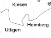
Die politischen Grenzen enthalten die Gemeinde-, Verwaltungskreis- und Kantonsgrenzen des Kantons Bern, basierend auf dem Übersichtsplan 1:5000.
Simple
- Date (Creation)
- 1998-08-01
- Date (Revision)
- 2026-01-01
- Date (Publication)
- 2026-04-16
- Identifier
- GRENZ5
- Status
- On going
Owner
Principal investigator
Principal investigator
Principal investigator
- Topic category
-
- D Boundaries
Extent
Extent
- Description
- Schweiz Suisse
))
- Maintenance and update frequency
- Annually
- Keywords
-
-
Innerstaatliche Grenze
-
See
-
Verwaltungsgrenze
-
Gemeinde
-
Grenze
-
Binnengewässer
-
Verwaltung
-
opendata.swiss
-
Resource constraints
- Use limitation
-
Auf sämtlichen Plots und Publikationen ist der Vermerk "Politische Grenzen © Amt für Geoinformation des Kantons Bern; Gemeinden des Kantons Bern" anzugeben.
Resource constraints
- Use constraints
- Licence End User
- Other constraints
- Die Daten dürfen gemäss Nutzungsbedingungen frei genutzt werden. Les données peuvent être utilisées librement selon les conditions d’utilisation.
Resource constraints
- Other constraints
- Freie Nutzung. Quellenangabe ist Pflicht. Utilisation libre. Obligation d’indiquer la source.
- Language
- Deutsch
- Character encoding
- UTF8
- Language
- Français
- Character encoding
- UTF8
- Language
- Italiano
- Character encoding
- UTF8
- Language
- English
- Character encoding
- UTF8
- Basic Geodata
- false
- Included with dataset
- false
- Distribution format
-
-
SHP
-
GPKG
-
GeoParquet
-
Digital transfer options
- Transfer size
- 10836281
- OnLine resource
-
ZIP-Datei mit Shapefile, Metadaten und Begleitdaten
Digital transfer options
- Transfer size
- 9741018
- OnLine resource
-
ZIP-Datei mit Geopackage mit Metadaten
Digital transfer options
- Transfer size
- 2939955
- OnLine resource
-
Geoparquet-Datei - Gemeindegrenzen, Fläche
Digital transfer options
- Transfer size
- 231661
- OnLine resource
-
Geoparquet-Datei - Kantonsgrenze, Fläche
Digital transfer options
- Transfer size
- 338314
- OnLine resource
-
Geoparquet-Datei - Seegrenzen, Fläche
Digital transfer options
- Transfer size
- 2025701
- OnLine resource
-
Geoparquet-Datei - Gemeindegrenzen, Linie
Digital transfer options
- Transfer size
- 236625
- OnLine resource
-
Geoparquet-Datei - Kantonsgrenze, Linie
Digital transfer options
- Transfer size
- 339913
- OnLine resource
-
Geoparquet-Datei - Seegrenzen, Linie
Digital transfer options
- Transfer size
- 333529
- OnLine resource
-
Geoparquet-Datei - Maske Kanton Bern
Digital transfer options
- Transfer size
- 1167557
- OnLine resource
-
Geoparquet-Datei - Verwaltungskreisgrenzen, Fläche
Digital transfer options
- Transfer size
- 777296
- OnLine resource
-
Geoparquet-Datei - Verwaltungskreisgrenzen, Linie
Digital transfer options
- OnLine resource
-
STAC-Collection - GRENZ5
Digital transfer options
- OnLine resource
-
Link zum Geoportal des Kantons Bern
- Reference system identifier
- CH1903+ / LV95 -- Swiss CH1903+ / LV95/EPSG:2056
Metadata
- Metadata identifier
- e835fc94-65b2-4e6c-aad6-c2ce5d3d5ef7
- Language
- Deutsch
- Character encoding
- UTF8
- Language
- Français
- Character encoding
- UTF8
Point of contact
Type of resource
- Resource scope
- Dataset
- Name
-
Geoprodukt - Géoproduit
- Date info (Creation)
- 1998-08-01T00:00:00Z
- Date info (Revision)
- 2026-04-16T00:00:00Z
Metadata standard
- Title
-
GM03 2+
)))