geocat.ch
Geotope der Schweiz
Géotopes suisses
Geotopi svizzeri
Geotopes in Switzerland
Geotops svizzers
Geotope sind geowissenschaftliche Naturdenkmäler. Erdgeschichtliche Geotope erzählen uns von der Entwicklung der Landschaft, des Klimas und des Lebens, vom Werden und Vergehen der Gebirge und vom Entstehen der Gesteine. Andere Geotope werfen ein Licht auf Vorgänge an der Erdoberfläche oder im Erdinnern. Sie schliessen auch das verborgene Reich der Höhlen und des Grundwassers ein. Eine letzte Gruppe von Geotopen umfasst aktive Landschaftselemente, wie z.B. Schutthalden, Flussauen oder Grundwasseraufstösse. Geotope sind räumlich begrenzte Teile der festen, unbelebten Erde (Geosphäre). Je nach ihrem thematischen Inhalt können sie ein einzelnes, punktuelles Vorkommen oder eine ganze Landschaftskammer bezeichnen. Sie sind vor Einflüssen zu bewahren, die ihre Substanz, Struktur, Form oder natürliche Weiterentwicklung beeinträchtigen. Die hier aufgeführten Geotope nationaler Bedeutung entstammen dem informellen Inventar der Arbeitsgruppe Geotope Schweiz (Akademie der Naturwissenschaften SCNAT). Das Inventar basiert nicht auf einer systematischen Erhebung und erhebt somit keinen Anspruch auf Vollständigkeit. Quellen: Felber, M. (1999): Inventar der Geotope nationaler Bedeutung. Geologia Insubrica 4/1. Reynard, E., Berger, J.-P., Constandache, M., Felber, M., Grangier, L., Häuselmann, P., Jeannin, P.-Y. & Martin, S. (2012): Révision de l'inventaire des géotopes suisses: rapport final. – Geosciences, Platform of the Swiss Academy of Science.
Les géotopes sont des monuments naturels géoscientifiques. Certains d'entre eux, qui témoignent de l'histoire de la Terre, nous racontent l'évolution du paysage, du climat et de la vie, la genèse et la disparition des montagnes, ainsi que la formation des roches. D'autres géotopes nous révèle des processus qui se déroulent à la surface ou à l'intérieur de la Terre. Les géotopes incluent également le monde caché des cavernes et des nappes d'eau souterraine. Un dernier groupe comprend des formes actives qui modèlent le paysage, telles qu'éboulis, zones alluviales ou émergences d'eau souterraine.Les géotopes sont des portions de la géosphère (partie minérale, non vivante de la Terre) délimitées dans l'espace. Ce terme peut recouvrir une occurrence unique, ponctuelle, ou tout un pan de paysage, selon son contenu thématique. Il faut les protéger contre les actions qui portent atteinte à leur contenu, leur structure, leur forme ou leur évolution naturelle. Les géotopes d'importance nationale mentionnés ici proviennent de l'inventaire informel dressé par le groupe de travail pour la protection des géotopes suisses (Académie des sciences naturelles SCNAT). N'étant pas basé sur un recensement systématique, il ne prétend pas être exhaustif. Sources: M. Felber (1999): Inventaire des géotopes d'importance nationale. Geologia Insubrica 4/1. Reynard, E., Berger, J.-P., Constandache, M., Felber, M., Grangier, L., Häuselmann, P., Jeannin, P.-Y. & Martin, S. (2012): Révision de l'inventaire des géotopes suisses: rapport final. – Geosciences, Platform of the Swiss Academy of Science.
I geotopi sono monumenti geoscientifici naturali. I geotopi della storia della terra sono una testimonianza dell'evoluzione del paesaggio, del clima e della vita, del divenire e della scomparsa delle montagne e della formazione delle rocce. Altri geotopi forniscono informazioni sui processi verificatisi sulla superficie terrestre o nelle viscere della terra. Essi comprendono anche il regno nascosto delle caverne e delle acque sotterranee. Un ultimo gruppo di geotopi comprende infine elementi attivi del paesaggio, come ad esempio il materiale detritico, le golene o gli affioramenti di acqua sotterranea. I geotopi sono porzioni della geosfera, la parte minerale non vivente della terra. A seconda del loro contenuto tematico, i geotopi possono indicare un singolo giacimento puntuale oppure un intero lembo di paesaggio. Devono essere protetti contro le influenze che ne deteriorano la sostanza, la struttura, la forma o lo sviluppo naturale. I geotopi d'importanza nazionale menzionati qui, provengono dall'inventario informale del Gruppo di lavoro protezione dei geotopi in Svizzera (Accademia di scienze naturali SCNAT). L'inventario non si basa su un rilevamento sistematico e non ha pertanto alcuna pretesa di esaustività. Fonti: Felber, M. (1999): Inventar der Geotope nationaler Bedeutung. Geologia Insubrica 4/1. Reynard, E., Berger, J.-P., Constandache, M., Felber, M., Grangier, L., Häuselmann, P., Jeannin, P.-Y. & Martin, S. (2012): Révision de l'inventaire des géotopes suisses: rapport final. – Geosciences, Platform of the Swiss Academy of Science.
Geotopes are geoscientific natural monuments. Geotopes that represent geological history show the development of the landscape, the climate and life, the formation and disappearance of mountains and the origins of rocks. Other geotopes shed light on the processes taking place on the Earth's surface and in the Earth's interior. They also include the hidden world of caves and groundwater. A final group of geotopes consists of active elements of the landscape, such as scree slopes, flood plains and groundwater springs. Geotopes are spatially limited parts of the mineral, uninhabited Earth (geosphere). Depending on their thematic content, they can be an individual occurrence in one location or an entire portion of the landscape. They must be protected against influences that can impair their substance, structure, form or natural development. The geotopes listed here are of national importance and are taken from the informal inventory of the Swiss geotope working group (Swiss Academy of Sciences SCNAT). The inventory is not based on a systematic survey and, therefore, does not claim to be complete. Sources: Felber, M. (1999): Inventar der Geotope nationaler Bedeutung. Geologia Insubrica 4/1. Reynard, E., Berger, J.-P., Constandache, M., Felber, M., Grangier, L., Häuselmann, P., Jeannin, P.-Y. & Martin, S. (2012): Révision de l'inventaire des géotopes suisses: rapport final. – Geosciences, Platform of the Swiss Academy of Science.
Ils geotops èn monuments natirals geoscientifics. Geotops ans infurmeschan davart il svilup da la cuntrada, dal clima e da la vita, davart la genesa e la spariziun da las muntognas e davart la furmaziun da la crappa. Auters geotops dattan in sguard sin ils process a la surfatscha u a l'intern da la terra. Els includan er il mund obscur dals cuvels e da l'aua sutterrana. In'ultima gruppa da geotops cumpiglia elements activs da la cuntrada, sco per exempel gondas, zonas umidas u lieus, nua che l'aua sutterrana cumpara a la surfatscha. Ils geotops èn parts localas da la geosfera. Tut tenor lur cuntegn tematic pon els designar in giaschament singul punctual u in'entira cuntrada. Els ston vegnir protegids cunter influenzas che disturban lur substanza, lur structura, lur furma u lur svilup natiral. Ils geotops d'impurtanza naziunala che vegnan menziunads qua figureschan en l'inventari informal da la gruppa da lavur Geotops svizzers (Academia svizra da las scienzas natiralas SCNAT). L'inventari na sa basa betg sin ina registraziun sistematica e n'è perquai betg cumplet. Funtaunas: Felber, M. (1999): Inventar der Geotope nationaler Bedeutung. Geologia Insubrica 4/1. Reynard, E., Berger, J.-P., Constandache, M., Felber, M., Grangier, L., Häuselmann, P., Jeannin, P.-Y. & Martin, S. (2012): Révision de l'inventaire des géotopes suisses: rapport final. – Geosciences, Platform of the Swiss Academy of Science.
Simple
-
Autre titreAltri nomi o acronimiAlternate titleAlternate titleAlternativtitel
-
Geotope der Schweiz
Géotopes suisses
Geotopi svizzeri
Geotopes in Switzerland
Geotops svizzers
-
Date (Création)Data (Creazione)Date (Creation)Date (Creation)Datum (Erstellung)
- 1990-01-01T00:00:00
-
Date (Dernière révision)Data (Ultima revisione)Date (Last Revision)Date (Last Revision)Datum (Letzte Überprüfung)
- 2012-12-31T00:00:00
-
IdentifiantIdentificatoreIdentifierIdentifierKennung
- ch.swisstopo.geologie-geotope
-
Forme de la présentationForma della presentazionePresentation formPresentation formPräsentationsform
-
Carte numériqueMappa digitaleDigital mapDigital mapDigitale Karte
-
ButScopoPurposePurposeZweck
-
Inventar der Geotope von nationaler Bedeutung
Inventaire des géotopes d'importance nationale
-
ÉtatStatoStatusStatusBearbeitungsstatus
-
TerminéCompletatoCompletedCompletedAbgeschlossen
Fournisseur
Fornitore di risorse
Resource provider
Resource provider
Anbieter
Point de contact
Punto di contatto
Point of contact
Point of contact
Ansprechpartner
Propriétaire
Proprietario
Owner
Owner
Eigentümer
-
Type de représentation spatialeTipo di rappresentazione spazialeSpatial representation typeSpatial representation typeRäumliche Darstellungsart
-
vecteurVettorialeVectorVectorVektor
Résolution spatiale
Risoluzione spaziale
Spatial resolution
Spatial resolution
Räumliche Auflösung
Fraction représentative
Frazione rappresentativa
Equivalent scale
Equivalent scale
Vergleichsmassstab
-
DénominateurDenominatoreDenominatorDenominatorMassstabszahl
- 25000
-
Catégorie de thèmeCategoria ISOTopic categoryTopic categoryThematik
-
-
F Informations géoscientifiquesF Informazioni geoscientificheF Geoscientific informationF Geoscientific informationF Erdwissenschaften
-
Étendue
Estensione
Extent
Extent
Ausdehnung
Étendue
Estensione
Extent
Extent
Ausdehnung
-
DescriptionDescrizioneDescriptionDescriptionBeschreibung
-
National Map 1:25'000
Landeskarte 1:25'000
Carte nationale 1:25'000
Carta nazionale 1:25'000
-
Identifiant géographiqueIdentificatore geograficoGeographic identifierGeographic identifierGeografische Kennung
- NM25LK25CN25CN25CN25
))

-
Fréquence de mise à jourFrequenza di aggiornamentoMaintenance and update frequencyMaintenance and update frequencyWartungsintervall
-
Non planifiéeNon pianificatoNot plannedNot plannedNicht geplant
-
Durée de conservationDurata di conservazioneDuration of ConservationDuration of ConservationAufbewahrungsdauer NV in Jahren
- 275
-
Évaluation de la valeur archivistiqueValutazione del valore archivisticoAppraisal of Archival ValueAppraisal of Archival ValueBewertung Archivwürdigkeit
-
AAAAA
-
Raison de la valeur d'archivageMotivo del valore archivisticoReason for Archiving ValueReason for Archiving ValueBegründung Archivwürdigkeit
-
Preuve de la pratique couranteProva della pratica commercialeEvidence of business practiceEvidence of business practiceNachweis der Geschäftspraxis
- geocat.ch
-
-
géotope
geotopo
geotope
-
zone naturelle protégée
zona naturale protetta
protected natural zone
-
inventaire
inventario
register
-
Planification de la conservation et de l'archivage AAP - Conféderation
Pianificazione della conservazione e dell’archiviazione AAP - Confederazione
Conservation and archiving planning AAP - Confederation
-
opendata.swiss
opendata.swiss
opendata.swiss
opendata.swiss
-
IFDG l’Infrastructure Fédérale de données géographiques
IFDG Infrastruttura federale dei dati geografici
FSDI Federal Spatial Data Infrastructure
-
- GEMET - INSPIRE themes, version 1.0
-
-
Géologie
Geologia
Geology
-
Sites protégés
Siti protetti
Protected sites
-
-
LangueLinguaLanguageLanguageSprache
- Français
-
Encodage de caractèresCodifica dei caratteriCharacter encodingCharacter encodingZeichenkodierung
-
Utf8UTF8UTF8UTF8Utf8
-
Catégorie de sous-thèmeCategoria di sottotemaSubtopic CategorySubtopic CategoryThematische Unterkategorien
-
F1 GéologieF1 GeologiaF1 GeologyF1 GeologyF1 Geologie
-
Format de distributionFormato (codifica)Distribution formatDistribution formatAbgabeformat
-
-
ESRI Shapefile (SHP)
-
Options de transfert numérique
Opzioni di trasferimento digitale
Digital transfer options
Digital transfer options
Optionen für die digitale Übertragung
-
Ressource en ligneRisorsa onlineOnLine resourceOnLine resourceOnline
-
Vorschau map.geo.admin.ch
Vorschau map.geo.admin.chAperçu map.geo.admin.chPrevisione map.geo.admin.chPreview map.geo.admin.ch
Options de transfert numérique
Opzioni di trasferimento digitale
Digital transfer options
Digital transfer options
Optionen für die digitale Übertragung
-
Ressource en ligneRisorsa onlineOnLine resourceOnLine resourceOnline
-
ch.swisstopo.geologie-geotope
WMTS-BGDI Dienst, Layer "Geotope der Schweiz"Service WMTS-IFDG, couche , Layer "Géotopes suisses"Servizio WMTS-IFDG, strato "Geotopi svizzeri"WMTS-FSDI service, layer "Geotopes in Switzerland"WMTS-BGDI Dienst, Layer "Geotope der Schweiz"
Options de transfert numérique
Opzioni di trasferimento digitale
Digital transfer options
Digital transfer options
Optionen für die digitale Übertragung
-
Ressource en ligneRisorsa onlineOnLine resourceOnLine resourceOnline
-
RESTful API von geo.admin.ch
Options de transfert numérique
Opzioni di trasferimento digitale
Digital transfer options
Digital transfer options
Optionen für die digitale Übertragung
-
Ressource en ligneRisorsa onlineOnLine resourceOnLine resourceOnline
-
Projektgruppe Geotope
Options de transfert numérique
Opzioni di trasferimento digitale
Digital transfer options
Digital transfer options
Optionen für die digitale Übertragung
-
Ressource en ligneRisorsa onlineOnLine resourceOnLine resourceOnline
-
Download (data.geo.admin.ch)
Options de transfert numérique
Opzioni di trasferimento digitale
Digital transfer options
Digital transfer options
Optionen für die digitale Übertragung
-
Ressource en ligneRisorsa onlineOnLine resourceOnLine resourceOnline
-
Thema Geologie (map.geologieportal.ch)
Options de transfert numérique
Opzioni di trasferimento digitale
Digital transfer options
Digital transfer options
Optionen für die digitale Übertragung
-
Ressource en ligneRisorsa onlineOnLine resourceOnLine resourceOnline
-
Geologie-Portal: Geotope
-
Généralités sur la provenanceInformazioni generali sulla provenienzaStatementStatementErklärung
-
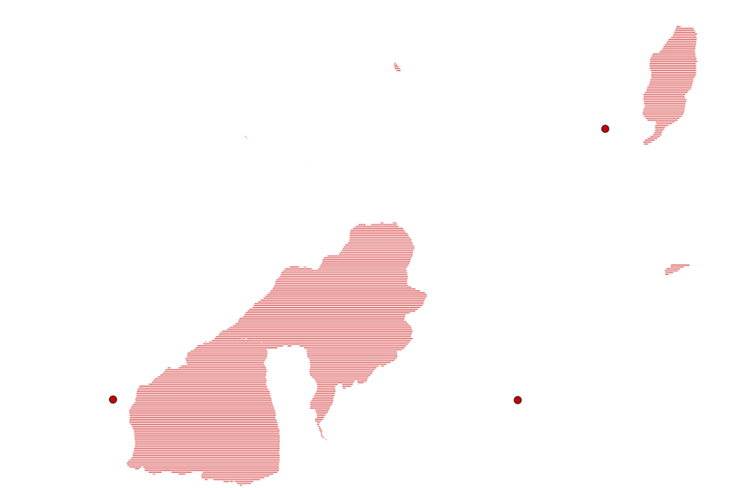
Der Umkreis jedes Geotops ist im Massstab 1:25'000 digitalisiert worden (ausnahmsweise im Massstab 1:100'000 für einige besonders ausgedehnte Geotope). Es handelt sich um einen geschätzten Umkreis, der meistens aus der vorhandenen kartographischen Daten und nicht aus Aufnahmen im Gelände bestimmt wurde.
Le périmètre de chaque géotope a été numérisé au 1:25'000 (exceptionnellement au 1:100'000 pour quelques géotopes particulièrement étendus). Il s’agit d’un périmètre estimatif, établi la plupart du temps sur la base des données cartographiques à disposition, et non pas d’un relevé sur le terrain.
-
NiveauLivelloHierarchy levelHierarchy levelBezugsebene
-
Jeu de donnéesSet di datiDatasetDatasetDatenbestand
-
Nom du système de référenceNome del sistema di riferimentoReference system identifierReference system identifierName des Referenzsystems
- Referenzsystem entsprechend der zugrundeliegenden topographischen Karte (CH1903)
Metadata
-
Identifiant des métadonnéesIdentificativo della schedaMetadata identifierMetadata identifierIdentifikator des Metadatensatzes
- e7dd54e9-fc98-4e5c-b46a-694d1ba6c84e
-
LangueLinguaLanguageLanguageSprache
- Deutsch
-
Encodage de caractèresCodifica dei caratteriCharacter encodingCharacter encodingZeichenkodierung
-
Utf8UTF8UTF8UTF8Utf8
-
LangueLinguaLanguageLanguageSprache
- Français
-
Encodage de caractèresCodifica dei caratteriCharacter encodingCharacter encodingZeichenkodierung
-
Utf8UTF8UTF8UTF8Utf8
-
LangueLinguaLanguageLanguageSprache
- Italiano
-
Encodage de caractèresCodifica dei caratteriCharacter encodingCharacter encodingZeichenkodierung
-
Utf8UTF8UTF8UTF8Utf8
-
LangueLinguaLanguageLanguageSprache
- English
-
Encodage de caractèresCodifica dei caratteriCharacter encodingCharacter encodingZeichenkodierung
-
Utf8UTF8UTF8UTF8Utf8
-
LangueLinguaLanguageLanguageSprache
- Rumantsch
-
Encodage de caractèresCodifica dei caratteriCharacter encodingCharacter encodingZeichenkodierung
-
Utf8UTF8UTF8UTF8Utf8
Point de contact
Punto di contatto
Point of contact
Point of contact
Ansprechpartner
Type de ressource
Tipo di risorsa
Type of resource
Type of resource
Anwendungsbereich der Metadaten
-
Domaine d'application de la ressourceAmbito di applicazione della risorsaResource scopeResource scopeDomäne der Ressourcenanwendung
-
Jeu de donnéesSet di datiDatasetDatasetDatenbestand
-
Lien vers la métadonnéeCollegamento ai metadatiMetadata linkageMetadata linkageLink zu den Metadaten
-
Informations de date (Création)Informazioni sulla data (Creazione)Date info (Creation)Date info (Creation)Datumsangaben (Erstellung)
- 2012-03-19T15:15:43Z
-
Informations de date (Révision)Informazioni sulla data (Revisione)Date info (Revision)Date info (Revision)Datumsangaben (Aktualisierung)
- 2026-04-13T09:47:17.239095Z
Norme des métadonnées
Standard dei metadati
Metadata standard
Metadata standard
Metadatenstandard
-
TitreTitoloTitleTitleTitel
-
eCH-0271