 geocat.ch
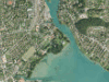
Orthofoto-Mosaik CITIMAGE
CITIMAGE der Stadt Biel und der Stadt Thun: hochaufgelöste Orthofotos mit einer Bodenauflösung von 10 cm. Die Luftbilder werden im Sommer aufgenommen, um ein attraktives Produkt mit Belaubung anbieten zu können.
Simple
- Date (Creation)
- 2013-07-12
- Date (Revision)
- 2013-07-12
- Date (Publication)
- 2016-08-11
- Identifier
- CITIMAGE
- Status
- Completed
Owner
Owner
Owner
Principal investigator
Principal investigator
- Topic category
-
- A Imagery base maps earth cover
Extent
Extent
- Description
- Kanton Bern (reduziert) Canton de Berne (réduit)
N
S
E
W
))
- Maintenance and update frequency
- Not planned
- Keywords
-
-
Luftbild
-
Resource constraints
- Use limitation
-
Auf sämtlichen Plots und Publikationen ist der Vermerk "CITIMAGE © Flotron AG, BSF Swissphoto AG, Bundesamt für Landestopografie swisstopo" anzugeben.
Resource constraints
- Use constraints
- Licence End User
- Other constraints
- Datennutzung mit Restriktionen. Utilisation des données avec restrictions.
- Language
- Deutsch
- Character encoding
- UTF8
- Language
- Français
- Character encoding
- UTF8
- Language
- Italiano
- Character encoding
- UTF8
- Language
- English
- Character encoding
- UTF8
- Basic Geodata
- false
- Included with dataset
- false
Digital transfer options
- OnLine resource
-
Link zum Geoportal des Kantons Bern
- Reference system identifier
- CH1903+ / LV95 -- Swiss CH1903+ / LV95/EPSG:2056
Metadata
- Metadata identifier
- e7c80c03-8366-4214-bb40-d5da2e1f46e6
- Language
- Deutsch
- Character encoding
- UTF8
- Language
- Français
- Character encoding
- UTF8
Point of contact
Type of resource
- Resource scope
- Dataset
- Name
-
Geoprodukt - Géoproduit
- Date info (Creation)
- 2013-07-12T00:00:00Z
- Date info (Revision)
- 2016-08-11T00:00:00Z
Metadata standard
- Title
-
GM03 2+
)))