geocat.ch
Cantons et Communes suisses - Limites généralisées (VS)
Limites administratives généralisées de l'Office fédéral de la statistique (OFS-GEOSTAT).
Simple
- Alternate title
-
Cantons et Communes suisses - Limites généralisées (VS)
- Date (Creation)
- 2009-07-31
- Date (Revision)
- 2026-01-01
- Identifier
- 135, 142
- Purpose
-
Les limites administratives de l'OFS, dont le degré de détail est faible, servent souvent à établir des représentations à petite échelle et des cartes thématiques.
- Status
- On going
Custodian
- Spatial representation type
- Vector
Spatial resolution
Equivalent scale
- Denominator
- 25000
- Topic category
-
- D Boundaries
Extent
Extent
- Description
-
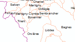
Canton of Valais (VS)
))

- Maintenance and update frequency
- Annually
- Maintenance note
-
Les limites généralisées des communes de l'état au 31 décembre YYYY sont publiées avec l'état au 1er janvier YYYY+1 vers le milieu de YYYY+1.
Resource format
- Title
-
ESRI Enterprise Geodatabase
- Date
- GEMET - INSPIRE themes, version 1.0
-
-
Administrative units
-
- GEMET
-
-
administrative boundary
-
- geocat.ch
-
-
canton
-
- GEMET
-
-
municipality
-
Resource constraints
- Use limitation
-
Aucunes
Resource constraints
- Access constraints
- Other restrictions
- Other constraints
-
Géodonnées accessibles au public (niveau A selon l'OGéo)
- Other constraints
-
Les conditions générales d'utilisation des géodonnées du Canton du Valais font foi ( https://www.vs.ch/fr/web/guest/information-legale).
- Language
- Français
- Character encoding
- UTF8
- Language
- Deutsch
- Character encoding
- UTF8
- Environment description
-
S:\Géodonnées VS\D Limites\Cantons suisses - Limites généralisés.lyr S:\Géodonnées VS\D Limites\Communes suisses - Limites généralisées.lyr
- Distribution format
-
-
ESRI Shapefile (SHP)
-
autres formats sur demande / andere Formate auf Anfrage
-
Distributor
- Statement
-
Les bases de données à l’échelle 1:25'000 sont simplifiées à l’aide d’algorithmes spéciaux et d’un système d’optimisation avec assistance et surveillance manuelles de manière à ce qu’elles puissent être utilisées pour des cartes et visualisations à l’échelle 1 :200'000 et en dessous.
- Hierarchy level
- Dataset
- Description
-
Basé sur les limites administratives et politiques de la Suisse actualisées par l'Office fédéral de la topographie dans la série GG25 (limites communales 1 :25'000) et swissBOUNDARIES3D.
- Geometric object type
- Surface
- Geometric object count
- 26
- Geometric object type
- Surface
- Geometric object count
- 2113
- Reference system identifier
- EPSG:2056/CH1903+_MN95
Metadata
- Metadata identifier
- e3959e7d-b331-4749-8585-e64d9a334792
- Language
- Français
- Character encoding
- UTF8
- Language
- Deutsch
- Character encoding
- UTF8
- Language
- Italiano
- Character encoding
- UTF8
- Language
- English
- Character encoding
- UTF8
- Language
- Rumantsch
- Character encoding
- UTF8
Distributor
Type of resource
- Resource scope
- Dataset
- Metadata linkage
-
https://www.geocat.ch/geonetwork/srv/api/records/e3959e7d-b331-4749-8585-e64d9a334792
- Date info (Creation)
- 2016-08-02T13:41:39Z
- Date info (Revision)
- 2026-04-13T09:39:09.214368Z
Metadata standard
- Title
-
eCH-0271