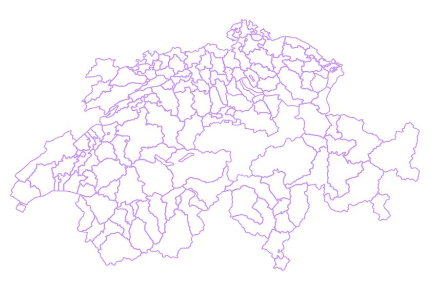
swissBOUNDARIES3D district boundaries
swissBOUNDARIES3D district boundaries constitute the administrative borders of the districts of the Swiss cantons. A district is an administrative subdivision positioned between canton and commune. The cantons of Geneva, Uri, Obwalden, Nidwalden, Glarus, Zug, Basel-Stadt and Appenzell Innerrhoden are not divided into districts. swissBOUNDARIES district boundaries is derived from the parent dataset swissBOUNDARIES3D.
Simple
Identification info
- Alternate title
-
District boundaries
- Date (Revision)
- 2024-12-18
- Date (Publication)
- 2025-04-06
- Citation identifier
- ch.swisstopo.swissboundaries3d-bezirk-flaeche.fill
Citation identifier
- Collective title
-
Administrative boundaries (national survey)
Point of contact
Responsible party
- Organisation name
-
Federal Office of Topography swisstopo
- Position name
-
Geodata Distribution
- Voice
-
+41 58 469 01 11
- Facsimile
-
+41 58 469 04 59
Address
- City
-
Wabern
- Postal code
-
3084
- Country
-
CH
- Electronic mail address
- Streetname
-
Seftigenstrasse
- Streetnumber
-
264
- Protocol
-
WWW:LINK
- Role
- Point of contact
- Last Name
-
geodata
- Organisation Acronym
-
swisstopo
- Maintenance and update frequency
- Annually
- Maintenance note
- swissBOUNDARIES3D est mis à jour annuellement. La version actualisée représente l’état au premier janvier de l’année en cours. Elle est disponible durant le premier trimestre. L’actualisation se base sur les informations de la mensuration officielle (MO) et de l'office fédéral de la statistique (OFS). swissBOUNDARIES3D viene aggiornato annualmente. La versione attuale rispecchia lo stato al 1° gennaio dell’anno in corso. L’aggiornamento è effettuato sulla base della Misurazione ufficiale (MU) e dei dati dell’Ufficio federale di statistica (UST). swissBOUNDARIES3D wird jährlich nachgeführt. Die aktuelle Version gibt den Zustand am 1. Januar des laufenden Jahres wieder. Die Nachführung erfolgt auf den Grundlagen der Amtlichen Vermessung (AV) und des Bundesamtes für Statistik (BFS).
-
GEMET - INSPIRE themes, version 1.0
-
-
Administrative units
-
-
geocat.ch
-
-
opendata.swiss
-
district
-
-
geocat.ch
-
-
FSDI Federal Spatial Data Infrastructure
-
-
GEMET
-
-
administrative boundary
-
- Use constraints
- License
- Other constraints
-
NonCommercialAllowed-CommercialAllowed-ReferenceRequired
- Aggregate Datasetindentifier
- 86cb844f-296b-40cb-b972-5b1ae8028f7c
- Association Type
- Larger work citation
- Denominator
- 10000
- Language
- Deutsch
- Language
- Français
- Language
- English
- Character set
- UTF8
- Topic category
-
- D Political and Administrative Boundaries
Extent
- Description
-
Switzerland
))

Extent
- Description
-
Liechtenstein
))

- Basic geodata identifier
-
39.3
- Basic geodata identifier type
- Federal
- Distribution format
-
-
ESRI Shapefile (SHP)
()
-
ESRI File Geodatabase FileGDB (GDB)
()
-
AutoCAD DXF (DXF)
()
-
INTERLIS 2 (XTF)
()
-
OGC Geopackage (GPKG)
()
-
ESRI Shapefile (SHP)
()
- OnLine resource
-
Preview map.geo.admin.ch
(
MAP:Preview
)
Preview map.geo.admin.ch
- OnLine resource
- Linked Data ( LINKED:DATA:RDF )
- OnLine resource
-
ch.swisstopo.swissboundaries3d-bezirk-flaeche.fill
(
OGC:WMS
)
WMS-FSDI service, layer "District boundaries"
- OnLine resource
-
ch.swisstopo.swissboundaries3d-bezirk-flaeche.fill
(
OGC:WMTS
)
WMTS-FSDI service, layer "District boundaries"
- OnLine resource
-
swissBOUNDARIES3D
(
WWW:LINK
)
swissBOUNDARIES3D
- OnLine resource
-
Download Server von geo.admin.ch
(
WWW:DOWNLOAD-URL
)
Download Server von geo.admin.ch
- OnLine resource
- map.geo.admin.ch ( CHTOPO:specialised-geoportal )
- OnLine resource
-
RESTful API from geo.admin.ch
(
ESRI:REST
)
RESTful API from geo.admin.ch
- OnLine resource
- Linked Data Service (using SPARQL) ( WWW:LINK )
- Geometric object type
- Curve
- Geometric object type
- Surface
- Reference system identifier
- EPSG:2056
Content Information
- Included with dataset
- Date (Publication)
- 2025-04-06
- Model type
- INTERLIS 2
Metadata
- Metadata language
- Deutsch
- Character set
- UTF8
- Hierarchy level
- Dataset
- Date stamp
- 2024-12-17T06:49:33.645Z
- Metadata standard name
-
GM03 2+
Metadata author
Responsible party
- Organisation name
-
Federal Office of Topography swisstopo
- Position name
-
Metadata contact
- Voice
-
+41 58 469 01 11
Address
- City
-
Wabern
- Postal code
-
3084
- Country
-
CH
- Electronic mail address
- Streetname
-
Seftigenstrasse
- Streetnumber
-
264
- Protocol
-
WWW:LINK
- Hours of service
-
08h30 - 11h00 / 14h00 - 16h00 GMT+1
- Role
- Point of contact
- Last Name
-
metadata
- Organisation Acronym
-
swisstopo
 geocat.ch


