geocat.ch
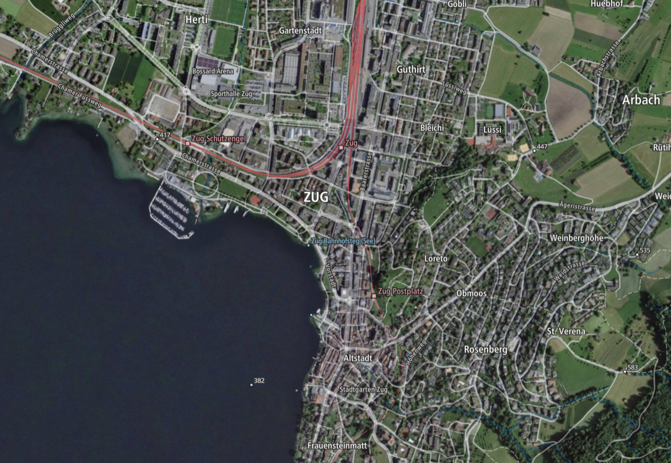
Imagery Base Map worldwide (Vector Tile Style)
“Imagery Base Map” offers a good overview of the current landscape thanks to a combination of orthoimages (rectified aerial photographs) and cartographic elements. It is based on official data: the topographic landscape model, the digital elevation model, the digital cartographic models and the official index of roads. The content varies depending on the zoom level.
The vector representation is based on the Maplibre Style Specification. The data basis consists of vector tiles (Base Vector Tileset). The orthoimages (SWISSIMAGE) are displayed as raster tiles.
Vector tiles from OpenStreetMap provided by openmaptiles.org are used abroad.
Simple
- Alternate title
-
Imagery Base Map World
- Date (Creation)
- 2021-04-01
- Date (Revision)
- 2024-03-01
- Identifier
- ch.swisstopo.imagerybasemap_world.vt
- Status
- On going
Point of contact
Owner
- Spatial representation type
- Vector
Spatial resolution
Equivalent scale
- Denominator
- 5000
Spatial resolution
Equivalent scale
- Denominator
- 1000000
- Topic category
-
- A Imagery base maps earth cover
Extent
Extent
- Description
-
National map 1:1'000'000
- Geographic identifier
- NM1000
))

- Maintenance and update frequency
- As needed
- geocat.ch
-
-
orthophoto
-
base map
-
official geodata
-
FSDI Federal Spatial Data Infrastructure
-
- GEMET - INSPIRE themes, version 1.0
-
-
Orthoimagery
-
Geographical names
-
Resource constraints
- Use limitation
-
The terms of use for free geodata and geoservices (OGD) from swisstopo apply, as do the general terms of use and operating regulations of the federal spatial data infrastructure FSDI.
For digital or analogue representations and publications, the following source reference must be included: © swisstopo, © OpenStreetMap contributors, © maptiler
Restrictions of use:
The "Mapbox Vector Tiles" geoservice has usage restrictions imposed due to the incorporation of OpenMaptiles data. As per licensing requirements, the global data can only be utilised by administrative units of the Swiss central federal administration, following specification in Annex 1 of the Government and Administration Organisation Ordinance (Annex 1 RVOV, SR 172.010.1). However, users outside the Federal Administration can access the vector tilesets covering Switzerland and Liechtenstein provided by swisstopo free of charge.
- Use constraints
- Other restrictions
- Other constraints
- Terms of use for free geodata and geoservices (OGD) from swisstopo
Associated resource
- Title
-
National survey
- Association Type
- Reference to a master resource of which this one is a part
- Language
- English
- Character encoding
- UTF8
- Supplemental Information
-
Global expansion (see restriction of use)
Units of the central federal administration can apply to swisstopo ( webgis@swisstopo.ch) for a key to access geodata services outside Switzerland.
- Subtopic Category
- A1 Base Maps, Landscape Models
- Basic Geodata
- true
- Basic Geodata ID
-
42.18
- Basic Geodata Legal Level
- Federal
- Basic Geodata Type
- Reference Geodata
- Distribution format
-
-
JavaScript Object Notation (JSON)
-
Digital transfer options
Digital transfer options
Digital transfer options
- OnLine resource
-
Download Vector Tile Style
- Reference system identifier
- EPSG:3857
Metadata
- Metadata identifier
- e192e265-7bd3-4897-9291-3febcf19aad3
- Language
- Deutsch
- Character encoding
- UTF8
- Language
- Français
- Character encoding
- UTF8
- Language
- Italiano
- Character encoding
- UTF8
- Language
- English
- Character encoding
- UTF8
- Language
- Rumantsch
- Character encoding
- UTF8
Point of contact
Type of resource
- Resource scope
- Dataset
- Metadata linkage
-
https://www.geocat.ch/geonetwork/srv/api/records/e192e265-7bd3-4897-9291-3febcf19aad3
- Date info (Creation)
- 2025-05-16T06:42:49.245Z
- Date info (Revision)
- 2026-04-13T09:28:14.451787Z
Metadata standard
- Title
-
eCH-0271