 geocat.ch
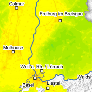
PM10 - Air quality in the Upper Rhine in 2018
This map represents the result of an air quality modelling in 2018 on the Upper Rhine. The annual average amount of fine particles with a diameter of less than 10 µm in µg/m³ is represented according to a categorisation whose values are calibrated around the regulatory limit values of the three countries.
The mapping of the annual average PM10 concentration shows the Rhine valley along a north-north-east/south-south-east axis from Ludwigshafen via Strasbourg to Basel with higher levels. The mountainous massifs of the Vosges and the Black Forest are less affected, with the exception of the valleys with the highest flow. This distribution is consistent with the origin of PM10 emissions, which are mainly due to two sectors of activity, residential and commercial heating and road transport.
The regulatory limit values in force are the following for the annual average: Germany and France: 40 µg/m³, Switzerland: 20 µg/m³. The World Health Organisation's guide value is 20 µg/m³ as an annual average.
In the Upper Rhine area, 60 km² would be exposed to exceeding the World Health Organisation's guide value of 20 µg/m³ for the annual average, i.e. 0.3% of the territory.
Simple
- Date (Creation)
- 2022-11-30
- Date (Publication)
- 2023-03-22
- Identifier
- 04_2022_305
- Status
- Completed
Point of contact
- mri:deliveryPoint
-
100, avenue d'Alsace
- mri:city
-
COLMAR
- mri:postalCode
-
68000
- Country
-
FRANCE
- mri:electronicMailAddress
-
GeoRhena
Point of contact
- mri:deliveryPoint
-
5, rue de Madrid
- mri:city
-
Schiltigheim
- mri:postalCode
-
67300
- Country
-
France
- mri:electronicMailAddress
Spatial resolution
Equivalent scale
- Denominator
- 100000
- Topic category
-
- L Environment
Extent
Extent
Temporal extent
- Time period
- 2018-01-01 2018-12-31
Extent
Extent
))
- Maintenance and update frequency
- Not planned
- Keywords
-
-
Map
-
- Keywords
-
-
Upper Rhine
-
- GEMET - Concepts, version 2.4
-
-
air quality management
-
air quality control
-
air quality
-
deposited particulate matter
-
Resource constraints
- Use limitation
-
Licence CC BY
Resource constraints
- Access constraints
- Other restrictions
- Use constraints
- Other restrictions
- Other constraints
-
No other limitation
- Language
- Français
- Character encoding
- UTF8
- Distribution format
-
-
PDF Map
-
Digital transfer options
- OnLine resource
-
Pdf Download
Digital transfer options
- OnLine resource
-
ATMO Vision website
Metadata
- Metadata identifier
- dfe20a9a-3ee4-4044-a6f1-70f1fc77c027
- Language
- Français
- Character encoding
- UTF8
- Language
- Deutsch
- Character encoding
- UTF8
- Language
- English
- Character encoding
- UTF8
Contact
- mdb:deliveryPoint
-
100, avenue d'Alsace
- mdb:city
-
COLMAR
- mdb:postalCode
-
68000
- mdb:country
-
FR
Type of resource
- Resource scope
- staticMap
- Name
-
Carte statique
- Date info (Revision)
- 2025-04-02T12:18:08.96659Z
Metadata standard
- Title
-
ISO 19115-3:2018
- Edition
-
1.0
)))