geocat.ch
Geologische Vektordatensätze swissGEOCOVER2D
Set di dati geologici vettoriali swissGEOCOVER2D
Geological Vector Datasets swissGEOCOVER2D
Jeu de données géologiques vectorielles swissGEOCOVER2D
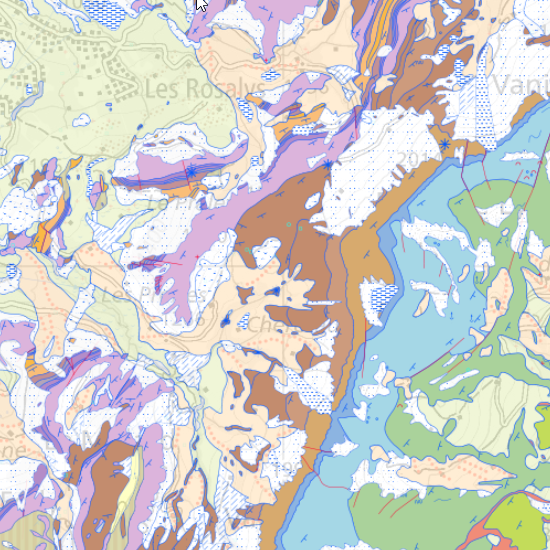
Der geologische Vektordatensatz swissGEOCOVER2D umfasst in Form von Punkten, Linien und Flächen alle für das Gebiet der Schweiz kartierten geologischen Objekte. Er umfasst das Grundgestein (Bedrock), die unkonsolidierten Ablagerungen (quaternäre Ablagerungen wie Wildbachablagerungen, Moränen, Schwemmböden oder Geröll) sowie verschiedene geomorphologische, anthropogene und tektonische Objekte (Gletschermorphologien, Zonen gravitativer Instabilität, Karstformen, Zonen tektonischer Verformung, bestimmte anthropogene Geländeformen), die in Form von Flächen dargestellt werden; die nicht-tektonischen linearen geologischen Strukturen (geologische Grenzen und Kontakte, markante Gesteinshorizonte, Moränenvalle) und die tektonischen Strukturen (Verwerfungen, Überschiebungen); punktförmige geologische Objekte (wie Strukturmessungen, Bohrungen, Findlinge, Quellen). Diese Daten, die gemäss dem 2D-Geodatenmodell standardisiert sind, werden derzeit aktualisiert (erste landesweite Aktualisierung bis Ende 2030). Der Fortschritt der Aktualisierung kann auf der Ebene <a href=" https://map.geo.admin.ch/?layers=ch.swisstopo.geologie-geocover.metadata&topic=geol" target="_blank">Einteilung swissGEOCOVER2D</a> eingesehen werden, zusammen mit den Metadaten, die die einzelnen Datensätze beschreiben. Für die aktualisierten Daten steht über das Tool „Objektinformation“ in den entsprechenden Ebenen ein kurzer Bericht für jedes betroffene Blatt zur Verfügung. Alle Ebenen können über diesen Link eingesehen werden: <a href="https://map.geo.admin.ch/#/map?center=2581428.05,1164471.38&z=5.772&topic=geol&layers=ch.swisstopo.geologie-swissgeocover2d_bedrock;ch.swisstopo.geologie-swissgeocover2d_tecto_lines;ch.swisstopo.geologie-swissgeocover2d_unconsolidated;ch.swisstopo.geologie-swissgeocover2d_surfaces;ch.swisstopo.geologie-swissgeocover2d_lines;ch.swisstopo.geologie-swissgeocover2d_points;ch.swisstopo.geologie-geocover.metadata,f&bgLayer=ch.swisstopo.pixelkarte-grau&catalogNodes=15174,1793,1787" target="_blank">swissGEOCOVER2D</a>
Il set di dati geologici vettoriali swissGEOCOVER2D raggruppa, sotto forma di punti, linee e superfici, l'insieme degli oggetti geologici mappati sul territorio svizzero. Comprende il substrato roccioso (Bedrock), i depositi non consolidati (quaternari, quali depositi torrentizi, morene, alluvioni o detriti) nonché vari oggetti geomorfologici, antropici e tettonici (morfologie glaciali, zone di instabilità gravitazionale, forme carsiche, zone di deformazione tettonica, alcuni terreni antropici), rappresentati sotto forma di superfici; le strutture geologiche lineari non tettoniche (confini e contatti geologici, orizzonti rocciosi di riferimento, vallum morenici) e le strutture tettoniche (faglie, sovrapposizioni); gli oggetti geologici puntuali (quali misurazioni strutturali, perforazioni, blocchi erratici, sorgenti). Questi dati, standardizzati secondo il Modello di dati geologici 2D, sono in fase di aggiornamento (primo aggiornamento per tutta la Svizzera entro la fine del 2030). Lo stato di avanzamento dell’aggiornamento può essere consultato sul livello <a href=" https://map.geo.admin.ch/?layers=ch.swisstopo.geologie-geocover.metadata&topic=geol" target="_blank">Suddivisione swissGEOCOVER2D</a>, insieme ai metadati che descrivono ciascuno dei set di dati. Per i dati aggiornati, è disponibile una breve relazione per ciascuna scheda interessata tramite lo strumento «Informazioni sull’oggetto» nei livelli corrispondenti. Tutti i livelli possono essere consultati seguendo questo link: <a href="https://map.geo.admin.ch/#/map?center=2581428.05,1164471.38&z=5.772&topic=geol&layers=ch.swisstopo.geologie-swissgeocover2d_bedrock;ch.swisstopo.geologie-swissgeocover2d_tecto_lines;ch.swisstopo.geologie-swissgeocover2d_unconsolidated;ch.swisstopo.geologie-swissgeocover2d_surfaces;ch.swisstopo.geologie-swissgeocover2d_lines;ch.swisstopo.geologie-swissgeocover2d_points;ch.swisstopo.geologie-geocover.metadata,f&bgLayer=ch.swisstopo.pixelkarte-grau&catalogNodes=15174,1793,1787" target="_blank">swissGEOCOVER2D</a>
The swissGEOCOVER2D vector geological dataset comprises, in the form of points, lines and areas, all the geological features mapped for the territory of Switzerland. It comprises the bedrock, unconsolidated deposits (Quaternary, such as torrential deposits, moraines, alluvial deposits or scree), as well as various geomorphological, anthropogenic and tectonic features (glacial landforms, areas of gravitational instability, karst features, areas of tectonic deformation, certain man-made features), represented as surfaces; non-tectonic linear geological structures (geological boundaries and contacts, reference rock horizons, morainic vallums) and tectonic structures (faults, thrust faults); point geological features (such as structural measurements, boreholes, erratic boulders and springs).
These data, standardised in accordance with the 2D Geological Data Model, are currently being updated (the first nationwide update for the whole of Switzerland is due by the end of 2030). The progress of the update can be viewed on the <a href=" https://map.geo.admin.ch/?layers=ch.swisstopo.geologie-geocover.metadata&topic=geol" target="_blank">swissGEOCOVER2D</a> division layer, which also includes the metadata describing each dataset. For the updated data, a brief report for each relevant sheet is available via the ‘Object Information’ tool within the relevant layers. All layers can be viewed by following this link: <a href="https://map.geo.admin.ch/#/map?center=2581428.05,1164471.38&z=5.772&topic=geol&layers=ch.swisstopo.geologie-swissgeocover2d_bedrock;ch.swisstopo.geologie-swissgeocover2d_tecto_lines;ch.swisstopo.geologie-swissgeocover2d_unconsolidated;ch.swisstopo.geologie-swissgeocover2d_surfaces;ch.swisstopo.geologie-swissgeocover2d_lines;ch.swisstopo.geologie-swissgeocover2d_points;ch.swisstopo.geologie-geocover.metadata,f&bgLayer=ch.swisstopo.pixelkarte-grau&catalogNodes=15174,1793,1787" target="_blank">swissGEOCOVER2D</a>
Le jeu de données géologiques vectorielles swissGEOCOVER2D regroupe, sous forme de points, de lignes et de surfaces, l'ensemble des objets géologiques cartographiés pour le territoire suisse. Il comprend le substratum rocheux (Bedrock), les dépôts non consolidés (quaternaires, tels que dépôts torrentiels, moraines, alluvions ou éboulis) ainsi que divers objets géomorphologiques, anthropiques et tectoniques (morphologies glaciaires, zones d'instabilité gravitaire, formes karstiques, zones de déformation tectonique, certains terrains anthropiques), représentés sous forme de surfaces; les structures linéaires géologiques non tectoniques (limites et contacts géologiques, horizons rocheux repères, vallums morainiques) et les structures tectoniques (failles, chevauchements) ; les objets géologiques ponctuels (tels que mesures structurales, forages, blocs erratiques, sources). Ces données, standardisées selon le Modèle de données géologiques 2D, sont en cours d'actualisation (première actualisation pour toute la Suisse d'ici fin 2030). L'état d'avancement de l'actualisation peut être consulté sur la couche <a href=" https://map.geo.admin.ch/?layers=ch.swisstopo.geologie-geocover.metadata&topic=geol" target="_blank">Découpage swissGEOCOVER2D</a>, avec également les métadonnées décrivant chacun des jeux de données. Pour les données actualisées, un bref rapport pour chaque feuille concernée est disponible via l'outil «Information Objet» dans les couches concernées. L’ensemble des couches peut être consulté en suivant ce lien : <a href="https://map.geo.admin.ch/#/map?center=2581428.05,1164471.38&z=5.772&topic=geol&layers=ch.swisstopo.geologie-swissgeocover2d_bedrock;ch.swisstopo.geologie-swissgeocover2d_tecto_lines;ch.swisstopo.geologie-swissgeocover2d_unconsolidated;ch.swisstopo.geologie-swissgeocover2d_surfaces;ch.swisstopo.geologie-swissgeocover2d_lines;ch.swisstopo.geologie-swissgeocover2d_points;ch.swisstopo.geologie-geocover.metadata,f&bgLayer=ch.swisstopo.pixelkarte-grau&catalogNodes=15174,1793,1787" target="_blank">swissGEOCOVER2D</a>
Simple
-
Data (Creazione)Date (Creation)Date (Création)Date (Creation)Datum (Erstellung)
- 2026-08-07
-
StatoStatusÉtatStatusBearbeitungsstatus
-
In corsoOn goingContinuOn goingKontinuierliche Aktualisierung
Proprietario
Owner
Propriétaire
Owner
Eigentümer
-
Tipo di rappresentazione spazialeSpatial representation typeType de représentation spatialeSpatial representation typeRäumliche Darstellungsart
-
VettorialeVectorvecteurVectorVektor
-
Categoria ISOTopic categoryCatégorie de thèmeTopic categoryThematik
-
-
F Informazioni geoscientificheF Geoscientific informationF Informations géoscientifiquesF Geoscientific informationF Erdwissenschaften
-
Estensione
Extent
Étendue
Extent
Ausdehnung
Estensione
Extent
Étendue
Extent
Ausdehnung
-
DescrizioneDescriptionDescriptionDescriptionBeschreibung
-
Switzerland (extent of the railway network with areas close to the border)
Schweiz (mit grenznahem Ausland)
Suisse (extension du réseau ferré avec l'étranger près de la frontière)
Svizzera (estensione della rete ferroviaria con parziale copertura oltre frontiera)
Switzerland (extent of the railway network with areas close to the border)
-
Identificatore geograficoGeographic identifierIdentifiant géographiqueGeographic identifierGeografische Kennung
- CHCHCHCHCH
))

-
Frequenza di aggiornamentoMaintenance and update frequencyFréquence de mise à jourMaintenance and update frequencyWartungsintervall
-
TrimestraleQuarterlyTrimestrielleQuarterlyVierteljährlich
- geocat.ch
-
-
opendata.swiss
opendata.swiss
opendata.swiss
opendata.swiss
-
carta geologica
geologic map
carte géologique
-
confederazione
confederation
confédération
-
EGDI (European Geological Data Infrastructure)
EGDI (European Geological Data Infrastructure)
EGDI (European Geological Data Infrastructure)
-
geodati di base
official geodata
géodonnées de base
-
- GEMET
-
-
processi geologici
geological process
processus géologique
-
scienze della terra
earth science
sciences de la terre
-
tettonica
tectonics
tectonique
-
geomorfologia
geomorphology
géomorphologie
-
- GEMET - INSPIRE themes, version 1.0
-
-
Geologia
Geology
Géologie
-
Vincoli sulle risorse
Resource constraints
Contraintes sur la ressource
Resource constraints
Ressourcenbeschränkungen
-
Vincoli d'usoUse constraintsContraintes d'utilisationUse constraintsNutzungseinschränkungen
-
Altre restrizioniOther restrictionsAutres restrictionsOther restrictionsAndere Beschränkungen
-
Altri vincoliOther constraintsAutres contraintesOther constraintsAndere Einschränkungen
- Opendata BY: Freie Nutzung. Quellenangabe ist Pflicht.Opendata BY: Libero utilizzo. Indicazione della fonte obbligatoria.Opendata BY: Open use. Must provide the source.Opendata BY: Utilisation libre. Obligation d’indiquer la source.
-
LinguaLanguageLangueLanguageSprache
- Deutsch
-
Codifica dei caratteriCharacter encodingEncodage de caractèresCharacter encodingZeichenkodierung
-
UTF8UTF8Utf8UTF8Utf8
-
LinguaLanguageLangueLanguageSprache
- Français
-
Codifica dei caratteriCharacter encodingEncodage de caractèresCharacter encodingZeichenkodierung
-
UTF8UTF8Utf8UTF8Utf8
-
Categoria di sottotemaSubtopic CategoryCatégorie de sous-thèmeSubtopic CategoryThematische Unterkategorien
-
F1 GeologiaF1 GeologyF1 GéologieF1 GeologyF1 Geologie
-
Geodati di baseBasic GeodataGéodonnées de baseBasic GeodataGeobasisdaten
- true
-
Identificativo dei geodati di baseBasic Geodata IDIdentifiant Géodonnées de baseBasic Geodata IDIdentifikator des Geobasisdatensatzes
-
46.9
-
Formato (codifica)Distribution formatFormat de distributionDistribution formatAbgabeformat
-
-
OGC Geopackage (GPKG)
-
ESRI File Geodatabase FileGDB (GDB)
-
INTERLIS
-
Opzioni di trasferimento digitale
Digital transfer options
Options de transfert numérique
Digital transfer options
Optionen für die digitale Übertragung
-
Risorsa onlineOnLine resourceRessource en ligneOnLine resourceOnline
-
Produkt- und Bestellinformationen
Opzioni di trasferimento digitale
Digital transfer options
Options de transfert numérique
Digital transfer options
Optionen für die digitale Übertragung
-
Risorsa onlineOnLine resourceRessource en ligneOnLine resourceOnline
-
Download
Opzioni di trasferimento digitale
Digital transfer options
Options de transfert numérique
Digital transfer options
Optionen für die digitale Übertragung
-
Risorsa onlineOnLine resourceRessource en ligneOnLine resourceOnline
-
viewer.swissgeol.ch
Identificativo
Identifier
Identifiant
Identifier
Identifikator
-
CodiceCodeCodeCodeCode
- EPSG:2056
-
DescrizioneDescriptionDescriptionDescriptionBeschreibung
-
CH1903+ / LV95 (EPSG:2056)
Metadata
-
Identificativo della schedaMetadata identifierIdentifiant des métadonnéesMetadata identifierIdentifikator des Metadatensatzes
- urn:uuid/debd3cec-708e-44c3-829e-e42d614fd658
-
LinguaLanguageLangueLanguageSprache
- Deutsch
-
Codifica dei caratteriCharacter encodingEncodage de caractèresCharacter encodingZeichenkodierung
-
UTF8UTF8Utf8UTF8Utf8
-
LinguaLanguageLangueLanguageSprache
- Italiano
-
Codifica dei caratteriCharacter encodingEncodage de caractèresCharacter encodingZeichenkodierung
-
UTF8UTF8Utf8UTF8Utf8
-
LinguaLanguageLangueLanguageSprache
- English
-
Codifica dei caratteriCharacter encodingEncodage de caractèresCharacter encodingZeichenkodierung
-
UTF8UTF8Utf8UTF8Utf8
-
LinguaLanguageLangueLanguageSprache
- Français
-
Codifica dei caratteriCharacter encodingEncodage de caractèresCharacter encodingZeichenkodierung
-
UTF8UTF8Utf8UTF8Utf8
-
LinguaLanguageLangueLanguageSprache
- Rumantsch
-
Codifica dei caratteriCharacter encodingEncodage de caractèresCharacter encodingZeichenkodierung
-
UTF8UTF8Utf8UTF8Utf8
Proprietario
Owner
Propriétaire
Owner
Eigentümer
Tipo di risorsa
Type of resource
Type de ressource
Type of resource
Anwendungsbereich der Metadaten
-
Ambito di applicazione della risorsaResource scopeDomaine d'application de la ressourceResource scopeDomäne der Ressourcenanwendung
-
Set di datiDatasetJeu de donnéesDatasetDatenbestand
-
Collegamento ai metadatiMetadata linkageLien vers la métadonnéeMetadata linkageLink zu den Metadaten
-
Informazioni sulla data (Creazione)Date info (Creation)Informations de date (Création)Date info (Creation)Datumsangaben (Erstellung)
- 2026-06-19T13:17:04.001863Z
-
Informazioni sulla data (Revisione)Date info (Revision)Informations de date (Révision)Date info (Revision)Datumsangaben (Aktualisierung)
- 2026-09-02T14:16:36.300734Z
Standard dei metadati
Metadata standard
Norme des métadonnées
Metadata standard
Metadatenstandard
-
TitoloTitleTitreTitleTitel
-
eCH-0271