geocat.ch
Gemeindekategorien
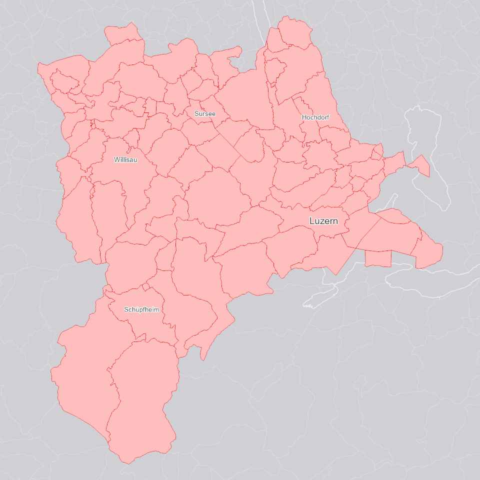
Die im kantonalen Richtplan verankerte kantonale Raum-, Zentren- und Achsenstruktur wurde mit acht Gemeindekategorien weiter differenziert und konkretisiert: Jede Gemeinde wird einer dieser acht Kategorien zugewiesen.
Simple
Informazioni di identificazione
- Titolo alternativo
-
GDGBKATE_DS
- Data (Creazione)
- 2025-01-05
- Formato di presentazione
- Mappa digitale
- Finalità
-
Die Gemeindekategorien unterscheiden sich hinsichtlich der Wachstumswerte für Neueinzonungen, den Siedlungsdichten sowie weiteren räumlichen Entwicklungsmöglichkeiten und Handlungsschwerpunkten. Die Grobzuteilung erfolgt in Z (Zentrumsgemeinden; diese werden weiter unterteilt in Z1-Z4) A (Gemeinden auf der Hauptentwicklungsachse; keine weitere Unterteilung) und L (Gemeinden in der Landschaft; diese werden weiter unterteilt in L1-L3).
- Status
- In corso
Punto di contatto
Servizio responsabile
- Nome dell'ente
-
Kanton Luzern, Abteilung Geoinformation
- Telefono
-
041 228 51 83
Indirizzo
- Risorsa online
- https://geoportal.lu.ch/ ( https )
- Ruolo
- Publisher
Punto di contatto
Servizio responsabile
- Nome dell'ente
-
Dienststelle Raum und Wirtschaft (rawi)
- Telefono
-
041 228 51 83
Indirizzo
- Risorsa online
- https://geoportal.lu.ch ( https )
- Ruolo
- Owner
- Cognome
-
Dienststelle Raum und Wirtschaft (rawi)
- Abbreviazione dell'organizzazione
-
rawi
- Frequenza di aggiornamento
- Secondo necessità
-
geocat.ch
-
-
opendata.swiss
-
Administrative Einteilung
-
Raumplanung
-
Statistik
-
- Vincoli di accesso
- none
- Vincoli di fruibilità
- Proprietà intellettuale dei dati
- Limitazione d’uso
-
öffentlich zugängliche Geobasisdaten
- Vincoli di accesso
- none
- Vincoli di fruibilità
- none
- Limitazione d’uso
-
Freie Nutzung. Quellenangabe ist Pflicht
- Identificatore aggregato del dataset
- b433e25c-9b17-4569-a918-21f91643fe63
- Tipo di associazione
- Larger work citation
- Tipo di rappresentazione spaziale
- Dati vettoriali
- Lingua dei metadati
- Deutsch
- Set dei caratteri dei metadati
- UTF8
- Tema
-
- D Confini politici ed amministrativi
- Descrizione
-
Kanton Luzern
))
- Formato di distribuzione
-
-
ESRI Geodatabase (.gdb)
(
)
-
ESRI Shapefile (.shp)
(
)
-
OGC GeoPackage (.gpkg)
(
)
-
ESRI Geodatabase (.gdb)
(
)
Distributore
Servizio responsabile
- Nome dell'ente
-
Dienststelle Raum und Wirtschaft (rawi)
- Telefono
-
041 228 51 83
Indirizzo
- Risorsa online
- https://geoportal.lu.ch ( https )
- Ruolo
- Point of contact
- Nome
-
Geodaten
- Cognome
-
Kanton Luzern
- Abbreviazione dell'organizzazione
-
rawi
- Risorsa online
-
Datenshop
(
https
)
Produktansicht Geodatenshop
- Livello
- Set di dati
- Genealogia del dato – Processo di produzione
-
unbekannt
- Oggetto di tipo geometrico
- polygon
- Identificatore del sistema di riferimento
- CH1903+
Informazioni sul contenuto
- Lingua dei metadati
-
ger
- Included with dataset
- Data (Pubblicazione)
- 2022-12-14
Classe
- Designazione
-
Flächen
- Descrizione
-
Gemeindekategorie nach Gemeindestand 1999
Attributo
- Nome
-
BFS_NR
- Descrizione
-
BFS-Gemeindenummer
Attributo
- Nome
-
OBJECTID
- Descrizione
-
OBJECTID
Attributo
- Nome
-
BAULBE_KRP
- Descrizione
-
Baulandbedarf Richtplan [qm/E]
Attributo
- Nome
-
EW_KRP
- Descrizione
-
Einwohnerzahl Richtplan
Attributo
- Nome
-
GEM_1999
- Descrizione
-
Gemeindename im Jahr 1999
Attributo
- Nome
-
BFSNR_1999
- Descrizione
-
BFS-Gemeindenummer 1999
Attributo
- Nome
-
ORTKAT_KRP
- Descrizione
-
Ortskategorie Richtplan
Attributo
- Nome
-
Shape
- Descrizione
-
Shape
Attributo
- Nome
-
Shape_Area
- Descrizione
-
Shape_Area
Attributo
- Nome
-
Shape_Length
- Descrizione
-
Shape_Length
- Genere del modello
- Descrizione di oggetto
- Lingua dei metadati
-
ger
- Included with dataset
- Data (Pubblicazione)
- 2022-12-14
Classe
- Designazione
-
Flächen
- Descrizione
-
Gemeindekategorie nach aktuellem Gemeindestand
Attributo
- Nome
-
BFS_NR
- Descrizione
-
BFS-Gemeindenummer
Attributo
- Nome
-
GEMEINDE
- Descrizione
-
Gemeindename
Attributo
- Nome
-
OBJECTID
- Descrizione
-
OBJECTID
Attributo
- Nome
-
WFAKT_KRP
- Descrizione
-
Faktor Richtplan
Attributo
- Nome
-
GDEKAT_KRP
- Descrizione
-
Gemeindekategorie Richtplan
Attributo
- Nome
-
Shape
- Descrizione
-
Shape
Attributo
- Nome
-
Shape_Area
- Descrizione
-
Shape_Area
Attributo
- Nome
-
Shape_Length
- Descrizione
-
Shape_Length
- Genere del modello
- Descrizione di oggetto
Metadata
- Lingua dei metadati
- Deutsch
- Set dei caratteri dei metadati
- UTF8
- Livello gerarchico
- Set di dati
- Data dei metadati
- 2025-09-03
- Nome dello Standard dei metadati
-
GM03 2+
Contatto
Servizio responsabile
- Nome dell'ente
-
Dienststelle Raum und Wirtschaft (rawi)
- Telefono
-
041 228 51 83
Indirizzo
- Città
-
Luzern
- Codice postale
-
6002
- Nazione
-
CH
- Via
-
Murbacherstrasse
- Numero
-
21
- Risorsa online
- https://geoportal.lu.ch ( https )
- Ruolo
- Point of contact
- Nome
-
Jonas
- Cognome
-
Thalmann
- Abbreviazione dell'organizzazione
-
rawi
- Frequenza di aggiornamento
- Secondo necessità