geocat.ch
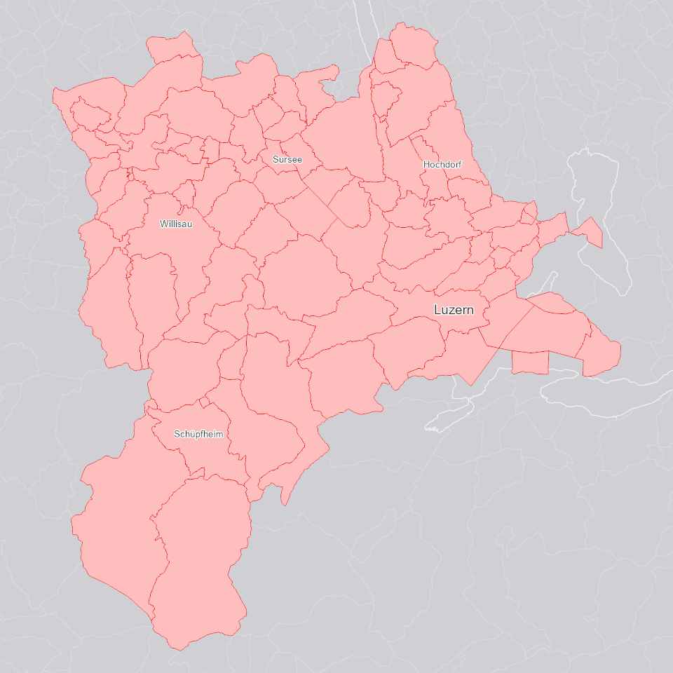
Gemeindekategorien
Die im kantonalen Richtplan verankerte kantonale Raum-, Zentren- und Achsenstruktur wurde mit acht Gemeindekategorien weiter differenziert und konkretisiert: Jede Gemeinde wird einer dieser acht Kategorien zugewiesen.
Simple
Identification info
- Alternate title
-
GDGBKATE_DS
- Date (Creation)
- 2025-01-05
- Presentation form
- Digital map
- Purpose
-
Die Gemeindekategorien unterscheiden sich hinsichtlich der Wachstumswerte für Neueinzonungen, den Siedlungsdichten sowie weiteren räumlichen Entwicklungsmöglichkeiten und Handlungsschwerpunkten. Die Grobzuteilung erfolgt in Z (Zentrumsgemeinden; diese werden weiter unterteilt in Z1-Z4) A (Gemeinden auf der Hauptentwicklungsachse; keine weitere Unterteilung) und L (Gemeinden in der Landschaft; diese werden weiter unterteilt in L1-L3).
- Status
- On going
Point of contact
Responsible party
- Organisation name
-
Kanton Luzern, Abteilung Geoinformation
- Voice
-
041 228 51 83
Address
- City
-
Luzern
- Postal code
-
6002
- Country
-
CH
- Electronic mail address
- Streetname
-
Murbacherstrasse
- Streetnumber
-
21
- Website
- https://geoportal.lu.ch/ ( https )
- Role
- Publisher
Point of contact
Responsible party
- Organisation name
-
Dienststelle Raum und Wirtschaft (rawi)
- Voice
-
041 228 51 83
Address
- City
-
Luzern
- Postal code
-
6002
- Country
-
CH
- Electronic mail address
- Streetname
-
Murbacherstrasse
- Streetnumber
-
21
- Website
- https://geoportal.lu.ch ( https )
- Role
- Owner
- Last Name
-
Dienststelle Raum und Wirtschaft (rawi)
- Organisation Acronym
-
rawi
- Maintenance and update frequency
- As needed
-
geocat.ch
-
-
opendata.swiss
-
Administrative Einteilung
-
Raumplanung
-
Statistik
-
- Access constraints
- none
- Use constraints
- Copyright
- Use limitation
-
öffentlich zugängliche Geobasisdaten
- Access constraints
- none
- Use constraints
- none
- Use limitation
-
Freie Nutzung. Quellenangabe ist Pflicht
- Aggregate Datasetindentifier
- b433e25c-9b17-4569-a918-21f91643fe63
- Association Type
- Larger work citation
- Spatial representation type
- Vector
- Language
- Deutsch
- Character set
- UTF8
- Topic category
-
- D Political and Administrative Boundaries
- Description
-
Kanton Luzern
))
- Distribution format
-
-
ESRI Geodatabase (.gdb)
(
)
-
ESRI Shapefile (.shp)
(
)
-
OGC GeoPackage (.gpkg)
(
)
-
ESRI Geodatabase (.gdb)
(
)
Distributor contact
Responsible party
- Organisation name
-
Dienststelle Raum und Wirtschaft (rawi)
- Voice
-
041 228 51 83
Address
- City
-
Luzern
- Postal code
-
6002
- Country
-
CH
- Electronic mail address
- Streetname
-
Murbacherstrasse
- Streetnumber
-
21
- Website
- https://geoportal.lu.ch ( https )
- Role
- Point of contact
- First Name
-
Geodaten
- Last Name
-
Kanton Luzern
- Organisation Acronym
-
rawi
- OnLine resource
-
Datenshop
(
https
)
Produktansicht Geodatenshop
- Hierarchy level
- Dataset
- Statement
-
unbekannt
- Geometric object type
- polygon
- Reference system identifier
- CH1903+
Content Information
- Metadata language
-
ger
- Included with dataset
- Date (Publication)
- 2022-12-14
Class
- Name
-
Flächen
- Description
-
Gemeindekategorie nach Gemeindestand 1999
Attribute
- Name
-
BFS_NR
- Description
-
BFS-Gemeindenummer
Attribute
- Name
-
OBJECTID
- Description
-
OBJECTID
Attribute
- Name
-
BAULBE_KRP
- Description
-
Baulandbedarf Richtplan [qm/E]
Attribute
- Name
-
EW_KRP
- Description
-
Einwohnerzahl Richtplan
Attribute
- Name
-
GEM_1999
- Description
-
Gemeindename im Jahr 1999
Attribute
- Name
-
BFSNR_1999
- Description
-
BFS-Gemeindenummer 1999
Attribute
- Name
-
ORTKAT_KRP
- Description
-
Ortskategorie Richtplan
Attribute
- Name
-
Shape
- Description
-
Shape
Attribute
- Name
-
Shape_Area
- Description
-
Shape_Area
Attribute
- Name
-
Shape_Length
- Description
-
Shape_Length
- Model type
- Feature description
- Metadata language
-
ger
- Included with dataset
- Date (Publication)
- 2022-12-14
Class
- Name
-
Flächen
- Description
-
Gemeindekategorie nach aktuellem Gemeindestand
Attribute
- Name
-
BFS_NR
- Description
-
BFS-Gemeindenummer
Attribute
- Name
-
GEMEINDE
- Description
-
Gemeindename
Attribute
- Name
-
OBJECTID
- Description
-
OBJECTID
Attribute
- Name
-
WFAKT_KRP
- Description
-
Faktor Richtplan
Attribute
- Name
-
GDEKAT_KRP
- Description
-
Gemeindekategorie Richtplan
Attribute
- Name
-
Shape
- Description
-
Shape
Attribute
- Name
-
Shape_Area
- Description
-
Shape_Area
Attribute
- Name
-
Shape_Length
- Description
-
Shape_Length
- Model type
- Feature description
Metadata
- Metadata language
- Deutsch
- Character set
- UTF8
- Hierarchy level
- Dataset
- Date stamp
- 2025-09-03
- Metadata standard name
-
GM03 2+
Metadata author
Responsible party
- Organisation name
-
Dienststelle Raum und Wirtschaft (rawi)
- Voice
-
041 228 51 83
Address
- City
-
Luzern
- Postal code
-
6002
- Country
-
CH
- Electronic mail address
- Streetname
-
Murbacherstrasse
- Streetnumber
-
21
- Website
- https://geoportal.lu.ch ( https )
- Role
- Point of contact
- First Name
-
Jonas
- Last Name
-
Thalmann
- Organisation Acronym
-
rawi
- Maintenance and update frequency
- As needed