geocat.ch
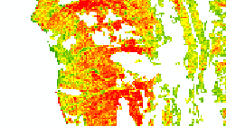
Cartographie Lidar des forêts
Cartographie de la ressource bois à partir de données Lidar, cartographie de la méthode d'exploitation, modélisation des coûts d'exploitation.
Simple
- Alternate title
-
Cartographie Lidar des forêts
- Date (Creation)
- 2016-07-12
- Identifier
- 432
- Purpose
-
Définir la ressource en bois, la méthode et les coûts d'exploitation
- Status
- Completed
Custodian
- Spatial representation type
- Grid
Spatial resolution
Equivalent scale
- Denominator
- 25000
- Topic category
-
- G Biota
Extent
Extent
- Description
-
Canton of Valais (VS)
))

- Maintenance and update frequency
- Irregular
Resource format
- Title
-
ESRI Enterprise Geodatabase
- Date
- GEMET
-
-
forest
-
- geocat.ch
-
-
protection forest
-
Resource constraints
- Use limitation
-
aucune
Resource constraints
- Access constraints
- Other restrictions
- Other constraints
-
Géodonnées partiellement accessibles aux public (niveau B selon l'OGéo)
- Other constraints
-
Les conditions générales d'utilisation des géodonnées du Canton du Valais font foi ( https://www.vs.ch/fr/web/guest/information-legale).
- Language
- Français
- Character encoding
- UTF8
- Language
- Deutsch
- Character encoding
- UTF8
- Environment description
-
S:\Géodonnées VS\G Forêt, flore, faune\LIDAR.lyr S:\Géodonnées VS\G Forêt, flore, faune\Méthodes de débardage en fonction du volume.lyr S:\Géodonnées VS\G Forêt, flore, faune\Méthodes de débardage.lyr
- Distribution format
-
-
GeoTIFF (GEOTIFF)
-
Cloud Optimized GeoTIFF (TIFF / TIF)
-
Distributor
- Statement
-
Données Lidar de swisstopo et données IFN traitées
- Hierarchy level
- Dataset
- Description
-
Traitement statistique par l'IRSTEA du nuage de point LIDAR en corrélation avec les données IFN (données terrain).
- Reference system identifier
- EPSG:2056/CH1903+_MN95
Metadata
- Metadata identifier
- db61ae9a-fa8f-4bc6-8900-99ccf0a87a3c
- Language
- Français
- Character encoding
- UTF8
- Language
- Deutsch
- Character encoding
- UTF8
- Language
- Italiano
- Character encoding
- UTF8
- Language
- English
- Character encoding
- UTF8
- Language
- Rumantsch
- Character encoding
- UTF8
Distributor
Type of resource
- Resource scope
- Dataset
- Metadata linkage
-
https://www.geocat.ch/geonetwork/srv/api/records/db61ae9a-fa8f-4bc6-8900-99ccf0a87a3c
- Date info (Creation)
- 2017-06-07T12:59:09Z
- Date info (Revision)
- 2026-04-13T09:38:15.316119Z
Metadata standard
- Title
-
eCH-0271