 geocat.ch
Übersichtsplan
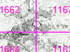
Der Übersichtsplan UP5 des Kantons Bern ist ein topographischer Plan, der für
den Massstab 1:5000 konzipiert ist. Er kann mit dem Parzellennetz des Geoprodukts 'Parzellennummern' (DIPANU) kombiniert werden.
Datendownload der Zusatzinformationen (u.a. Blatteinteilung, Symbolisierungsdateien): Siehe 'Bezug der Geodaten > Bemerkungen zum Bezug der Geodaten'.
Simple
- Date (Creation)
- 1997-12-01
- Date (Revision)
- 2025-08-05
- Date (Publication)
- 2026-04-02
- Identifier
- UP5
- Status
- On going
Owner
Owner
Principal investigator
Principal investigator
- Topic category
-
- A Imagery base maps earth cover
Extent
Extent
- Description
- Kanton Bern (erweitert) Canton de Berne (étendu)
))
- Maintenance and update frequency
- Biannually
- Keywords
-
-
Karte
-
Kartenhintergrund
-
opendata.swiss
-
Resource constraints
- Use limitation
-
Auf sämtlichen Plots und Publikationen ist der Vermerk "Übersichtsplan © Amt für Geoinformation des Kantons Bern; swisstopo" anzugeben.
Resource constraints
- Use constraints
- Licence End User
- Other constraints
- Die Daten dürfen gemäss Nutzungsbedingungen frei genutzt werden. Les données peuvent être utilisées librement selon les conditions d’utilisation.
Resource constraints
- Other constraints
- Freie Nutzung. Quellenangabe ist Pflicht. Utilisation libre. Obligation d’indiquer la source.
- Language
- Deutsch
- Character encoding
- UTF8
- Language
- Français
- Character encoding
- UTF8
- Language
- Italiano
- Character encoding
- UTF8
- Language
- English
- Character encoding
- UTF8
- Basic Geodata
- true
- Basic Geodata ID
-
2-BE
- Basic Geodata Legal Level
- Cantonal
- Included with dataset
- false
- Distribution format
-
-
Tiles ZIP
-
Digital transfer options
- OnLine resource
-
Link zum Daten-Download (zoniert)
Digital transfer options
- OnLine resource
-
Link zum Geoportal des Kantons Bern
- Reference system identifier
- CH1903+ / LV95 -- Swiss CH1903+ / LV95/EPSG:2056
Metadata
- Metadata identifier
- d9d7203a-cf41-4272-b550-b14e98e03c7b
- Language
- Deutsch
- Character encoding
- UTF8
- Language
- Français
- Character encoding
- UTF8
Point of contact
Type of resource
- Resource scope
- Dataset
- Name
-
Geoprodukt - Géoproduit
- Date info (Creation)
- 1997-12-01T00:00:00Z
- Date info (Revision)
- 2026-04-02T00:00:00Z
Metadata standard
- Title
-
GM03 2+
)))