geocat.ch
SWISSIMAGE 10 cm, digitale Orthophotomosaik der Schweiz
SWISSIMAGE 10 cm, mosaique d'orthophotos numériques de la Suisse
SWISSIMAGE 10 cm, mosaico di ortofoto digitali della Svizzera
SWISSIMAGE 10 cm, digital orthophotomosaic of Switzerland
SWISSIMAGE 10 cm
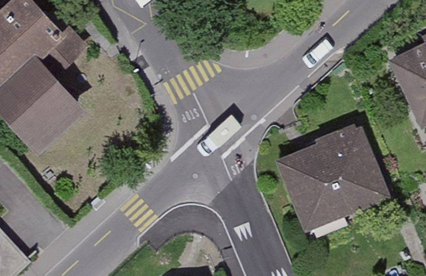
Das Orthophotomosaik SWISSIMAGE 10 cm ist eine Zusammensetzung der neuen digitalen Farbluftbilder über die ganze Schweiz mit einer Bodenauflösung von 10 cm im Flachland und der wichtigsten Alpentäler sowie 25 cm in den Alpen. Es wird in einem Nachführungszyklus von 3 Jahren seit 2018 aktualisiert.
La mosaïque d"orthophotos SWISSIMAGE 10 cm est un assemblage des nouvelles images aériennes numériques en couleurs sur l'ensemble de la Suisse avec une résolution au sol de 10 cm dans les régions de plaine et les principales vallées alpines et de 25 cm dans les Alpes. Elle est mise à jour selon un cycle de 3 ans depuis 2018.
Il mosaico di ortofoto SWISSIMAGE 10 cm è una composizione di nuove immagini aeree digitali a colori per la totalità del territorio svizzero, con una risoluzione al suolo di 10 cm nelle regioni di pianura e per nelle vallate alpine e di 25 cm nelle Alpi. Esso viene aggiornato con un ciclo di 3 anni da 2018.
The orthophoto mosaic SWISSIMAGE 10 cm is a composition of new digital color aerial photographs over the whole of Switzerland with a ground resolution of 10 cm in the plain areas and main alpine valleys and 25 cm over the Alps. It is updated in a cycle of 3 years since 2018.
Simple
-
Autre titreAltri nomi o acronimiAlternate titleAlternate titleAlternativtitel
-
SWISSIMAGE 10 cm Raster
SWISSIMAGE 10 cm Raster
SWISSIMAGE 10 cm Raster
SWISSIMAGE 10 cm Raster
SWISSIMAGE 10 cm Raster
-
Date (Création)Data (Creazione)Date (Creation)Date (Creation)Datum (Erstellung)
- 2018-01-01
-
IdentifiantIdentificatoreIdentifierIdentifierKennung
- ch.swisstopo.swissimage-dop10
-
ÉtatStatoStatusStatusBearbeitungsstatus
-
ContinuIn corsoOn goingOn goingKontinuierliche Aktualisierung
Point de contact
Punto di contatto
Point of contact
Point of contact
Ansprechpartner
-
Type de représentation spatialeTipo di rappresentazione spazialeSpatial representation typeSpatial representation typeRäumliche Darstellungsart
-
grilleRasterGridGridRaster, Gitter
-
Catégorie de thèmeCategoria ISOTopic categoryTopic categoryThematik
-
-
A Imagerie, cartes de base et occupation du solA Mappe di base con immagini della copertura terrestreA Imagery base maps earth coverA Imagery base maps earth coverA Oberflächenbeschreibung
-
Étendue
Estensione
Extent
Extent
Ausdehnung
Étendue
Estensione
Extent
Extent
Ausdehnung
-
DescriptionDescrizioneDescriptionDescriptionBeschreibung
-
SWISSIMAGE 10 cm
SWISSIMAGE 10 cm
SWISSIMAGE 10 cm
SWISSIMAGE 10 cm
SWISSIMAGE 10 cm
-
Identifiant géographiqueIdentificatore geograficoGeographic identifierGeographic identifierGeografische Kennung
- SWISSIMAGE 10 cmSWISSIMAGE 10 cmSWISSIMAGE 10 cmSWISSIMAGE 10 cmSWISSIMAGE 10 cm
))

-
Fréquence de mise à jourFrequenza di aggiornamentoMaintenance and update frequencyMaintenance and update frequencyWartungsintervall
-
InconnueSconosciutoUnknownUnknownUnbekannt
- geocat.ch
-
-
orthophoto
ortofoto
orthophoto
-
mosaïque d'orthophotos numériques en couleur
mosaico di ortofoto digitali a colori
digital color orthophoto mosaic
-
e-geo.ch
e-geo.ch
e-geo.ch
-
opendata.swiss
opendata.swiss
opendata.swiss
opendata.swiss
-
- GEMET
-
-
photographie aérienne
fotografia aerea (immagine)
aerial photograph
-
- GEMET - INSPIRE themes, version 1.0
-
-
Ortho-imagerie
Orto immagini
Orthoimagery
-
- geocat.ch
-
-
BGDI Bundesgeodaten-Infrastruktur
IFDG l’Infrastructure Fédérale de données géographiques
IFDG Infrastruttura federale dei dati geografici
FSDI Federal Spatial Data Infrastructure
-
Contraintes sur la ressource
Vincoli sulle risorse
Resource constraints
Resource constraints
Ressourcenbeschränkungen
-
Autres contraintesAltri vincoliOther constraintsOther constraintsAndere Einschränkungen
- Opendata BY: Freie Nutzung. Quellenangabe ist Pflicht.Opendata BY: Utilisation libre. Obligation d’indiquer la source.Opendata BY: Libero utilizzo. Indicazione della fonte obbligatoria.Opendata BY: Open use. Must provide the source.
Ressource associée
Risorsa associata
Associated resource
Associated resource
Verlinkte Ressource
-
Type d'associationTipo di associazioneAssociation TypeAssociation TypeAssoziationstyp
-
Citation de travail plus largeCitazione di un'opera più ampiaReference to a master resource of which this one is a partReference to a master resource of which this one is a partÜbergeordneter Datenbestand
-
Metadata ReferenceRiferimento metadatiMetadata ReferenceMetadata ReferenceMetadatenreferenz
-
LangueLinguaLanguageLanguageSprache
- Deutsch
-
Catégorie de sous-thèmeCategoria di sottotemaSubtopic CategorySubtopic CategoryThematische Unterkategorien
-
A3 Images aériennes, satellitesA3 Immagini aeree e satellitariA3 Aerial and Satellite ImageryA3 Aerial and Satellite ImageryA3 Luft-, Satellitenbilder
-
Format de distributionFormato (codifica)Distribution formatDistribution formatAbgabeformat
-
-
GeoTIFF (GEOTIFF)
-
Options de transfert numérique
Opzioni di trasferimento digitale
Digital transfer options
Digital transfer options
Optionen für die digitale Übertragung
Options de transfert numérique
Opzioni di trasferimento digitale
Digital transfer options
Digital transfer options
Optionen für die digitale Übertragung
Options de transfert numérique
Opzioni di trasferimento digitale
Digital transfer options
Digital transfer options
Optionen für die digitale Übertragung
-
Nombre de dimensionsNumero di dimensioniNumber of dimensionsNumber of dimensionsAnzahl der Dimensionen
- 2
-
Géométrie de la celluleGeometria della cellaCell geometryCell geometryZellgeometrie
-
SurfaceAreaAreaAreaFläche
-
Disponibilité des paramètres de transformationDisponibilità dei parametri di trasformazioneTransformation parameter availabilityTransformation parameter availabilityVerfügbarkeit der Transformationsparameter
- false
-
Nom du système de référenceNome del sistema di riferimentoReference system identifierReference system identifierName des Referenzsystems
- EPSG:2056
Metadata
-
Identifiant des métadonnéesIdentificativo della schedaMetadata identifierMetadata identifierIdentifikator des Metadatensatzes
- d8864f44-7392-47b5-ad0e-cf1d52d156ac
-
LangueLinguaLanguageLanguageSprache
- Deutsch
-
Encodage de caractèresCodifica dei caratteriCharacter encodingCharacter encodingZeichenkodierung
-
Utf8UTF8UTF8UTF8Utf8
-
LangueLinguaLanguageLanguageSprache
- Français
-
Encodage de caractèresCodifica dei caratteriCharacter encodingCharacter encodingZeichenkodierung
-
Utf8UTF8UTF8UTF8Utf8
-
LangueLinguaLanguageLanguageSprache
- Italiano
-
Encodage de caractèresCodifica dei caratteriCharacter encodingCharacter encodingZeichenkodierung
-
Utf8UTF8UTF8UTF8Utf8
-
LangueLinguaLanguageLanguageSprache
- English
-
Encodage de caractèresCodifica dei caratteriCharacter encodingCharacter encodingZeichenkodierung
-
Utf8UTF8UTF8UTF8Utf8
-
LangueLinguaLanguageLanguageSprache
- Rumantsch
-
Encodage de caractèresCodifica dei caratteriCharacter encodingCharacter encodingZeichenkodierung
-
Utf8UTF8UTF8UTF8Utf8
Point de contact
Punto di contatto
Point of contact
Point of contact
Ansprechpartner
-
Heures de serviceOrario di servizioHours of serviceHours of serviceBetriebszeiten
-
08h30 - 11h00 / 14h00 - 16h00 GMT+1
Type de ressource
Tipo di risorsa
Type of resource
Type of resource
Anwendungsbereich der Metadaten
-
Domaine d'application de la ressourceAmbito di applicazione della risorsaResource scopeResource scopeDomäne der Ressourcenanwendung
-
Jeu de donnéesSet di datiDatasetDatasetDatenbestand
-
Lien vers la métadonnéeCollegamento ai metadatiMetadata linkageMetadata linkageLink zu den Metadaten
-
Informations de date (Création)Informazioni sulla data (Creazione)Date info (Creation)Date info (Creation)Datumsangaben (Erstellung)
- 2020-12-16T09:41:27Z
-
Informations de date (Révision)Informazioni sulla data (Revisione)Date info (Revision)Date info (Revision)Datumsangaben (Aktualisierung)
- 2026-04-13T09:30:43.247756Z
Norme des métadonnées
Standard dei metadati
Metadata standard
Metadata standard
Metadatenstandard
-
TitreTitoloTitleTitleTitel
-
eCH-0271