geocat.ch
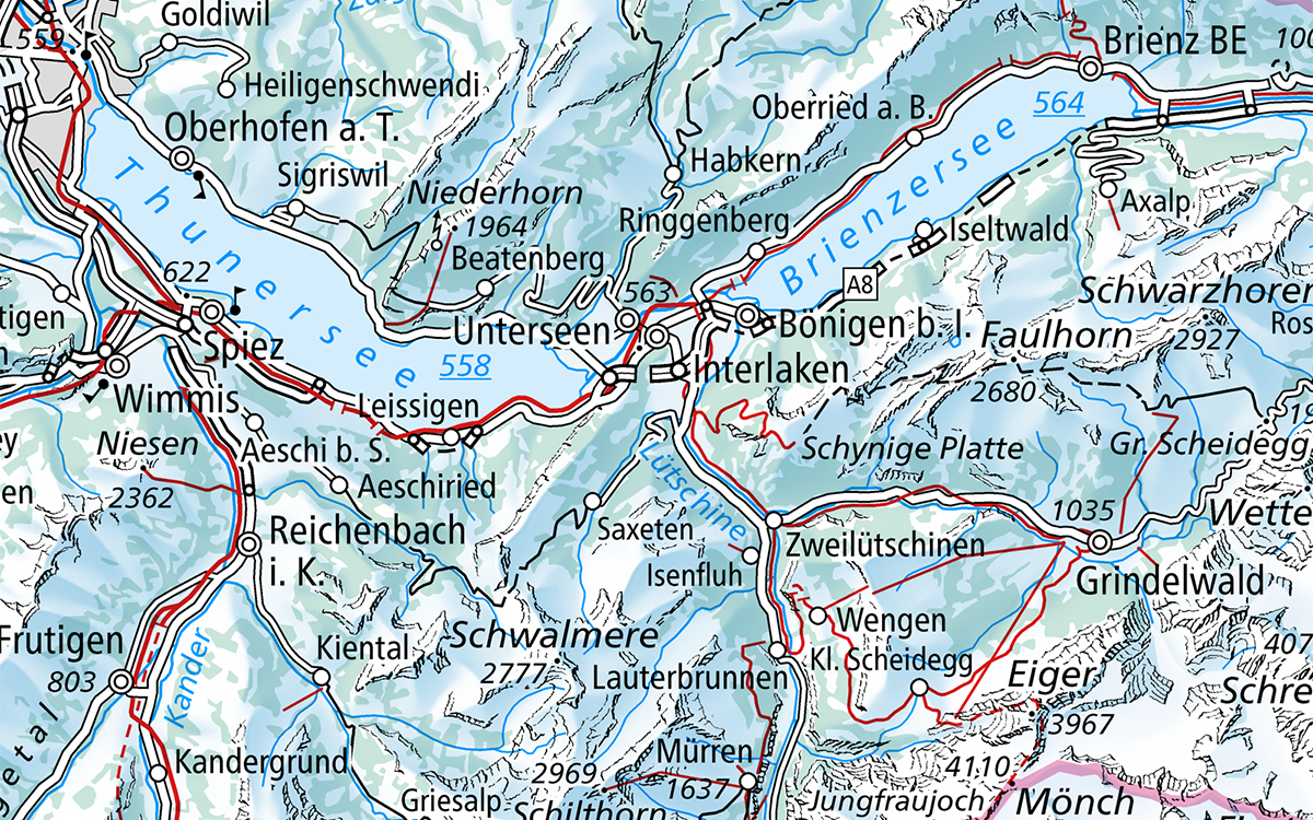
National Map 1:500'000, winter representation
The winter national map 1:500'000 is a derivation of the topographical national map 1:500'000 of Switzerland with detailed depictions of traffic, settlement areas, terrain, bodies of water and vegetation. Switzerland is comprehensively mapped in a winter representation. The winter national map 1:500'000 is only available in a digital format (Swiss Map Raster, API, WMTS).
Simple
- Alternate title
-
Winter national map 1:500'000
- Date (Creation)
- 2024-11-01
- Date (Revision)
- 2025-11-28
- Identifier
- ch.swisstopo.landeskarte-farbe_winter_500
- Presentation form
- Digital map
- Purpose
-
Georeferenzdaten des Bundesrechts
- Status
- On going
Point of contact
Owner
- Spatial representation type
- Grid
Spatial resolution
Equivalent scale
- Denominator
- 500000
- Topic category
-
- A Imagery base maps earth cover
Extent
Extent
- Description
-
National Map 1:500'000
- Geographic identifier
- NM500
))

- Maintenance and update frequency
- Annually
- User defined maintenance frequency
-
P6Y0M0DT0H0M0S
- Duration of Conservation
- 0
- Appraisal of Archival Value
- N
- geocat.ch
-
-
ski tour
-
opendata.swiss
-
national map
-
terrain representation
-
official geoservice
-
traffic network
-
- GEMET
-
-
cartography
-
relief (land)
-
border
-
vegetation
-
water (geographic)
-
- GEMET - INSPIRE themes, version 1.0
-
-
Geographical names
-
- geocat.ch
-
-
FSDI Federal Spatial Data Infrastructure
-
- geocat.ch
-
-
topography
-
- GEMET
-
-
map chart
-
Resource constraints
- Other constraints
- Opendata BY: Open use. Must provide the source.
- Language
- Deutsch
- Character encoding
- UTF8
- Language
- Français
- Character encoding
- UTF8
- Language
- Italiano
- Character encoding
- UTF8
- Language
- Rumantsch
- Character encoding
- UTF8
- Subtopic Category
- A1 Base Maps, Landscape Models
- Basic Geodata
- true
- Basic Geodata ID
-
42.2
- Basic Geodata Legal Level
- Federal
- Basic Geodata Type
- Reference Geodata
- Distribution format
-
-
Cloud Optimized GeoTIFF (TIFF / TIF)
-
Point of contact
Digital transfer options
- OnLine resource
-
Vorschau map.geo.admin.ch
Preview map.geo.admin.ch
Digital transfer options
- OnLine resource
-
Swiss Map Raster 500 Winter
Product information and download
- Statement
-
Based on the topographic survey
- Hierarchy level
- Dataset
- Reference system identifier
- CH1903+
Metadata
- Metadata identifier
- d6e3c162-474c-405a-93a1-f4866774668b
- Language
- Deutsch
- Character encoding
- UTF8
- Language
- Français
- Character encoding
- UTF8
- Language
- Italiano
- Character encoding
- UTF8
- Language
- English
- Character encoding
- UTF8
- Language
- Rumantsch
- Character encoding
- UTF8
Point of contact
Type of resource
- Resource scope
- Dataset
- Metadata linkage
-
https://www.geocat.ch/geonetwork/srv/api/records/d6e3c162-474c-405a-93a1-f4866774668b
- Date info (Creation)
- 2024-09-11T07:41:26.409Z
- Date info (Revision)
- 2026-04-13T09:25:08.252891Z
Metadata standard
- Title
-
eCH-0271