 geocat.ch
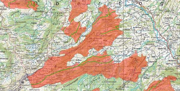
Wildruhezonen
Die Ausscheidung von Wildruhezonen dient der Vermeidung übermässiger Störung von Wildtieren. Wildruhezonen sind für Säugetiere und Vögel wichtige Gebiete, die während bestimmten Jahreszeiten - oder in einzelnen Fällen während des ganzen Jahres - nicht oder nur beschränkt für Freizeitaktivitäten genutzt werden dürfen. Es gibt rechtskräftige und empfohlene Wildruhezonen sowie erlaubte Wege/Routen.
Simple
- Date (Creation)
- 2013-09-06
- Date (Revision)
- 2026-06-21
- Other citation details
-
Natur- und Landschaftsschutz
- Purpose
-
-
- Status
- Completed
partner
- Hours of service
-
Mo. - Fr. von 8:00 - 17:00 Uhr
- Spatial representation type
- Vector
Spatial resolution
Equivalent scale
- Denominator
- 1000
Spatial resolution
- Spatial resolution
- 5 m
Extent
Extent
- Description
-
Kanton St.Gallen
))
- Maintenance and update frequency
- Annually
- geocat.ch
-
-
Wildruhezonen
-
opendata.swiss
-
Resource constraints
- Access constraints
- Other restrictions
- Other constraints
-
A = öffentlich
Resource constraints
- Classification
- Unclassified
- Language
- Deutsch
- Subtopic Category
- L2 Nature and Landscape Protection
- Distribution format
-
-
ESRI Shapefile
-
andere Formate auf Anfrage
-
Distributor
- Hours of service
-
Mo. - Fr. von 8:00 - 17:00 Uhr
- Statement
-
Auswahl geeigneter Zonen erfolgt durch das zuständige Fachamt.
- Hierarchy level
- Dataset
- Reference system identifier
- CH1903+_LV95 / EPSG 2056
Metadata
- Metadata identifier
- d52d7e14-450d-43d8-be55-4077b9abc8f8-8371
- Language
- Deutsch
- Character encoding
- UTF8
Resource provider
- Hours of service
-
Mo. - Fr. von 8:00 - 17:00 Uhr
Type of resource
- Resource scope
- Dataset
- Date info (Revision)
- 2026-06-21T01:15:29+02:00
Metadata standard
- Title
-
GM03 Core
)))
