geocat.ch
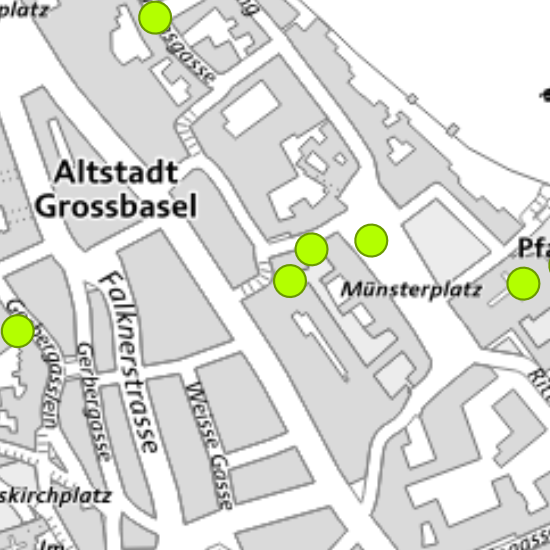
Archäologische Informationsstellen
Die Karte der Archäologischen Informationsstellen zeigt die in Basel fest eingerichteten Informationsstellen mit bedeutenden archäologischen Funden zur Stadtgeschichte. Sie decken den Zeitraum von der Bronzezeit bis zum Anfang des 20. Jahrhunderts ab.
Simple
- Date (Creation)
- 2021-11-02
- Status
- Completed
Owner
- Spatial representation type
- Vector
- Topic category
-
- M Society
Extent
Extent
- Description
-
Canton of Basel-Stadt (BS)
))

- Maintenance and update frequency
- As needed
- GEMET
-
-
archaeology
-
Resource constraints
- Other constraints
-
Die Geodaten sind öffentlich zugänglich. (Zugangsberechtigungsstufe [A] = öffentlich)
- Other constraints
-
Es gelten die Nutzungsbedingungen für Geodaten des Kantons Basel-Stadt. ( http://www.geo.bs.ch/AGB)
Associated resource
- Association Type
- Reference to a master resource of which this one is a part
- Language
- Deutsch
- Character encoding
- UTF8
- Basic Geodata
- true
- Basic Geodata ID
-
129-BS
- Basic Geodata Legal Level
- Cantonal
- Distribution format
-
-
ESRI Shapefile (SHP)
-
ESRI File Geodatabase FileGDB (GDB)
-
OGC Geopackage (GPKG)
-
GeoJSON (GEOJSON)
-
TEXT, comma separated (CSV)
-
FlatGeobuf
-
GeoParquet
-
Digital transfer options
- OnLine resource
-
MapBS
Öffentliches Auskunftssystem des Kantons Basel-Stadt
Digital transfer options
- OnLine resource
-
Geodaten-Shop
Öffentlich zugänglicher Geodaten-Downloaddienst des Kantons Basel-Stadt
Digital transfer options
- OnLine resource
-
WMS BS
Die derzeit im WMS BS verfügbaren Datenebenen entsprechen, bis auf wenige Ausnahmen, den Geodaten, welche auch in MapBS dargestellt sind. Der WMS BS ist kostenlos nutzbar und bietet Zugriff auf öffentliche sowie beschränkt öffentliche Geodaten, wobei gegebenenfalls Benutzername und Passwort benötigt werden (Zugangsdaten von MapBS).
Digital transfer options
- OnLine resource
-
WFS BS
Die derzeit im WFS BS verfügbaren Datenebenen entsprechen, bis auf wenige Ausnahmen, den Geodaten, welche auch in MapBS dargestellt sind. Der WFS BS ist kostenlos nutzbar und bietet Zugriff auf öffentliche sowie beschränkt öffentliche Geodaten, wobei gegebenenfalls Benutzername und Passwort benötigt werden (Zugangsdaten von MapBS).
- Reference system identifier
- CH1903+ / LV95/EPSG: 2056
Metadata
- Metadata identifier
- cc57b48e-edf0-4b71-9ffe-0b3bb2391923
- Language
- Deutsch
- Character encoding
- UTF8
- Language
- Français
- Character encoding
- UTF8
- Language
- Italiano
- Character encoding
- UTF8
- Language
- English
- Character encoding
- UTF8
Custodian
Type of resource
- Resource scope
- Dataset
- Metadata linkage
-
https://www.geocat.ch/geonetwork/srv/api/records/cc57b48e-edf0-4b71-9ffe-0b3bb2391923
- Date info (Creation)
- 2021-10-14T14:16:15Z
- Date info (Revision)
- 2026-04-13T09:29:15.228847Z
Metadata standard
- Title
-
eCH-0271