geocat.ch
Parzellenplan Amtliche Vermessung
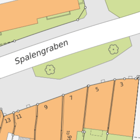
Der Parzellenplan Amtliche Vermessung ist ein aus dem Datenmodell der Amtlichen Vermessung stammender, reduzierter Datensatz im Vektorformat. Auf Grund der Elimination von doppelten Linien sind diese Daten nur für Darstellungen und nicht für Auswertungen geeignet. Auch die Darstellung einzelner Ebenen ist wegen dieser Einschränkung nur bedingt sinnvoll. Dieser Datenauszug ist für verschiedene Massstäbe optimiert verfügbar.
Simple
- Date (Creation)
- 1996-02-01
- Status
- Completed
Owner
- Spatial representation type
- Vector
- Topic category
-
- A Imagery base maps earth cover
Extent
Extent
- Description
-
Canton of Basel-Stadt (BS)
))

- Maintenance and update frequency
- Daily
- geocat.ch
-
-
basis plan
-
- geocat.ch
-
-
cadastral surveying
-
- geocat.ch
-
-
opendata.swiss
-
Resource constraints
- Other constraints
-
Die Geodaten sind öffentlich zugänglich. (Zugangsberechtigungsstufe [A] = öffentlich)
- Other constraints
-
Es gelten die Nutzungsbedingungen für Geodaten des Kantons Basel-Stadt. ( http://www.geo.bs.ch/agb)
Associated resource
- Title
-
Parzellenplan Amtliche Vermessung
- Association Type
- Reference to a master resource of which this one is a part
- Language
- Deutsch
- Character encoding
- UTF8
- Subtopic Category
- A1 Base Maps, Landscape Models
- Basic Geodata
- true
- Basic Geodata ID
-
8-BS
- Basic Geodata Legal Level
- Cantonal
- Basic Geodata Type
- openData
- Distribution format
-
-
AutoCAD DXF (DXF)
-
AutoCAD DWG (DWG)
-
Distributor
- Hours of service
-
Mo - Do: 8:00 bis 12:00, 13:30 bis 16:30, Fr: 8:00 bis 12:00, 13:30 bis 16:00
Digital transfer options
- OnLine resource
-
MapBS
Öffentliches Auskunftssystem des Kantons Basel-Stadt
Digital transfer options
- OnLine resource
-
Geodaten-Shop
Öffentlich zugänglicher Geodaten-Downloaddienst des Kantons Basel-Stadt
Digital transfer options
- OnLine resource
-
WMS BS
Die derzeit im WMS BS verfügbaren Datenebenen entsprechen, bis auf wenige Ausnahmen, den Geodaten, welche auch in MapBS dargestellt sind. Der WMS BS ist kostenlos nutzbar und bietet Zugriff auf öffentliche sowie beschränkt öffentliche Geodaten, wobei gegebenenfalls Benutzername und Passwort benötigt werden (Zugangsdaten von MapBS).
Digital transfer options
- OnLine resource
-
WMTS BS
Im WMTS BS werden die in MapBS verfügbaren Hintergrundkarten angeboten. Der WMTS BS ist kostenlos nutzbar.
Digital transfer options
- OnLine resource
-
Permalink opendata.swiss
Permalink opendata.swiss
- Reference system identifier
- CH1903+ / LV95/EPSG: 2056
Metadata
- Metadata identifier
- ba6680fe-3c87-4659-98ce-2d1ec9e42bbe
- Language
- Deutsch
- Character encoding
- UTF8
- Language
- Français
- Character encoding
- UTF8
- Language
- Italiano
- Character encoding
- UTF8
- Language
- English
- Character encoding
- UTF8
Custodian
Type of resource
- Resource scope
- Dataset
- Metadata linkage
-
https://www.geocat.ch/geonetwork/srv/api/records/ba6680fe-3c87-4659-98ce-2d1ec9e42bbe
- Date info (Creation)
- 2015-01-21T13:03:06Z
- Date info (Revision)
- 2026-04-13T09:39:12.4443Z
Metadata standard
- Title
-
eCH-0271