geocat.ch
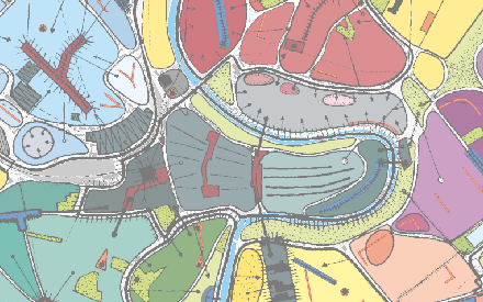
STEK-Karte "Quartierkonzept für Bern"
Die Karte "Quartierkonzept für Bern" aus dem räumlichen Stadtentwicklungskonzept 2016 der Stadt Bern (STEK 2016) zeigt, wie einerseits die Identität und Rolle der Quartiere und andererseits die Zentren- und Versorgungsstruktur gestärkt werden soll.
Simple
- Date (Revision)
- 2017-03-01
- Status
- Completed
Publisher
Owner
- Topic category
-
- E Planning cadastre
Extent
Extent
- Description
-
Stadt Bern
))

- Maintenance and update frequency
- Not planned
- geocat.ch
-
-
Freiraumentwicklung
-
Freiraumplanung
-
Grünraum
-
Individualverkehr
-
Leitidee
-
Mobilitätsmanagement
-
Quartierentwicklung
-
Quartierplanung
-
Raumentwicklung
-
Raumplanung
-
Siedlungsentwicklung
-
Siedlungsplanung
-
Stadtplanung
-
Stadtraumprägend
-
Veloverkehr
-
Verkehrskonzept
-
Verkehrsplanung
-
opendata.swiss
-
Öffentlicher Verkehr
-
Resource constraints
- Use limitation
-
Zugangsberechtigungsstufe A: öffentlich zugänglich. Es gelten die Nutzungsbedingungen der Stadt Bern ( https://www.bern.ch/nutzungsbedingungen-geodaten).
- Language
- Deutsch
- Character encoding
- UTF8
- Subtopic Category
- E1 Spatial Planning, Spatial Development
- Distribution format
-
-
GeoTIFF
-
Distributor
Digital transfer options
- OnLine resource
-
Geoportal
Link zur Detailseite vom Geoportal der Stadt Bern.
Digital transfer options
- OnLine resource
-
Stadtplan
Link zum Thema im Internet-Stadtplan der Stadt Bern
Digital transfer options
- OnLine resource
-
STEK2016_Quartierkonzept
Web Map Services WMS
Digital transfer options
- OnLine resource
-
WMTS STEK2016_Quartierkonzept
Web Map Tile Services WMTS
Digital transfer options
- OnLine resource
-
Permalink opendata.swiss
Permalink opendata.swiss
- Reference system identifier
- EPSG:2056
Metadata
- Metadata identifier
- b302e72a-2058-4d79-8d6b-363a18a446ef
- Language
- Deutsch
- Character encoding
- UTF8
Custodian
Type of resource
- Resource scope
- Dataset
- Date info (Creation)
- 2026-06-20T10:45:49
Metadata standard
- Title
-
GM03 2+