geocat.ch
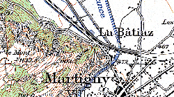
Anciennes cartes nationales
Archives des cartes nationales du 1:25'000 au 1:500'000
Simple
- Alternate title
-
Anciennes CP25-CP500
- Date (Creation)
- 1952-06-30
- Date (Revision)
- 2024-11-01
- Identifier
- 345
- Purpose
-
fond visuel
- Status
- Historical archive
Custodian
- Spatial representation type
- Grid
Spatial resolution
Equivalent scale
- Denominator
- 25000
- Topic category
-
- A Imagery base maps earth cover
Extent
Extent
- Description
-
Canton of Valais (VS)
))

- Maintenance and update frequency
- Not planned
Resource format
- Title
-
ESRI Enterprise Geodatabase
- Date
- GEMET
-
-
cartography
-
- geocat.ch
-
-
terrain representation
-
national map
-
official geodata
-
- geocat.ch
-
-
topography
-
- GEMET
-
-
map chart
-
Resource constraints
- Use limitation
-
sous licence
Resource constraints
- Access constraints
- Other restrictions
- Other constraints
-
Géodonnées accessibles au public (niveau A selon l'OGéo)
- Other constraints
-
Les conditions générales d'utilisation des géodonnées du Canton du Valais font foi ( https://www.vs.ch/fr/web/guest/information-legale).
- Language
- Français
- Character encoding
- UTF8
- Language
- Deutsch
- Character encoding
- UTF8
- Environment description
-
S:\Géodonnées VS\A1 Cartes de référence\Swiss Map Raster\Anciennes_cartes_pixel
- Supplemental Information
-
Liste années CP25 S:\Géodonnées VS\A1 Cartes de référence\Vue d_ensemble des anciennes Swiss Map Raster.lyr
- Subtopic Category
- A1 Base Maps, Landscape Models
- Basic Geodata
- true
- Basic Geodata ID
-
49
- Basic Geodata Legal Level
- Federal
- Basic Geodata Type
- Reference Geodata
- Distribution format
-
-
GeoTIFF (GEOTIFF)
-
Cloud Optimized GeoTIFF (TIFF / TIF)
-
Distributor
- Statement
-
Se base sur la Mensuration
- Hierarchy level
- Dataset
- Reference system identifier
- EPSG:2056/CH1903+_MN95
Metadata
- Metadata identifier
- aeb2991f-6cf7-4d33-9e73-5a8a53418f3c
- Language
- Français
- Character encoding
- UTF8
- Language
- Deutsch
- Character encoding
- UTF8
- Language
- Italiano
- Character encoding
- UTF8
- Language
- English
- Character encoding
- UTF8
- Language
- Rumantsch
- Character encoding
- UTF8
Distributor
Type of resource
- Resource scope
- Series
- Name
-
jeu de données
- Metadata linkage
-
https://www.geocat.ch/geonetwork/srv/api/records/aeb2991f-6cf7-4d33-9e73-5a8a53418f3c
- Date info (Creation)
- 2014-12-16T17:27:03Z
- Date info (Revision)
- 2026-06-02T12:09:37.701358Z
Metadata standard
- Title
-
eCH-0271