 geocat.ch
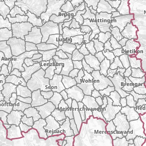
Upper Rhine Administrative base - 2024
Upper Rhine Administrative base - Update 2024
Simple
- Alternate title
-
Administrative base 2024
- Date (Creation)
- 2022-02-18
- Date (Publication)
- 2022-02-18
- Date (Revision)
- 2024-02-28
- Identifier
- limites_communales
- Status
- Completed
Point of contact
- mri:deliveryPoint
-
100, avenue d'Alsace
- mri:city
-
COLMAR
- mri:postalCode
-
68000
- Country
-
FRANCE
- Spatial representation type
- Vector
Spatial resolution
Equivalent scale
- Denominator
- 100000
Extent
Extent
Temporal extent
- Time period
- 2024-01-01 2024-12-31
Extent
Extent
N
S
E
W
))
- Maintenance and update frequency
- Annually
- Keywords
-
-
Open-Data
-
- Place
-
-
Upper Rhine
-
- GEMET - INSPIRE themes, version 1.0
-
-
Statistical units
-
Administrative units
-
Geographical names
-
- GEMET - Concepts, version 2.4
-
-
municipality
-
urban community
-
administrative boundary
-
Resource constraints
- Use limitation
-
© + OSM contributors + Add GeoRhena logo in case of reuse
Resource constraints
- Access constraints
- Other restrictions
- Use constraints
- Other restrictions
- Other constraints
-
No other limitation
- Language
- Français
- Character encoding
- UTF8
- Language
- Deutsch
- Character encoding
- UTF8
- Language
- English
- Character encoding
- UTF8
- Distribution format
-
-
SHP GeoData
-
Digital transfer options
- OnLine resource
-
limites_communales
Limites communales, fond administratif du Rhin Supérieur
Digital transfer options
- OnLine resource
-
boundaries:limites_communales
Limites communales, fond administratif du Rhin Supérieur
Digital transfer options
- OnLine resource
-
Téléchargement du Shapefile Téléchargement du Shapefile
- Statement
-
GeoRhena + OSM contributors - 2021
- Hierarchy level
- Dataset
Metadata
- Metadata identifier
- acf56ec7-2719-46fb-bac6-725c47e6bfb1
- Language
- Français
- Character encoding
- UTF8
- Language
- Deutsch
- Character encoding
- UTF8
- Language
- English
- Character encoding
- UTF8
Contact
- mdb:deliveryPoint
-
100, avenue d'Alsace
- mdb:city
-
COLMAR
- mdb:postalCode
-
68000
- mdb:country
-
FR
Type of resource
- Resource scope
- Dataset
- Date info (Revision)
- 2024-04-03T12:19:25.525845Z
Metadata standard
- Title
-
ISO 19115-3:2018
- Edition
-
1.0
)))