 geocat.ch
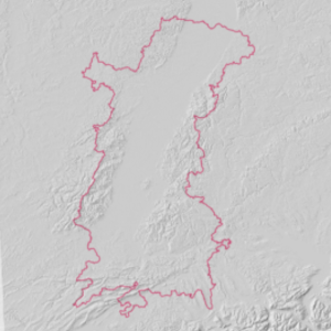
Relief - Hillshade in the Upper Rhine area
This data represents the relief by using a shading effect obtained following a treatment carried out on the digital terrain model.
Simple
- Date (Creation)
- 2021-11-10
- Date (Publication)
- 2021-12-14
- Identifier
- ombrage_schattierung
- Status
- Completed
Point of contact
- mri:deliveryPoint
-
100, avenue d'Alsace
- mri:city
-
COLMAR
- mri:postalCode
-
68000
- Country
-
FRANCE
- mri:electronicMailAddress
-
GeoRhena
- Spatial representation type
- Vector
Spatial resolution
Equivalent scale
- Denominator
- 5000
- Topic category
-
- C Elevation
- A Imagery base maps earth cover
Extent
Extent
Temporal extent
- Time period
- 2011-01-01 2011-12-31
Extent
Extent
N
S
E
W
))
- Maintenance and update frequency
- Not planned
- Keywords
-
-
Open-Data
-
Relief
-
- Keywords
-
-
Upper Rhine
-
- GEMET - Concepts, version 2.4
-
-
altitude
-
relief (land)
-
Resource constraints
- Use limitation
-
Licence CC BY - © European Union, Copernicus Land Monitoring Service 2018, European Environment Agency (EEA)
Resource constraints
- Access constraints
- Other restrictions
- Use constraints
- Other restrictions
- Other constraints
-
No other limitation
- Language
- Français
- Character encoding
- UTF8
Digital transfer options
- OnLine resource
-
relief_ombrage
Relief en ombrage sur le territoire de la conférence du Rhin Supérieur
- Statement
-
Shading performed on the digital terrain model from the EU-DEM v1.1 product (Copernicus programme)
- Hierarchy level
- Dataset
Metadata
- Metadata identifier
- a9879e36-c147-481c-8d3c-fae8f8893a5f
- Language
- Français
- Character encoding
- UTF8
- Language
- Deutsch
- Character encoding
- UTF8
- Language
- English
- Character encoding
- UTF8
Contact
- mdb:deliveryPoint
-
100, avenue d'Alsace
- mdb:city
-
COLMAR
- mdb:postalCode
-
68000
- mdb:country
-
FR
Type of resource
- Resource scope
- Dataset
- Date info (Revision)
- 2022-09-14T11:44:55.496771Z
Metadata standard
- Title
-
ISO 19115-3:2018
- Edition
-
1.0
)))