 geocat.ch
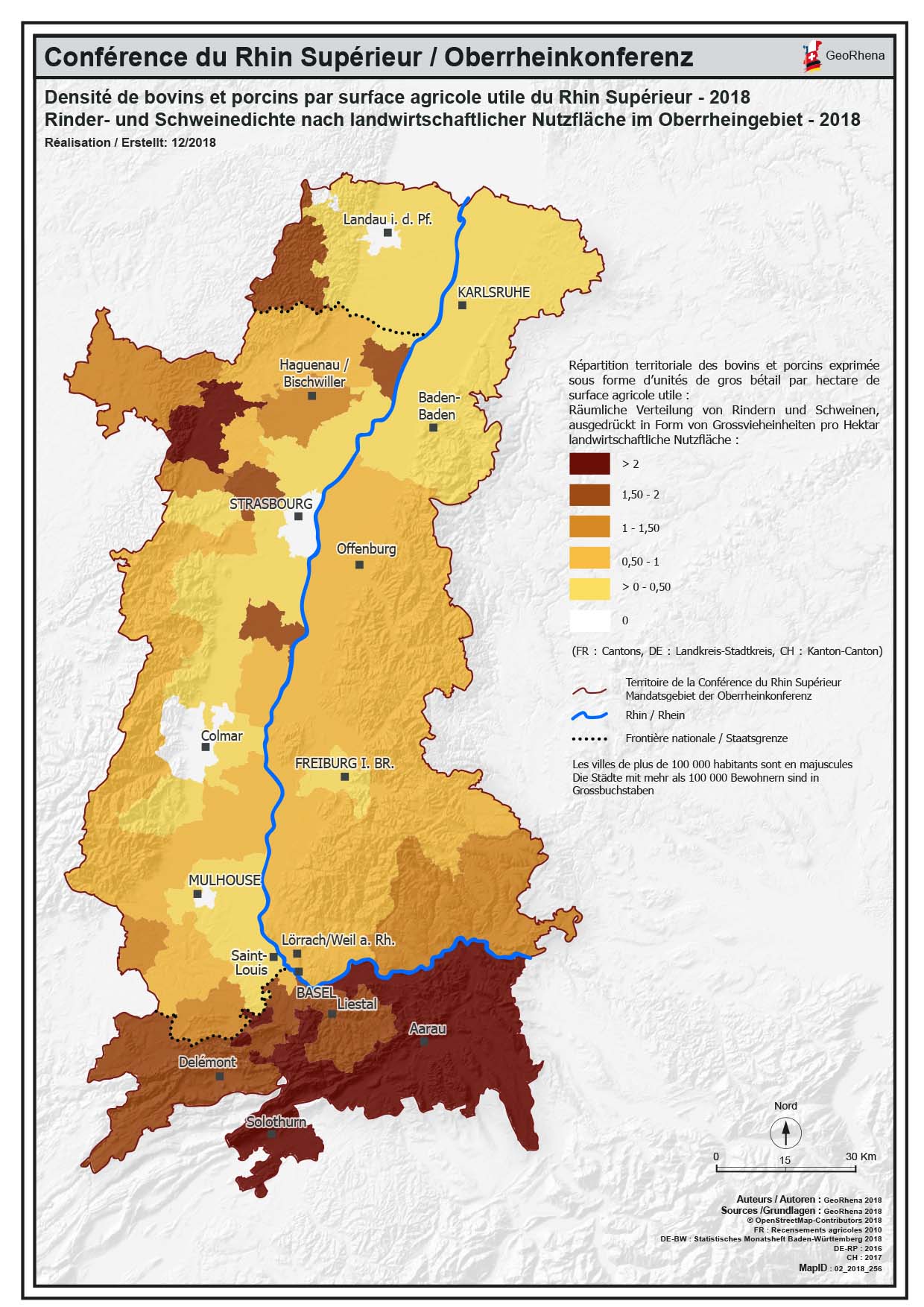
Densité de bovins et porcins par SAU PDF - 2018 / Rinder- und Schweinedichte nach LNF PDF - 2018
Carte PDF de la densité de bovins et porcins par surface agricole utile (SAU) du Rhin Supérieur - 2018
PDF Karte der Rinder- und Schweinedichte nach landwirtschaftlicher Nutzfläche (NLF) im Oberrheingebiet - 2018
Simple
- Date (Creation)
- 2019-01-24
- Presentation form
- Hardcopy map
- Status
- Completed
- Topic category
-
- S Farming
Extent
Extent
N
S
E
W
))
- Maintenance and update frequency
- Unknown
- Keywords
-
-
densité;bovin;guide;porcin;SAU;Rinde;Schweine;NLF;2018;PDF;carte;Karte
-
Resource constraints
- Use limitation
-
© OSM contributors - GeoRhena - Chambre régionale d’agriculture Grand Est
- Use constraints
- Copyright
- Language
- Français
- Supplemental Information
-
© Copyright GeoRhena / Michelin/ OSM 2018
- Distribution format
-
-
PDF
-
Metadata
- Metadata identifier
- a9216f1e-6cb1-4452-93f9-c6550bae1237
- Language
- Français
- Character encoding
- UTF8
Type of resource
- Resource scope
- staticMap
- Name
-
© Michelin 2018
- Date info (Revision)
- 2025-06-18T13:43:19.528145Z
Metadata standard
- Title
-
ISO 19115-3:2018
- Edition
-
1.0
)))