geocat.ch
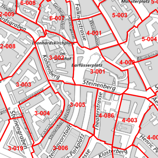
Grundbuchplaneinteilung
Einteilung der Grundbuchpläne des Kantons Basel-Stadt. Die Planeinteilungen sind Bestandteil der Informationsebene Administrative Einteilungen.
Simple
- Date (Creation)
- 1996-02-01
- Status
- Completed
Owner
- Topic category
-
- D Boundaries
Extent
Extent
- Description
-
Canton of Basel-Stadt (BS)
))

- Maintenance and update frequency
- As needed
- geocat.ch
-
-
plan division
-
- geocat.ch
-
-
cadastral surveying
-
- geocat.ch
-
-
administrative division
-
Resource constraints
- Other constraints
-
Die Geodaten sind öffentlich zugänglich. (Zugangsberechtigungsstufe [A] = öffentlich)
- Other constraints
-
Es gelten die Nutzungsbedingungen für Geodaten des Kantons Basel-Stadt. ( http://www.geo.bs.ch/agb)
Associated resource
- Association Type
- Resource is a description of associated resource
- Metadata Reference
Associated resource
- Title
-
Amtliche Vermessung Basel-Stadt
- Association Type
- Reference to a master resource of which this one is a part
- Language
- Deutsch
- Character encoding
- UTF8
- Basic Geodata
- true
- Basic Geodata ID
-
14
- Basic Geodata Legal Level
- Cantonal
- Distribution format
-
-
ESRI Shapefile (SHP)
-
INTERLIS 1 (ITF)
-
Distributor
- Hours of service
-
Mo - Do: 8:00 bis 12:00, 13:30 bis 16:30, Fr: 8:00 bis 12:00, 13:30 bis 16:00
Digital transfer options
- OnLine resource
-
MapBS
Öffentliches Auskunftssystem des Kantons Basel-Stadt
Digital transfer options
- OnLine resource
-
Geodaten-Shop
Öffentlich zugänglicher Geodaten-Downloaddienst des Kantons Basel-Stadt
- Reference system identifier
- CH1903+ / LV95/EPSG: 2056
Metadata
- Metadata identifier
- a620b168-c5cc-408c-b126-15e252e5f792
- Language
- Deutsch
- Character encoding
- UTF8
- Language
- Français
- Character encoding
- UTF8
- Language
- Italiano
- Character encoding
- UTF8
- Language
- English
- Character encoding
- UTF8
Custodian
Type of resource
- Resource scope
- Dataset
- Metadata linkage
-
https://www.geocat.ch/geonetwork/srv/api/records/a620b168-c5cc-408c-b126-15e252e5f792
- Date info (Creation)
- 2011-07-20T11:44:16Z
- Date info (Revision)
- 2026-04-13T09:15:47.153894Z
Metadata standard
- Title
-
eCH-0271