geocat.ch
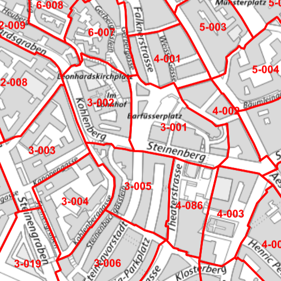
Grundbuchplaneinteilung
Einteilung der Grundbuchpläne des Kantons Basel-Stadt. Die Planeinteilungen sind Bestandteil der Informationsebene Administrative Einteilungen.
Simple
-
Date (Création)Data (Creazione)Date (Creation)Datum (Erstellung)
- 1996-02-01
-
ÉtatStatoStatusBearbeitungsstatus
-
TerminéCompletatoCompletedAbgeschlossen
Propriétaire
Proprietario
Owner
Eigentümer
-
Catégorie de thèmeCategoria ISOTopic categoryThematik
-
-
D LimitesD ConfiniD BoundariesD Grenzen
-
Étendue
Estensione
Extent
Ausdehnung
Étendue
Estensione
Extent
Ausdehnung
-
DescriptionDescrizioneDescriptionBeschreibung
-
Canton of Basel-Stadt (BS)
Kanton Basel-Stadt (BS)
Canton de Bâle-Ville (BS)
Cantone di Basilea Città (BS)
))

-
Fréquence de mise à jourFrequenza di aggiornamentoMaintenance and update frequencyWartungsintervall
-
Comme nécessaireSecondo necessitàAs neededBei Bedarf
- geocat.ch
-
-
répartition du plan
ripartizione del piano
plan division
-
- geocat.ch
-
-
mensuration officielle MO
misurazione ufficiale MU
cadastral surveying
-
- geocat.ch
-
-
division administrative
divisione amministrativa
administrative division
-
Contraintes sur la ressource
Vincoli sulle risorse
Resource constraints
Ressourcenbeschränkungen
-
Autres contraintesAltri vincoliOther constraintsAndere Einschränkungen
-
Die Geodaten sind öffentlich zugänglich. (Zugangsberechtigungsstufe [A] = öffentlich)
-
Autres contraintesAltri vincoliOther constraintsAndere Einschränkungen
-
Es gelten die Nutzungsbedingungen für Geodaten des Kantons Basel-Stadt. ( http://www.geo.bs.ch/agb)
Ressource associée
Risorsa associata
Associated resource
Verlinkte Ressource
-
Type d'associationTipo di associazioneAssociation TypeAssoziationstyp
-
Description deÈ una descrizione diResource is a description of associated resourceIst Beschreibung von
-
Metadata ReferenceRiferimento metadatiMetadata ReferenceMetadatenreferenz
Ressource associée
Risorsa associata
Associated resource
Verlinkte Ressource
-
TitreTitoloTitleTitel
-
Amtliche Vermessung Basel-Stadt
-
Type d'associationTipo di associazioneAssociation TypeAssoziationstyp
-
Citation de travail plus largeCitazione di un'opera più ampiaReference to a master resource of which this one is a partÜbergeordneter Datenbestand
-
LangueLinguaLanguageSprache
- Deutsch
-
Encodage de caractèresCodifica dei caratteriCharacter encodingZeichenkodierung
-
Utf8UTF8UTF8Utf8
-
Géodonnées de baseGeodati di baseBasic GeodataGeobasisdaten
- true
-
Identifiant Géodonnées de baseIdentificativo dei geodati di baseBasic Geodata IDIdentifikator des Geobasisdatensatzes
-
14
-
Niveau des géodonnées de baseLivello legale dei geodati di baseBasic Geodata Legal LevelGeobasisdatenebene
-
CantonalCantonalCantonalKantonal
-
Format de distributionFormato (codifica)Distribution formatAbgabeformat
-
-
ESRI Shapefile (SHP)
-
INTERLIS 1 (ITF)
-
Distributeur
Distributore
Distributor
Verteiler
-
Heures de serviceOrario di servizioHours of serviceBetriebszeiten
-
Mo - Do: 8:00 bis 12:00, 13:30 bis 16:30, Fr: 8:00 bis 12:00, 13:30 bis 16:00
Options de transfert numérique
Opzioni di trasferimento digitale
Digital transfer options
Optionen für die digitale Übertragung
-
Ressource en ligneRisorsa onlineOnLine resourceOnline
-
MapBS
Öffentliches Auskunftssystem des Kantons Basel-Stadt
Options de transfert numérique
Opzioni di trasferimento digitale
Digital transfer options
Optionen für die digitale Übertragung
-
Ressource en ligneRisorsa onlineOnLine resourceOnline
-
Geodaten-Shop
Öffentlich zugänglicher Geodaten-Downloaddienst des Kantons Basel-Stadt
-
Nom du système de référenceNome del sistema di riferimentoReference system identifierName des Referenzsystems
- CH1903+ / LV95/EPSG: 2056
Metadata
-
Identifiant des métadonnéesIdentificativo della schedaMetadata identifierIdentifikator des Metadatensatzes
- a620b168-c5cc-408c-b126-15e252e5f792
-
LangueLinguaLanguageSprache
- Deutsch
-
Encodage de caractèresCodifica dei caratteriCharacter encodingZeichenkodierung
-
Utf8UTF8UTF8Utf8
-
LangueLinguaLanguageSprache
- Français
-
Encodage de caractèresCodifica dei caratteriCharacter encodingZeichenkodierung
-
Utf8UTF8UTF8Utf8
-
LangueLinguaLanguageSprache
- Italiano
-
Encodage de caractèresCodifica dei caratteriCharacter encodingZeichenkodierung
-
Utf8UTF8UTF8Utf8
-
LangueLinguaLanguageSprache
- English
-
Encodage de caractèresCodifica dei caratteriCharacter encodingZeichenkodierung
-
Utf8UTF8UTF8Utf8
Dépositaire
Custode
Custodian
Verwalter
Type de ressource
Tipo di risorsa
Type of resource
Anwendungsbereich der Metadaten
-
Domaine d'application de la ressourceAmbito di applicazione della risorsaResource scopeDomäne der Ressourcenanwendung
-
Jeu de donnéesSet di datiDatasetDatenbestand
-
Informations de date (Création)Informazioni sulla data (Creazione)Date info (Creation)Datumsangaben (Erstellung)
- 2011-07-20T11:44:16Z
-
Informations de date (Révision)Informazioni sulla data (Revisione)Date info (Revision)Datumsangaben (Aktualisierung)
- 2026-04-13T09:15:47.153894Z
Norme des métadonnées
Standard dei metadati
Metadata standard
Metadatenstandard
-
TitreTitoloTitleTitel
-
eCH-0271