geocat.ch
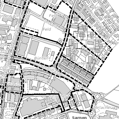
Bebauungspläne (Sarnen, OW)
Detaillierter Plan zu spezifischen Bauvorschriften auf einem Grundstück. Wird für einzelne Parzellen oder kleinere Gebiete erstellt. Der Bebauungsplan regelt unter anderem: Baugrenzen, Höhenvorgaben, Bauformen, Erschliessungsmassnahmen (z.B. Strassen, Wege, Parkplätze)
Simple
- Date (Creation)
- 2010-01-01
- Date (Revision)
- 2025-08-28
- Identifier
- sa_nutzungsplanung
- Status
- On going
Owner
- Hours of service
-
Mo - Fr von 08.00 - 11.45 Uhr und 13.30 - 17.00 Uhr; vor allg. Feiertagen bis 16.00 Uhr
- Spatial representation type
- Vector
- Topic category
-
- E Planning cadastre
Extent
Extent
- Description
-
Sarnen
))

- Maintenance and update frequency
- As needed
- GEMET
-
-
federal law
-
land management and planning
-
physical planning
-
regional structure
-
regional development
-
- geocat.ch
-
-
land use plan
-
land use planning
-
spatial development
-
zoning plan
-
Resource constraints
- Access constraints
- Other restrictions
- Use constraints
- Other restrictions
- Other constraints
- Die Geodaten sind öffentlich zugänglich (Zugangsberechtigungsstufe A gemäss GeoIV Art. 21).
- Language
- Deutsch
- Character encoding
- UTF8
- Environment description
-
Adalin
- Subtopic Category
- E1 Spatial Planning, Spatial Development
- Basic Geodata
- true
- Basic Geodata ID
-
73>B.1
- Basic Geodata Legal Level
- Bund
- Distribution format
-
-
INTERLIS
-
andere Formate auf Anfrage
-
Distributor
Digital transfer options
- OnLine resource
-
Geoshop OW
Datenbezug
Digital transfer options
- OnLine resource
-
npl_nutzungsplanung_v1_2
WMS-Dienst geodienste.ch
Digital transfer options
- OnLine resource
-
Geodienste.ch
Datenbezug
Digital transfer options
- OnLine resource
-
ch.ow.nutzungsplanung-kommunal
WMS-Dienst Kanton Obwalden
Digital transfer options
- OnLine resource
-
Geobasisdatenkatalog
Digital transfer options
- OnLine resource
-
Webkarte Nutzungsplanung
Identifier
- Code
- 2056
Metadata
- Metadata identifier
- D9E72DBD-2F22-4524-8EAA-22E19F30E330
- Language
- Deutsch
- Character encoding
- UTF8
- Language
- Français
- Character encoding
- UTF8
- Language
- English
- Character encoding
- UTF8
- Language
- Italiano
- Character encoding
- UTF8
Custodian
Type of resource
- Resource scope
- Dataset
- Date info (Revision)
- 2026-05-12T13:10:54.000Z
Metadata standard
- Title
-
GM03_2