geocat.ch
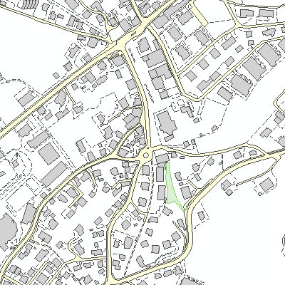
Bodenbedeckung (amtliche Vermessung) (Sachseln, OW)
Der Geobasisdatensatz umfasst die befestigten und humusierten Flächen, Gebäude, Gewässer sowie bestockte und vegetationslose Flächen.
Simple
- Date (Creation)
- 1990-01-01
- Date (Revision)
- 2026-06-17
- Identifier
- sc_dm01
- Status
- On going
Owner
Das Volkswirtschaftsamt führt das Handelsregister und die Stiftungsaufsicht mit Ausnahme der BVG-Vorsorgeeinrichtungen. Es ist die statistische Anlaufstelle und Bewilligungsbehörde für den Erwerb von Grundstücken durch Personen im Ausland. Die Abteilung Grundbuch führt in Sarnen und Engelberg das Grundbuch und ist für die Grundbuchbereinigung besorgt. Das Volkswirtschaftsamt setzt die Neue Regionalpolitik des Bundes um, unterstützt überkantonale Träger des Tourismus und ist Koordinationsstelle für Fragen der Welthandelsabkommen (GATT/GATS/TRIPS). Es ist Anlaufstelle für die Submission und den Binnenmarkt und richtet Beiträge für die Wohnbau- und Eigentumsförderung aus. Das Volkswirtschaftsamt ist darüber hinaus für die Angebotsbestellung im Bereich des öffentlichen Verkehrs zuständig sowie mit den Aufgaben der amtlichen Vermessung und dem amtlichen Teil von GIS Obwalden betraut.
- Hours of service
-
Mo-Fr 08.00-11.45, 13.30-17.00
- Spatial representation type
- Vector
- Topic category
-
- A Imagery base maps earth cover
Extent
Extent
- Description
-
Sachseln
))

- Maintenance and update frequency
- Continual
- GEMET
-
-
stock (biological)
-
distribution area
-
building
-
water (geographic)
-
humus
-
vegetation cover
-
wood
-
meadow
-
- geocat.ch
-
-
cadastral surveying
-
road
-
Resource constraints
- Access constraints
- Other restrictions
- Use constraints
- Other restrictions
- Other constraints
- Die Geodaten sind öffentlich zugänglich (Zugangsberechtigungsstufe A gemäss GeoIV Art. 21).
- Language
- Deutsch
- Character encoding
- UTF8
- Environment description
-
Adalin
- Subtopic Category
- A2 Land Cover, Land Use
- Basic Geodata
- true
- Basic Geodata ID
-
55>A.1
- Basic Geodata Legal Level
- Bund
- Distribution format
-
-
INTERLIS
-
andere Formate auf Anfrage
-
Distributor
Digital transfer options
- OnLine resource
-
Geoshop OW
Datenbezug
Digital transfer options
Digital transfer options
- OnLine resource
-
Geobasisdatenkatalog
Digital transfer options
- OnLine resource
-
Geodienste.ch
Datenbezug
Digital transfer options
- OnLine resource
-
ch.ow.bodenbedeckung
WMS-Dienst Kanton Obwalden
Digital transfer options
- OnLine resource
-
Webkarte Plan für das Grundbuch
Identifier
- Code
- 2056
Metadata
- Metadata identifier
- D9A1DEA3-B64B-4722-8DBC-29AFD247AF79
- Language
- Deutsch
- Character encoding
- UTF8
- Language
- Français
- Character encoding
- UTF8
- Language
- English
- Character encoding
- UTF8
- Language
- Italiano
- Character encoding
- UTF8
Custodian
Type of resource
- Resource scope
- Dataset
- Date info (Revision)
- 2026-05-12T13:10:54.000Z
Metadata standard
- Title
-
GM03_2